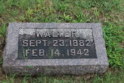
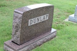
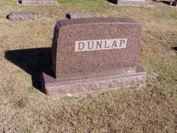
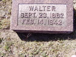
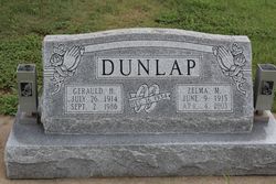
Walter Dunlap Sr.
| Birth | : | 23 Sep 1882 Woodston, Rooks County, Kansas, USA |
| Death | : | 14 Feb 1942 Woodston, Rooks County, Kansas, USA |
| Burial | : | Cementerio de la Capital, Puerto Nuevo, San Juan Municipality, USA |
| Coordinate | : | 18.3842810, -66.0724590 |
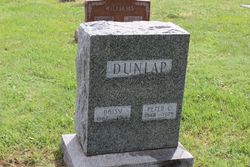
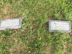
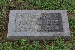
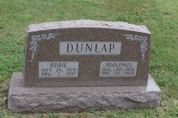
| Description | : | Walter Dunlap, son of P. C. and Fedelia Jane Dunlap, was born near Woodston on September 23, 1882. He moved to Woodston with the family at an early age, where he grew to manhood and became asociated with his father in the hardware and implement business. Walter married Vera M. Hadley of Cawker City, on July 3, 1912. They had three sons: Walter Jr., Gerauld H., and Paul C. All were born in Woodston. Walter, Jr., passed away on February 7, 1968, at the age of 54 years. Walter Sr. passed away February 14, 1942, at the age... Read More |
frequently asked questions (FAQ):
-
Where is Walter Dunlap Sr.'s memorial?
Walter Dunlap Sr.'s memorial is located at: Cementerio de la Capital, Puerto Nuevo, San Juan Municipality, USA.
-
When did Walter Dunlap Sr. death?
Walter Dunlap Sr. death on 14 Feb 1942 in Woodston, Rooks County, Kansas, USA
-
Where are the coordinates of the Walter Dunlap Sr.'s memorial?
Latitude: 18.3842810
Longitude: -66.0724590
Family Members:
Parent
Spouse
Siblings
Children
Flowers:
Nearby Cemetories:
1. Cementerio de la Capital
Puerto Nuevo, San Juan Municipality, USA
Coordinate: 18.3842810, -66.0724590
2. Cementerio Villa Nevárez
Rio Piedras, San Juan Municipality, USA
Coordinate: 18.3924500, -66.0638900
3. Buxeda Memorial Park
Rio Piedras, San Juan Municipality, USA
Coordinate: 18.3755675, -66.0480496
4. Cementerio Municipal de Río Piedras
Rio Piedras, San Juan Municipality, USA
Coordinate: 18.4017485, -66.0528151
5. El Señorial Memorial Park
San Juan, San Juan Municipality, USA
Coordinate: 18.3446200, -66.0541130
6. Cementerio Nuevo Barrio Los Frailes
Guaynabo, Guaynabo Municipality, USA
Coordinate: 18.3685590, -66.1151280
7. Los Angeles Memorial Park
Guaynabo, Guaynabo Municipality, USA
Coordinate: 18.3963450, -66.1214500
8. Cementerio Historico de Guaynabo
Guaynabo, Guaynabo Municipality, USA
Coordinate: 18.3489400, -66.1082400
9. Parroquia San Vicente de Paul Criptas
San Juan, San Juan Municipality, USA
Coordinate: 18.4420270, -66.0653170
10. Cementerio San José
San Juan, San Juan Municipality, USA
Coordinate: 18.4385570, -66.0498880
11. Cementerio Municipal Amelia
Amelia, Guaynabo Municipality, USA
Coordinate: 18.4330540, -66.1200940
12. Cementerio Buxeda
Carolina Municipality, USA
Coordinate: 18.4424640, -66.0311190
13. Puerto Rico Memorial
Carolina Municipality, USA
Coordinate: 18.4459860, -66.0318730
14. Cementerio Municipal de Trujillo Alto
Trujillo Alto, Trujillo Alto Municipality, USA
Coordinate: 18.3497200, -65.9989000
15. Cementerio Municipal
Bay View, Catano Municipality, USA
Coordinate: 18.4439080, -66.1326360
16. Cementerio Municipal Braulio Dueño Colón
Bayamon, Bayamon Municipality, USA
Coordinate: 18.3929400, -66.1608700
17. San Francisco de Asis
San Juan, San Juan Municipality, USA
Coordinate: 18.4663550, -66.1134620
18. Catedral de San Juan Bautista
San Juan, San Juan Municipality, USA
Coordinate: 18.4656070, -66.1179690
19. Cementerio y Mausoléo Barrio Palma
Las Palmas, Catano Municipality, USA
Coordinate: 18.4358130, -66.1543280
20. Puerto Rico National Cemetery
Bayamon, Bayamon Municipality, USA
Coordinate: 18.4109097, -66.1693268
21. Cementerio Santa María Magdalena de Pazzis
San Juan, San Juan Municipality, USA
Coordinate: 18.4692410, -66.1199200
22. Cementerio Porta Coeli
Hato Tejas, Bayamon Municipality, USA
Coordinate: 18.4140450, -66.1721380
23. Cementerio Parque de Luz
Caguas, Caguas Municipality, USA
Coordinate: 18.2871070, -66.0450910
24. Cementerio La Resurrección
Carolina, Carolina Municipality, USA
Coordinate: 18.3424690, -65.9736260

