
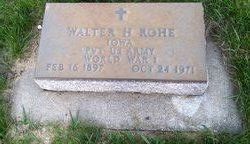

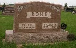
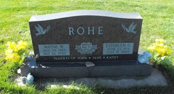
Walter Herman Rohe
| Birth | : | 16 Feb 1897 Davenport, Scott County, Iowa, USA |
| Death | : | 24 Oct 1971 Templeton, Carroll County, Iowa, USA |
| Burial | : | Sacred Heart Cemetery, Templeton, Carroll County, USA |
| Coordinate | : | 41.9138746, -94.9460994 |
| Description | : | Carroll Daily Times Herald, October 25, 1971 TEMPLETON--Walter H. Rohe, 74, died at 8:20 a.m. Sunday, Oct. 24, at his home in Templeton. He had been ill for a year and a half. Requiem mass will be celebrated at 10:30 a.m. Wednesday in Sacred Heart Church here by the Rt. Rev. Msgr. A.W. Behrens. Interment will be in the parish cemetery, with military honors by the DeWitt-Loustanau Post No. 20, American Legion, of Dedham. Friends may call after 6 p.m. Monday at the Ohde Funeral Home in Manning, where the rosary will be recited at 7:30 and 8:15 p.m. both Monday... Read More |
frequently asked questions (FAQ):
-
Where is Walter Herman Rohe's memorial?
Walter Herman Rohe's memorial is located at: Sacred Heart Cemetery, Templeton, Carroll County, USA.
-
When did Walter Herman Rohe death?
Walter Herman Rohe death on 24 Oct 1971 in Templeton, Carroll County, Iowa, USA
-
Where are the coordinates of the Walter Herman Rohe's memorial?
Latitude: 41.9138746
Longitude: -94.9460994
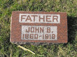
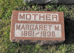
Family Members:
Parent
Spouse
Siblings

Children
Flowers:


Nearby Cemetories:
1. Sacred Heart Cemetery
Templeton, Carroll County, USA
Coordinate: 41.9138746, -94.9460994
2. Elba Cemetery
Templeton, Carroll County, USA
Coordinate: 41.9068985, -94.9131012
3. Sacred Heart Cemetery
Manning, Carroll County, USA
Coordinate: 41.9132500, -95.0540000
4. Gray Cemetery
Gray, Audubon County, USA
Coordinate: 41.8414001, -94.9946976
5. Manning Cemetery
Manning, Carroll County, USA
Coordinate: 41.8990000, -95.0620000
6. Holy Angels Cemetery
Carroll County, USA
Coordinate: 42.0014000, -94.9141998
7. Cameron Cemetery
Audubon County, USA
Coordinate: 41.8236008, -94.9167023
8. Dedham Cemetery
Dedham, Carroll County, USA
Coordinate: 41.8993988, -94.8225021
9. Saint Josephs Cemetery
Dedham, Carroll County, USA
Coordinate: 41.8993988, -94.8210983
10. Saint Augustine Cemetery
Halbur, Carroll County, USA
Coordinate: 42.0066986, -94.9744034
11. Lincoln Township Cemetery
Gray, Audubon County, USA
Coordinate: 41.8198130, -95.0154970
12. Saint Marys Catholic Cemetery
Willey, Carroll County, USA
Coordinate: 41.9783363, -94.8212204
13. Iowa Township Cemetery
Aspinwall, Crawford County, USA
Coordinate: 41.9216995, -95.1113968
14. McCurdy Cemetery
Carroll County, USA
Coordinate: 41.9403000, -94.7649994
15. Viola Center Cemetery
Viola Center, Audubon County, USA
Coordinate: 41.8236008, -94.8016968
16. Old Carrollton Cemetery
Carrollton, Carroll County, USA
Coordinate: 41.9233017, -94.7403030
17. Mount Olivet Cemetery
Carroll, Carroll County, USA
Coordinate: 42.0536340, -94.8595510
18. Carroll City Cemetery
Carroll, Carroll County, USA
Coordinate: 42.0560963, -94.8599856
19. Hayes Township Cemetery
Westside, Crawford County, USA
Coordinate: 42.0083199, -95.1216583
20. Luccocks Grove Cemetery
Audubon County, USA
Coordinate: 41.7619019, -94.8653030
21. Douglas Township Cemetery
Audubon County, USA
Coordinate: 41.7611008, -95.0282974
22. Oak Hill Cemetery
Coon Rapids, Carroll County, USA
Coordinate: 41.9053001, -94.7200012
23. Westside Cemetery
Westside, Crawford County, USA
Coordinate: 42.0602989, -95.0922012
24. Saint Francis Cemetery
Maple River, Carroll County, USA
Coordinate: 42.0969009, -94.9372025