
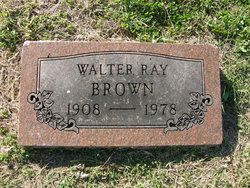
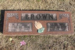
Walter Ray “Chubb” Brown
| Birth | : | 28 Mar 1908 Pittsburg, Crawford County, Kansas, USA |
| Death | : | 5 Oct 1978 Pittsburg, Crawford County, Kansas, USA |
| Burial | : | Hall-Watts-Pratt Family Cemetery, Knott County, USA |
| Coordinate | : | 37.2884530, -82.8774920 |
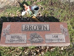
| Description | : | Oct. 5, 1978 Pittsburg Morning Sun Pittsburg, Kansas WALTER RAY "CHUBB" BROWN Walter Ray "Chubb" Brown, 70, of 606 N. Smith, died early Thursday, Oct. 5, 1978, at his home after a short illness. Mr. Brown was born March 28, 1908 in Pittsburg, and had lived here his entire life as a laborer. He was a member of the Church of God Holiness. Survivors include his step-mother Lenora Brown, of the home, two brothers, Sam Brown, Route 2, and Ted Brown, Ashburg, Mo. two Step-brothers, Henry Mynatt, 612 N. Smith, and Clifford Mynatt,... Read More |
frequently asked questions (FAQ):
-
Where is Walter Ray “Chubb” Brown's memorial?
Walter Ray “Chubb” Brown's memorial is located at: Hall-Watts-Pratt Family Cemetery, Knott County, USA.
-
When did Walter Ray “Chubb” Brown death?
Walter Ray “Chubb” Brown death on 5 Oct 1978 in Pittsburg, Crawford County, Kansas, USA
-
Where are the coordinates of the Walter Ray “Chubb” Brown's memorial?
Latitude: 37.2884530
Longitude: -82.8774920
Family Members:
Parent
Siblings
Flowers:


Nearby Cemetories:
1. Taylor Family Cemetery
Mallie, Knott County, USA
Coordinate: 37.2914970, -82.8977410
2. Caney Slone Cemetery
Mallie, Knott County, USA
Coordinate: 37.2920300, -82.9144700
3. Reynolds Cemetery
Mallie, Knott County, USA
Coordinate: 37.3109100, -82.9091500
4. Bentley Family Cemetery
Mallie, Knott County, USA
Coordinate: 37.3053454, -82.9179815
5. Caleb Johnson Cemetery
Kite, Knott County, USA
Coordinate: 37.2954130, -82.8266870
6. Owens Family Cemetery
Leburn, Knott County, USA
Coordinate: 37.3191300, -82.9161000
7. Carr Fork Memorial Cemetery
Brinkley, Knott County, USA
Coordinate: 37.2857819, -82.9333420
8. Green Perry Cemetery
Leburn, Knott County, USA
Coordinate: 37.3270290, -82.9250810
9. Francis-Day Cemetery
Littcarr, Knott County, USA
Coordinate: 37.2674962, -82.9422748
10. Jonah Hall Cemetery
Kite, Knott County, USA
Coordinate: 37.3138340, -82.8150840
11. Franklin P Perkins Cemetery
Mallie, Knott County, USA
Coordinate: 37.3154700, -82.9441600
12. Smith Family Cemetery
Littcarr, Knott County, USA
Coordinate: 37.2422500, -82.9275900
13. Granville C. Smith Cemetery
Brinkley, Knott County, USA
Coordinate: 37.3131670, -82.9490560
14. Henry Tuttle Cemetery
Kite, Knott County, USA
Coordinate: 37.3266500, -82.8156280
15. Thornsberry Cemetery
Kite, Knott County, USA
Coordinate: 37.3266640, -82.8156010
16. William Thornsberry Cemetery
Kite, Knott County, USA
Coordinate: 37.3266640, -82.8155980
17. Ben Slone Cemetery
Garner, Knott County, USA
Coordinate: 37.3477080, -82.9043610
18. Cody Cemetery
Bath, Knott County, USA
Coordinate: 37.2269741, -82.9034400
19. Waddles Cemetery
Kite, Knott County, USA
Coordinate: 37.3368710, -82.8132920
20. Hale Cemetery
Mallie, Knott County, USA
Coordinate: 37.2227770, -82.9104280
21. Strange Cemetery
Kite, Knott County, USA
Coordinate: 37.3143290, -82.7917500
22. Bates Cemetery
Colson, Letcher County, USA
Coordinate: 37.2280480, -82.8251450
23. Bald Hill Cemetery
Knott County, USA
Coordinate: 37.3596992, -82.8546982
24. Draughn-Jones Cemetery
Hindman, Knott County, USA
Coordinate: 37.3205380, -82.9607890