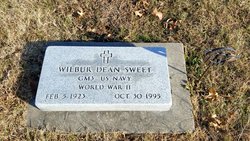
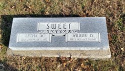
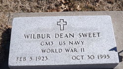
Wilbur Dean Sweet
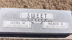
| Birth | : | 5 Feb 1923 Jackson County, Kansas, USA |
| Death | : | 30 Oct 1995 Onaga, Pottawatomie County, Kansas, USA |
| Burial | : | Coles Chapel Cemetery, Christian County, USA |
| Coordinate | : | 37.0991120, -87.4212460 |
| Plot | : | Section JJ |
| Inscription | : | GM3 US NAVY WORLD WAR II |
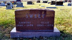
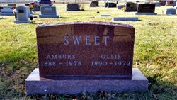
| Description | : | Wilbur Dean Sweet, 72, Onaga, died Monday, October 30, 1995, at his home. The son of Amburs and Ollie Dick Sweet, he was born February 5, 1923 north of Holton. He graduated from Onaga High School with the class of 1941. Mr. Sweet worked for the U.S. Government as a guard in prison systems and other related duties. He later worked for the Jackson County Sheriff's Department. He was a member of St. Vincent de Paul Catholic Church in Onaga and Onaga Post No. 7772 of the V.F.W. He was a U.S. Navy veteran of World War II, having received... Read More |
frequently asked questions (FAQ):
-
Where is Wilbur Dean Sweet's memorial?
Wilbur Dean Sweet's memorial is located at: Coles Chapel Cemetery, Christian County, USA.
-
When did Wilbur Dean Sweet death?
Wilbur Dean Sweet death on 30 Oct 1995 in Onaga, Pottawatomie County, Kansas, USA
-
Where are the coordinates of the Wilbur Dean Sweet's memorial?
Latitude: 37.0991120
Longitude: -87.4212460
Family Members:
Parent
Spouse
Siblings
Children
Flowers:
Nearby Cemetories:
1. Coles Chapel Cemetery
Christian County, USA
Coordinate: 37.0991120, -87.4212460
2. Flatrock Cemetery
Crofton, Christian County, USA
Coordinate: 37.0755997, -87.4439011
3. Stanley Cemetery
White Plains, Hopkins County, USA
Coordinate: 37.1375008, -87.4030991
4. Clark Cemetery
Crofton, Christian County, USA
Coordinate: 37.0486200, -87.4242500
5. Dunning Cemetery
Christian County, USA
Coordinate: 37.0802994, -87.3610992
6. McIntosh Church Cemetery
Nortonville, Hopkins County, USA
Coordinate: 37.1437340, -87.4615520
7. Fox Cemetery
White Plains, Hopkins County, USA
Coordinate: 37.1533012, -87.4036026
8. Pennington Cemetery
Apex, Christian County, USA
Coordinate: 37.0883400, -87.3520090
9. Pleasant Hill Church Cemetery
Nortonville, Hopkins County, USA
Coordinate: 37.1567500, -87.4360160
10. Croft Cemetery
Crofton, Christian County, USA
Coordinate: 37.0575130, -87.4735320
11. Petersburg Cemetery
Mannington, Christian County, USA
Coordinate: 37.1117000, -87.4934830
12. Haleys Mill Cemetery
Haleys Mill, Christian County, USA
Coordinate: 37.0767560, -87.3500630
13. Oates Family Cemetery
White Plains, Hopkins County, USA
Coordinate: 37.1544770, -87.3873530
14. Ridge Top Cemetery
Crofton, Christian County, USA
Coordinate: 37.0647011, -87.4875031
15. Rock Bridge Cemetery
Apex, Christian County, USA
Coordinate: 37.0980000, -87.3410670
16. Whitfield Cemetery
Hopkins County, USA
Coordinate: 37.1613998, -87.3996964
17. Foster Garden Cemetery
Crofton, Christian County, USA
Coordinate: 37.0600371, -87.4877745
18. Atkinson Cemetery
Hopkinsville, Christian County, USA
Coordinate: 37.1002998, -87.3383026
19. Jackson Cemetery #2
Apex, Christian County, USA
Coordinate: 37.1264500, -87.3427680
20. Jackson Cemetery #3
Apex, Christian County, USA
Coordinate: 37.0876730, -87.3365560
21. Coal Creek Cemetery
Crofton, Christian County, USA
Coordinate: 37.0618070, -87.3477860
22. Jackson Cemetery #1
Apex, Christian County, USA
Coordinate: 37.0821600, -87.3296360
23. Good Hope Cemetery
Nortonville, Hopkins County, USA
Coordinate: 37.1402600, -87.5019000
24. Furgerson Cemetery
Hopkins County, USA
Coordinate: 37.1629990, -87.4756210

