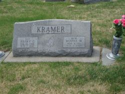
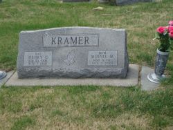
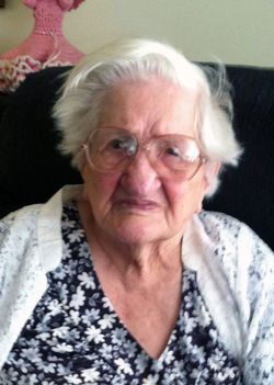
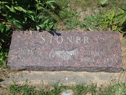
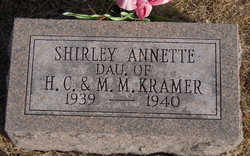
Wilhelmina Marie “Minnie” Pieper Kramer
| Birth | : | 8 May 1911 Cook, Johnson County, Nebraska, USA |
| Death | : | 2 Nov 2001 Adams, Gage County, Nebraska, USA |
| Burial | : | Park Hill Cemetery, Syracuse, Otoe County, USA |
| Coordinate | : | 40.6693993, -96.1875000 |
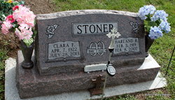
| Description | : | Lincoln Journal Star (NE) - Sunday, November 4, 2001 Kramer -- Minnie M., 90, Sterling, widow of Henry C., died Friday (11/2/01) in Adams. Born near Cook. Homemaker. Survivors: son, Pastor David Kramer, Nashua, Iowa; daughters, Rosie Lempka, Tecumseh, Sharon Lott, Geneva; nine grandchildren; three stepgrandchildren; seven great-grandchildren; two stepgreat-grandchildren; sisters, Amanda Stoner, Lincoln, Clara Stoner, Syracuse, Darlene Carman, Cook; nieces and nephews. Services: 10:30 a.m. Monday, Saint John Lutheran Church, Sterling. Burial: 1:30 p.m. Monday, Parkhill Cemetery, Syracuse. Visitation: Until 8 p.m. Sunday, with family greeting friends 6:30-8 p.m. Sunday, Zink-Fox Funeral Home, Sterling; one hour before services, the church.... Read More |
frequently asked questions (FAQ):
-
Where is Wilhelmina Marie “Minnie” Pieper Kramer's memorial?
Wilhelmina Marie “Minnie” Pieper Kramer's memorial is located at: Park Hill Cemetery, Syracuse, Otoe County, USA.
-
When did Wilhelmina Marie “Minnie” Pieper Kramer death?
Wilhelmina Marie “Minnie” Pieper Kramer death on 2 Nov 2001 in Adams, Gage County, Nebraska, USA
-
Where are the coordinates of the Wilhelmina Marie “Minnie” Pieper Kramer's memorial?
Latitude: 40.6693993
Longitude: -96.1875000
Family Members:
Parent
Spouse
Siblings
Children
Flowers:
Nearby Cemetories:
1. Park Hill Cemetery
Syracuse, Otoe County, USA
Coordinate: 40.6693993, -96.1875000
2. Warner Cemetery
Syracuse, Otoe County, USA
Coordinate: 40.6822014, -96.1652985
3. Dudley Cemetery
Syracuse, Otoe County, USA
Coordinate: 40.6082993, -96.1988983
4. Corbin Family Cemetery
Otoe, Otoe County, USA
Coordinate: 40.7095820, -96.1028640
5. Unadilla Cemetery
Unadilla, Otoe County, USA
Coordinate: 40.6974983, -96.2818985
6. Whitten Family Cemetery
Otoe, Otoe County, USA
Coordinate: 40.7407460, -96.1414650
7. Delaware Lutheran Cemetery
Otoe County, USA
Coordinate: 40.6244087, -96.0870438
8. North Branch Lutheran Cemetery
Otoe County, USA
Coordinate: 40.7640510, -96.1781450
9. Dunbar Cemetery
Dunbar, Otoe County, USA
Coordinate: 40.6542015, -96.0578003
10. Hopewell Presbyterian Church Cemetery
Otoe County, USA
Coordinate: 40.6090150, -96.2930630
11. Otoe County Poor Farm Cemetery
Dunbar, Otoe County, USA
Coordinate: 40.6610430, -96.0471480
12. Union Cemetery
Otoe, Otoe County, USA
Coordinate: 40.7411003, -96.0746994
13. Pleasant Hill Cemetery
Otoe County, USA
Coordinate: 40.7694016, -96.2602997
14. Thompson Cemetery
Otoe County, USA
Coordinate: 40.7256012, -96.3311005
15. Schacht Cemetery
Otoe County, USA
Coordinate: 40.5447006, -96.1271973
16. Saint Pauls Cemetery
Otoe County, USA
Coordinate: 40.5372330, -96.1524720
17. Saint Johns Cemetery
Talmage, Otoe County, USA
Coordinate: 40.5820847, -96.0474625
18. Avoca Cemetery
Avoca, Cass County, USA
Coordinate: 40.7994003, -96.1278000
19. Pioneer Cemetery
Palmyra, Otoe County, USA
Coordinate: 40.6903000, -96.3685989
20. Hope Lutheran Cemetery
Burr, Otoe County, USA
Coordinate: 40.5525017, -96.2938995
21. Holy Trinity Catholic Church Cemetery
Otoe County, USA
Coordinate: 40.7763090, -96.0583380
22. Biggs Cemetery
Lorton, Otoe County, USA
Coordinate: 40.6025009, -96.0105972
23. Grace Lutheran Church Cemetery
Cook, Johnson County, USA
Coordinate: 40.5178000, -96.1799500
24. Cook Cemetery
Cook, Johnson County, USA
Coordinate: 40.5168991, -96.1797028

