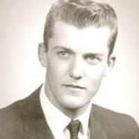
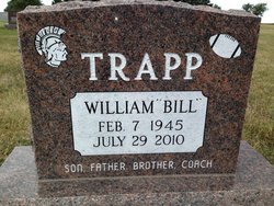
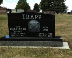
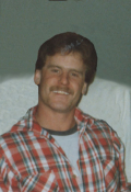
William Alan/Allen “Bill” Trapp
| Birth | : | 7 Feb 1945 South Dakota, USA |
| Death | : | 29 Jul 2010 Albion, Boone County, Nebraska, USA |
| Burial | : | Conde Cemetery, Conde, Spink County, USA |
| Coordinate | : | 45.1617370, -98.0854110 |
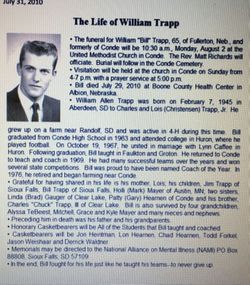
| Description | : | Aged: 65 Years ************************************************** Obituary published by Paetznick-Garness Funeral Chapel William "Bill" Trapp (Died July 29, 2010) Services for William "Bill" Trapp, 65, of Fullerton, Nebraska and formerly of Conde will be 10:30 a.m., Monday, August 2nd at the United Methodist Church in Conde. Rev. Matt Richards will officiate. Burial will follow in the Conde Cemetery under the direction of Paetznick-Garness Funeral Chapel, Groton. Visitation will be held at the church in Conde on Sunday from 4-7 p.m. with a prayer service at 5:00 p.m. Bill passed away July 29, 2010 at Boone County Health Center in Albion, Nebraska. William Allen Trapp was born on February 7,... Read More |
frequently asked questions (FAQ):
-
Where is William Alan/Allen “Bill” Trapp's memorial?
William Alan/Allen “Bill” Trapp's memorial is located at: Conde Cemetery, Conde, Spink County, USA.
-
When did William Alan/Allen “Bill” Trapp death?
William Alan/Allen “Bill” Trapp death on 29 Jul 2010 in Albion, Boone County, Nebraska, USA
-
Where are the coordinates of the William Alan/Allen “Bill” Trapp's memorial?
Latitude: 45.1617370
Longitude: -98.0854110
Family Members:
Parent
Siblings
Flowers:
Nearby Cemetories:
1. Conde Cemetery
Conde, Spink County, USA
Coordinate: 45.1617370, -98.0854110
2. Saint Johns Cemetery
Conde, Spink County, USA
Coordinate: 45.1538860, -98.0888600
3. Verdon Cemetery
Spink County, USA
Coordinate: 45.2332993, -98.0843964
4. Crandall Cemetery
Clark County, USA
Coordinate: 45.1528015, -97.9630966
5. Verdon Cemetery
Verdon, Brown County, USA
Coordinate: 45.2551100, -98.1037410
6. Witt Crandall Cemetery
Crandall, Day County, USA
Coordinate: 45.1752870, -97.9517410
7. Saint Josephs Cemetery
Turton, Spink County, USA
Coordinate: 45.0479660, -98.0899500
8. Sunnyside Cemetery
Turton, Spink County, USA
Coordinate: 45.0472600, -98.0849800
9. Scotland Cemetery
Day County, USA
Coordinate: 45.2580986, -97.9606018
10. Hutterville Colony Cemetery
Stratford, Brown County, USA
Coordinate: 45.2639000, -98.2139500
11. Saint Pauls Cemetery
Ferney, Brown County, USA
Coordinate: 45.3269005, -98.0927963
12. Baldwin Cemetery
Brentford, Spink County, USA
Coordinate: 45.1130981, -98.3392029
13. Plainview Cemetery
Brentford, Spink County, USA
Coordinate: 45.1782990, -98.3486023
14. East Rondell Cemetery
Stratford, Brown County, USA
Coordinate: 45.3053017, -98.2675018
15. Saint Ansgar Cemetery
Lily, Day County, USA
Coordinate: 45.1733017, -97.7994003
16. Saint Thomas Cemetery
Crocker, Clark County, USA
Coordinate: 45.0964012, -97.8088989
17. West Hanson Cemetery
Groton, Brown County, USA
Coordinate: 45.3570320, -98.1845470
18. Oakwood Cemetery
Stratford, Brown County, USA
Coordinate: 45.2599983, -98.3516998
19. Bethany Cemetery
Mellette, Spink County, USA
Coordinate: 45.2149086, -98.3806381
20. Clifton Cemetery
Clifton Township, Spink County, USA
Coordinate: 45.0106010, -98.3197021
21. Bethany Cemetery
Day County, USA
Coordinate: 45.2831001, -97.8174973
22. Sjurson Cemetery
Butler, Day County, USA
Coordinate: 45.2692990, -97.7768610
23. Our Saviors Lutheran West Cemetery
Clark County, USA
Coordinate: 45.1381000, -97.7372000
24. Scandinavia Lutheran Cemetery
Gem Township, Brown County, USA
Coordinate: 45.3569104, -98.3307271

