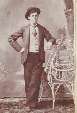
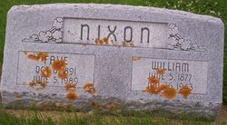
William Allen Nixon
| Birth | : | 5 Jun 1877 Kansas, USA |
| Death | : | 28 Jan 1943 Van Buren County, Iowa, USA |
| Burial | : | Freeling General Cemetery, Freeling, Light Regional Council, Australia |
| Coordinate | : | -34.4506860, 138.8227030 |
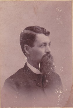
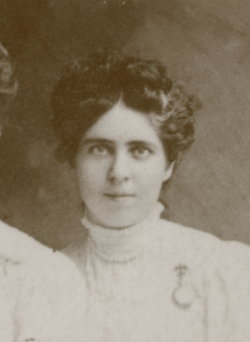
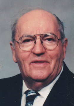
| Description | : | William was the son of Jacob Nixon and Barbara Agnes Rowe. William A. Nixon died quite suddenly about 11:30 Tuesday night, January 28, 1943 at his home on a farm a mile northwest of Cantril where he had lived about three years, moving there from a farm west of Hillsboro. He was born in Kansas about 66 years ago, a son of Mr. And Mrs. Jacob Nixon and is survived by his wife, formerly Faye Peck and four children, Eugene, Mary, Dorothy and Betty, all at home. He is also survived by three brothers, Dr. Earl Nixon of Oxford, Kansas, Scott... Read More |
frequently asked questions (FAQ):
-
Where is William Allen Nixon's memorial?
William Allen Nixon's memorial is located at: Freeling General Cemetery, Freeling, Light Regional Council, Australia.
-
When did William Allen Nixon death?
William Allen Nixon death on 28 Jan 1943 in Van Buren County, Iowa, USA
-
Where are the coordinates of the William Allen Nixon's memorial?
Latitude: -34.4506860
Longitude: 138.8227030
Family Members:
Parent
Spouse
Siblings
Children
Flowers:
Nearby Cemetories:
1. Freeling General Cemetery
Freeling, Light Regional Council, Australia
Coordinate: -34.4506860, 138.8227030
2. Schoenfeld Lutheran Cemetery
Freeling, Light Regional Council, Australia
Coordinate: -34.4303990, 138.7962020
3. Morn Hill Primitive Cemetery
Light Regional Council, Australia
Coordinate: -34.4302930, 138.7962190
4. Nain Lutheran Cemetery
Nain, Light Regional Council, Australia
Coordinate: -34.4505600, 138.9000300
5. Templers Wesleyan Churchyard
Templers, Light Regional Council, Australia
Coordinate: -34.4699180, 138.7467280
6. Zum Schmalen Weg Lutheran Cemetery
Nain, Light Regional Council, Australia
Coordinate: -34.4519000, 138.9034000
7. Gomersal Good Shepherd Lutheran Cemetery
Gomersal, Light Regional Council, Australia
Coordinate: -34.5240570, 138.8715950
8. Greenock Public Cemetery
Greenock, Light Regional Council, Australia
Coordinate: -34.4541700, 138.9284000
9. Magdala Lutheran Cemetery
Light Regional Council, Australia
Coordinate: -34.4330100, 138.7088600
10. Gnadenfrei Lutheran Cemetery
Marananga, Light Regional Council, Australia
Coordinate: -34.4824300, 138.9336200
11. Bethel Steinthal Lutheran Cemetery
Stockport, District Council of Clare and Gilbert Valleys, Australia
Coordinate: -34.3478380, 138.8194770
12. Trinity Lutheran Cemetery
Rosedale, Light Regional Council, Australia
Coordinate: -34.5580000, 138.8464600
13. Gomersal Schoenborn Lutheran Cemetery
Gomersal, Light Regional Council, Australia
Coordinate: -34.5401200, 138.9014600
14. Bethel Moravian Lutheran Cemetery
Bethel, Light Regional Council, Australia
Coordinate: -34.3339900, 138.8276000
15. Bethel Lutheran Cemetery
Bethel, Light Regional Council, Australia
Coordinate: -34.3310930, 138.8341580
16. Concordia Pioneer Cemetery
Concordia, Barossa Council, Australia
Coordinate: -34.5748700, 138.8016100
17. Stockport Cemetery
Stockport, District Council of Clare and Gilbert Valleys, Australia
Coordinate: -34.3367900, 138.7405500
18. Langmeil Lutheran Churchyard
Tanunda, Barossa Council, Australia
Coordinate: -34.5265900, 138.9551600
19. St. John's Lutheran Cemetery
Tanunda, Barossa Council, Australia
Coordinate: -34.5325870, 138.9510190
20. Nuriootpa Cemetery
Nuriootpa, Barossa Council, Australia
Coordinate: -34.4660790, 138.9841150
21. Kapunda Christ Church Anglican Cemetery
Kapunda, Light Regional Council, Australia
Coordinate: -34.3483370, 138.9275760
22. Tabor Old Lutheran Church Cemetery
Tanunda, Barossa Council, Australia
Coordinate: -34.5253900, 138.9587660
23. St. John's Catholic Cemetery
Kapunda, Light Regional Council, Australia
Coordinate: -34.3712190, 138.9546610
24. Tabor Lutheran Cemetery
Tanunda, Barossa Council, Australia
Coordinate: -34.5219890, 138.9630260

