

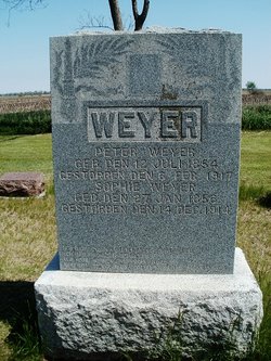
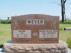
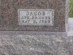
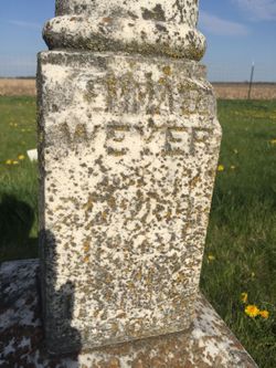
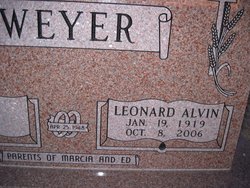
William “Bill” Weyer
| Birth | : | 7 Oct 1887 Gage County, Nebraska, USA |
| Death | : | 4 Nov 1963 Wymore, Gage County, Nebraska, USA |
| Burial | : | Union Chapel Cemetery, Healing Springs, Bath County, USA |
| Coordinate | : | 37.9295703, -79.8833874 |
| Plot | : | NE corner, back row |
frequently asked questions (FAQ):
-
Where is William “Bill” Weyer's memorial?
William “Bill” Weyer's memorial is located at: Union Chapel Cemetery, Healing Springs, Bath County, USA.
-
When did William “Bill” Weyer death?
William “Bill” Weyer death on 4 Nov 1963 in Wymore, Gage County, Nebraska, USA
-
Where are the coordinates of the William “Bill” Weyer's memorial?
Latitude: 37.9295703
Longitude: -79.8833874
Family Members:
Parent

Spouse
Siblings

Children
Flowers:


Nearby Cemetories:
1. Union Chapel Cemetery
Healing Springs, Bath County, USA
Coordinate: 37.9295703, -79.8833874
2. Green Hill Cemetery
Valley View, Alleghany County, USA
Coordinate: 37.9007000, -79.9003000
3. Healing Springs Baptist Church Cemetery
Hot Springs, Bath County, USA
Coordinate: 37.9630340, -79.8607840
4. William Keyser Family Cemetery
Warm Springs, Bath County, USA
Coordinate: 37.9688500, -79.8369400
5. Emory United Methodist Church Cemetery
Falling Spring, Alleghany County, USA
Coordinate: 37.9227000, -79.9625000
6. Eden United Methodist Church Cemetery
Hot Springs, Bath County, USA
Coordinate: 38.0068090, -79.8801530
7. Falling Spring Presbyterian Church Cemetery
Alleghany County, USA
Coordinate: 37.8885000, -79.9771000
8. McClintic Family Cemetery
Bath County, USA
Coordinate: 38.0000860, -79.9428750
9. Pinehurst Cemetery
Switch Back, Bath County, USA
Coordinate: 38.0141570, -79.8415650
10. Oak Grove Advent Christ Church Cemetery
Millboro, Bath County, USA
Coordinate: 37.9601025, -79.7541402
11. Smith Cemetery
Alleghany County, USA
Coordinate: 37.8614006, -79.9897003
12. Peters Family Cemetery
Millboro, Bath County, USA
Coordinate: 37.8932500, -79.7521700
13. Mount Pleasant United Methodist Church Cemetery
Alleghany County, USA
Coordinate: 37.8500420, -79.9831190
14. Mount Hope Cemetery
Bath County, USA
Coordinate: 38.0460900, -79.8634000
15. Walton Memorial Church Cemetery
Clifton Forge, Alleghany County, USA
Coordinate: 37.8342460, -79.7889610
16. Red Hill Cemetery
Clifton Forge, Alleghany County, USA
Coordinate: 37.8153648, -79.8133937
17. Crown Hill Cemetery
Clifton Forge, Alleghany County, USA
Coordinate: 37.8139000, -79.8171997
18. Puckett Cemetery
Griffith, Alleghany County, USA
Coordinate: 37.8721000, -79.7386000
19. Mountain View Cemetery
Clifton Forge, Alleghany County, USA
Coordinate: 37.8135986, -79.8139038
20. Oakland Grove Presbyterian Church and Cemetery
Selma, Alleghany County, USA
Coordinate: 37.8018000, -79.8603000
21. Central Advent Christian Church Cemetery
Clifton Forge, Alleghany County, USA
Coordinate: 37.8286018, -79.7602997
22. West Warm Springs Cemetery
West Warm Springs, Bath County, USA
Coordinate: 38.0565970, -79.8062930
23. Mount Carmel Cemetery
Low Moor, Alleghany County, USA
Coordinate: 37.7879370, -79.8869510
24. Sunrise Cemetery
Low Moor, Alleghany County, USA
Coordinate: 37.7877220, -79.8860710