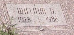
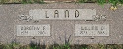
William Daniel Land
| Birth | : | 3 Apr 1923 Liberty, Clay County, Missouri, USA |
| Death | : | 16 Sep 1988 Topeka, Shawnee County, Kansas, USA |
| Burial | : | Pilgrims Rest Cemetery, Christmasville, Carroll County, USA |
| Coordinate | : | 36.0875015, -88.6521988 |
frequently asked questions (FAQ):
-
Where is William Daniel Land's memorial?
William Daniel Land's memorial is located at: Pilgrims Rest Cemetery, Christmasville, Carroll County, USA.
-
When did William Daniel Land death?
William Daniel Land death on 16 Sep 1988 in Topeka, Shawnee County, Kansas, USA
-
Where are the coordinates of the William Daniel Land's memorial?
Latitude: 36.0875015
Longitude: -88.6521988
Family Members:
Spouse
Children
Flowers:
Nearby Cemetories:
1. Pilgrims Rest Cemetery
Christmasville, Carroll County, USA
Coordinate: 36.0875015, -88.6521988
2. McDonald Cemetery
Christmasville, Carroll County, USA
Coordinate: 36.0781900, -88.6219700
3. Capps Cemetery #1
Weakley County, USA
Coordinate: 36.0842056, -88.6881638
4. Fowler Cemetery
Christmasville, Carroll County, USA
Coordinate: 36.0688030, -88.6226690
5. Concord Missionary Baptist Church Cemetery
Hinkledale, Carroll County, USA
Coordinate: 36.1022150, -88.6147960
6. New Hope Presbyterian Church Cemetery
McKenzie, Carroll County, USA
Coordinate: 36.1143150, -88.6226200
7. New Prospect Cemetery
Greenfield, Weakley County, USA
Coordinate: 36.1192017, -88.6889038
8. Seminary Cemetery
Gleason, Weakley County, USA
Coordinate: 36.1314011, -88.6607971
9. Fuqua Cemetery #2
Trezevant, Carroll County, USA
Coordinate: 36.0494520, -88.6123430
10. Oak Grove Cemetery
Trezevant, Carroll County, USA
Coordinate: 36.0350060, -88.6398990
11. McClure - Capp Cemetery
McKenzie, Carroll County, USA
Coordinate: 36.0976110, -88.5855280
12. Patterson Cemetery
Skullbone, Gibson County, USA
Coordinate: 36.0603300, -88.7129100
13. Walker Family Cemetery
Trezevant, Carroll County, USA
Coordinate: 36.0358510, -88.6130660
14. Pleasant Green Cemetery
Bradford, Gibson County, USA
Coordinate: 36.0382996, -88.6992035
15. Republican Grove Cemetery
Trezevant, Carroll County, USA
Coordinate: 36.0235150, -88.6545770
16. Wingo Chapel Cemetery
Wingo, Carroll County, USA
Coordinate: 36.0485500, -88.5834000
17. Wingo Family Cemetery
Trezevant, Carroll County, USA
Coordinate: 36.0329430, -88.5955100
18. Drewry Cemetery
Greenfield, Weakley County, USA
Coordinate: 36.1126000, -88.7366000
19. Mount Pleasant Cemetery
Bradford, Gibson County, USA
Coordinate: 36.0677210, -88.7398220
20. Mount Ararat Cemetery
Trezevant, Carroll County, USA
Coordinate: 36.0140960, -88.6293450
21. McKenzie Amish Community Cemetery
McKenzie, Weakley County, USA
Coordinate: 36.1400340, -88.5823520
22. Everett Chapel Cemetery
Weakley County, USA
Coordinate: 36.1408005, -88.5813980
23. Saint Johns Cemetery
McKenzie, Carroll County, USA
Coordinate: 36.0583950, -88.5609220
24. Trezevant Cemetery
Trezevant, Carroll County, USA
Coordinate: 36.0120400, -88.6195660


