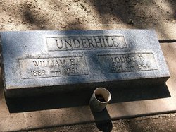
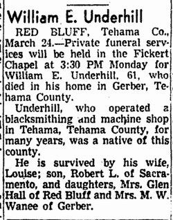
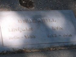
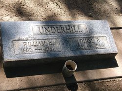
William Ephriam “Willie” Underhill
| Birth | : | 5 Jun 1889 Paskenta, Tehama County, California, USA |
| Death | : | 23 Mar 1951 Gerber, Tehama County, California, USA |
| Burial | : | Strong Village Cemetery, Strong, Franklin County, USA |
| Coordinate | : | 44.8102570, -70.2248688 |
frequently asked questions (FAQ):
-
Where is William Ephriam “Willie” Underhill's memorial?
William Ephriam “Willie” Underhill's memorial is located at: Strong Village Cemetery, Strong, Franklin County, USA.
-
When did William Ephriam “Willie” Underhill death?
William Ephriam “Willie” Underhill death on 23 Mar 1951 in Gerber, Tehama County, California, USA
-
Where are the coordinates of the William Ephriam “Willie” Underhill's memorial?
Latitude: 44.8102570
Longitude: -70.2248688
Family Members:
Parent
Spouse
Children
Flowers:
Nearby Cemetories:
1. Strong Village Cemetery
Strong, Franklin County, USA
Coordinate: 44.8102570, -70.2248688
2. Town Line Cemetery
Strong, Franklin County, USA
Coordinate: 44.8026700, -70.2469700
3. Conant Cemetery
Strong, Franklin County, USA
Coordinate: 44.7917950, -70.2267550
4. West Freeman Cemetery
Franklin County, USA
Coordinate: 44.8382170, -70.2357000
5. Stevens Cemetery
Franklin County, USA
Coordinate: 44.8410210, -70.2167130
6. Isaac Thompson Burial Plot
Avon, Franklin County, USA
Coordinate: 44.8061104, -70.2716675
7. True Cemetery
Freeman, Franklin County, USA
Coordinate: 44.8439900, -70.2164980
8. Cunningham-Cates Cemetery
Strong, Franklin County, USA
Coordinate: 44.7794647, -70.1886368
9. Huff Cemetery
Franklin County, USA
Coordinate: 44.8501000, -70.2116000
10. Hunter Cemetery
Strong, Franklin County, USA
Coordinate: 44.7613300, -70.2173610
11. Mile Square Cemetery
Avon, Franklin County, USA
Coordinate: 44.8270500, -70.2924600
12. Day Mountain Cemetery
Avon, Franklin County, USA
Coordinate: 44.7648667, -70.2688667
13. Voter Cemetery
New Vineyard, Franklin County, USA
Coordinate: 44.7968250, -70.1479050
14. Sprague-Howland Cemetery
Avon, Franklin County, USA
Coordinate: 44.8042440, -70.3052920
15. Hunter Mountain Cemetery
New Vineyard, Franklin County, USA
Coordinate: 44.7633300, -70.1775000
16. Pease Cemetery
Avon, Franklin County, USA
Coordinate: 44.7993670, -70.3060500
17. Herrick Mountain Cemetery
New Vineyard, Franklin County, USA
Coordinate: 44.7736790, -70.1589960
18. Brackley Cemetery
Phillips, Franklin County, USA
Coordinate: 44.8729000, -70.2594170
19. Barrett Cemetery
New Vineyard, Franklin County, USA
Coordinate: 44.8385700, -70.1362300
20. Hackett-Notch Cemetery
New Vineyard, Franklin County, USA
Coordinate: 44.7863000, -70.1303830
21. Starbird Corner Cemetery
Franklin County, USA
Coordinate: 44.8838070, -70.2193160
22. Tuttle Corner Cemetery
Freeman, Franklin County, USA
Coordinate: 44.8763250, -70.1727650
23. Pearson Cemetery
New Vineyard, Franklin County, USA
Coordinate: 44.7637540, -70.1406170
24. Mount Blue Cemetery
Avon, Franklin County, USA
Coordinate: 44.7762830, -70.3240830

