William Franklin Bias
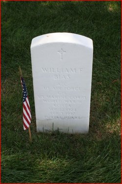
| Birth | : | 22 Sep 1924 Boone County, West Virginia, USA |
| Death | : | 3 Feb 1997 |
| Burial | : | Holy Family Cemetery, Lidderdale, Carroll County, USA |
| Coordinate | : | 42.1178017, -94.7839966 |
| Plot | : | Section 1B, Site 7277 |
| Inscription | : | Grave marker notes also Marine Corps. |
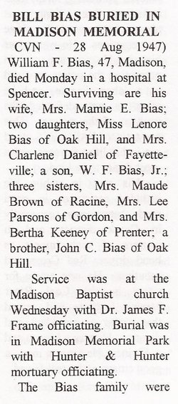
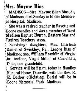
| Description | : | EX-EDUCATOR WILLIAM BIAS DIES William Bias, retired assistant superintendent of the New Kent County Public Schools, died Monday of Alzheimer's disease. He was 72 and lived in Quinton. Mr. Bias served the school system as assistant superintendent from 1972 to 1987. He taught physical education at New Kent High School in 1986 and also coached golf and football there. He earned a bachelor's degree from Concord University in West Virginia in 1952. He taught physical education and history for several years in West Virginia before enlisting in the Air Force. After his discharge four years later, Mr. Bias coached sports at Fork Union Military Academy. He... Read More |
frequently asked questions (FAQ):
-
Where is William Franklin Bias's memorial?
William Franklin Bias's memorial is located at: Holy Family Cemetery, Lidderdale, Carroll County, USA.
-
When did William Franklin Bias death?
William Franklin Bias death on 3 Feb 1997 in
-
Where are the coordinates of the William Franklin Bias's memorial?
Latitude: 42.1178017
Longitude: -94.7839966
Family Members:
Parent
Siblings
Flowers:
Nearby Cemetories:
1. Holy Family Cemetery
Lidderdale, Carroll County, USA
Coordinate: 42.1178017, -94.7839966
2. Immanuel Cemetery
Lidderdale, Carroll County, USA
Coordinate: 42.1389008, -94.8022003
3. East Liberty Cemetery
Lidderdale, Carroll County, USA
Coordinate: 42.1591988, -94.7636032
4. West Lawn Cemetery
Glidden, Carroll County, USA
Coordinate: 42.0649986, -94.7406006
5. Dickson Cemetery
Glidden Township, Carroll County, USA
Coordinate: 42.1074982, -94.6939011
6. Lanesboro Cemetery
Lanesboro, Carroll County, USA
Coordinate: 42.1810989, -94.7230988
7. Carroll City Cemetery
Carroll, Carroll County, USA
Coordinate: 42.0560963, -94.8599856
8. North Coon Cemetery
Carroll County, USA
Coordinate: 42.1260986, -94.6716995
9. Mount Olivet Cemetery
Carroll, Carroll County, USA
Coordinate: 42.0536340, -94.8595510
10. Our Lady Of Mount Carmel Cemetery
Mount Carmel, Carroll County, USA
Coordinate: 42.1547012, -94.9088974
11. Saint Francis Cemetery
Maple River, Carroll County, USA
Coordinate: 42.0969009, -94.9372025
12. Cottonwood Cemetery
Lake City, Calhoun County, USA
Coordinate: 42.2491989, -94.7936020
13. Dillavou Cemetery
Kendrick Township, Greene County, USA
Coordinate: 42.0802994, -94.6138992
14. Saint Marys Catholic Cemetery
Willey, Carroll County, USA
Coordinate: 41.9783363, -94.8212204
15. Luckow Cemetery
Auburn, Sac County, USA
Coordinate: 42.2168999, -94.9266968
16. Bishop Cemetery
Calhoun Township, Calhoun County, USA
Coordinate: 42.2230400, -94.6453190
17. Holy Angels Cemetery
Carroll County, USA
Coordinate: 42.0014000, -94.9141998
18. Saint Bernards Cemetery
Breda, Carroll County, USA
Coordinate: 42.1786003, -94.9732971
19. Lake City Cemetery
Lake City, Calhoun County, USA
Coordinate: 42.2719002, -94.7574997
20. Saint Marys Catholic Cemetery
Lake City, Calhoun County, USA
Coordinate: 42.2730000, -94.7567000
21. Saint Marys Cemetery
Sac County, USA
Coordinate: 42.2611008, -94.8839035
22. Oak Lawn Cemetery
Auburn, Sac County, USA
Coordinate: 42.2611008, -94.8852997
23. Grant City Cemetery
Grant City, Sac County, USA
Coordinate: 42.2681007, -94.8908005
24. Arcadia Cemetery
Arcadia Township, Carroll County, USA
Coordinate: 42.1000680, -95.0130550


