
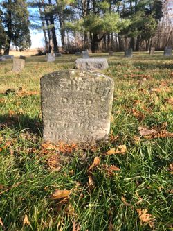
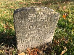

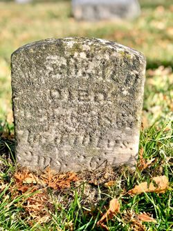
William Heald
| Birth | : | 10 Jan 1766 Loudoun County, Virginia, USA |
| Death | : | 6 Apr 1867 Cedar County, Iowa, USA |
| Burial | : | Hickory Grove Cemetery, Cedar County, USA |
| Coordinate | : | 41.6637000, -91.3073000 |
| Plot | : | Row 7 Grave 6 |
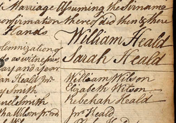
| Description | : | His family moved from Loudoun County, Virginia into the Monongahela Valley in 1771, being some of the earliest settlers. He and his brother John preceded the family in a move to Columbiana County, Ohio. He later moved his family to the Iowa region. William married Sarah Wilson on 1 Nov 1792 He lived to be 101 years old. ----------------------------- From Find A Grave contributor Mary Ann Bumgarner: WRITTEN BY HIMSELF ON HIS 100TH BIRTHDAY (Born 1766) I was born in Loudoun County, Virginia, on the 10th day of the First Month, 1766, at the foot of a mountain called "Short Hill", a spur which puts out... Read More |
frequently asked questions (FAQ):
-
Where is William Heald's memorial?
William Heald's memorial is located at: Hickory Grove Cemetery, Cedar County, USA.
-
When did William Heald death?
William Heald death on 6 Apr 1867 in Cedar County, Iowa, USA
-
Where are the coordinates of the William Heald's memorial?
Latitude: 41.6637000
Longitude: -91.3073000
Family Members:
Parent

Spouse
Siblings

Children
Flowers:


Nearby Cemetories:
1. Hickory Grove Cemetery
Cedar County, USA
Coordinate: 41.6637000, -91.3073000
2. Chamness Burial Plot
Springdale, Cedar County, USA
Coordinate: 41.6597351, -91.3182108
3. Saint Bernadette Catholic Church
West Branch, Cedar County, USA
Coordinate: 41.6755750, -91.3396070
4. Friends Village Cemetery
West Branch, Cedar County, USA
Coordinate: 41.6732000, -91.3470000
5. Herbert Hoover National Historic Site
West Branch, Cedar County, USA
Coordinate: 41.6681500, -91.3519900
6. West Branch Cemetery
West Branch, Cedar County, USA
Coordinate: 41.6765000, -91.3515000
7. Springdale Cemetery
Springdale, Cedar County, USA
Coordinate: 41.6786003, -91.2581024
8. Downey Cemetery
Downey, Cedar County, USA
Coordinate: 41.6119003, -91.3182983
9. Honey Grove Cemetery
Cedar County, USA
Coordinate: 41.7158012, -91.3266983
10. North Liberty Cemetery
Springdale, Cedar County, USA
Coordinate: 41.6852989, -91.2292023
11. Oasis Cemetery
Oasis, Johnson County, USA
Coordinate: 41.7005997, -91.3858032
12. Pee Dee Cemetery
Cedar County, USA
Coordinate: 41.6699982, -91.2142029
13. Saint Joseph Cemetery
Cedar Valley, Cedar County, USA
Coordinate: 41.7295000, -91.2667000
14. North Prairie Cemetery
West Liberty, Muscatine County, USA
Coordinate: 41.5924988, -91.2694016
15. United Brethren Cemetery
Cedar County, USA
Coordinate: 41.7445000, -91.3285000
16. Howard Cemetery
Plato, Cedar County, USA
Coordinate: 41.7486303, -91.2918299
17. Fairview Cemetery
Johnson County, USA
Coordinate: 41.6931000, -91.4171982
18. Molback Farm Cemetery
Iowa City, Johnson County, USA
Coordinate: 41.6253910, -91.4181800
19. Burnett Burial Site
Rochester, Cedar County, USA
Coordinate: 41.6680782, -91.1834911
20. Dunfee Burial Site
Rochester, Cedar County, USA
Coordinate: 41.6266900, -91.1834904
21. North Scott Cemetery
Johnson County, USA
Coordinate: 41.6634500, -91.4477000
22. Oak Ridge Cemetery
West Liberty, Muscatine County, USA
Coordinate: 41.5619011, -91.2641983
23. Mount Calvary Cemetery
West Liberty, Muscatine County, USA
Coordinate: 41.5564003, -91.2711029
24. South Prairie Cemetery
West Liberty, Muscatine County, USA
Coordinate: 41.5541992, -91.3308029