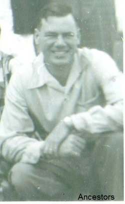
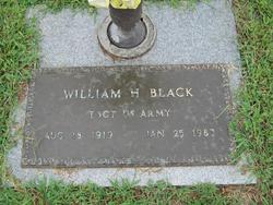
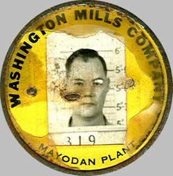
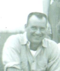
William Herbert “Bill or Huggie (within family)” Black
| Birth | : | 18 Aug 1919 Mayodan, Rockingham County, North Carolina, USA |
| Death | : | 25 Jan 1983 Winston-Salem, Forsyth County, North Carolina, USA |
| Burial | : | Saint Joseph Cemetery, Damar, Rooks County, USA |
| Coordinate | : | 39.3046989, -99.6038971 |
| Description | : | Mayodan - William Herbert "Bill, Huggie" Black, 63, of 404 N. 11th Ave., died Tuesday at Forsyth Memorial Hospital, Winston-Salem. Funeral will be 11a.m. Thursday at Ray Funeral Home, Madison. Burial will be in Mayodan Municipal Cemetery. He was a native of Rockingham County, a member of First Baptist Church of Mayodan and Veterans of Foreign Wars and a World War II veteran. Surviving are wife, Mrs. Ernestine Johnson Black; sisters, Miss Iris Black, Mrs. Lillian Martin and Mrs. Nannie Wood of Mayodan; brothers: Clifton, Gilmer and Robert Black of Mayodan, Thomas Black of Summerfield. The family will be... Read More |
frequently asked questions (FAQ):
-
Where is William Herbert “Bill or Huggie (within family)” Black's memorial?
William Herbert “Bill or Huggie (within family)” Black's memorial is located at: Saint Joseph Cemetery, Damar, Rooks County, USA.
-
When did William Herbert “Bill or Huggie (within family)” Black death?
William Herbert “Bill or Huggie (within family)” Black death on 25 Jan 1983 in Winston-Salem, Forsyth County, North Carolina, USA
-
Where are the coordinates of the William Herbert “Bill or Huggie (within family)” Black's memorial?
Latitude: 39.3046989
Longitude: -99.6038971
Family Members:
Parent
Spouse
Siblings
Flowers:
Nearby Cemetories:
1. Saint Joseph Cemetery
Damar, Rooks County, USA
Coordinate: 39.3046989, -99.6038971
2. Palco Cemetery
Palco, Rooks County, USA
Coordinate: 39.2633018, -99.5674973
3. Samuel Cemetery
Graham County, USA
Coordinate: 39.3074989, -99.6782990
4. Wildhorse Township Cemetery
Wildhorse Township, Graham County, USA
Coordinate: 39.3438988, -99.6866989
5. Green Mound Cemetery
Palco, Rooks County, USA
Coordinate: 39.2788800, -99.5120500
6. Pleasantview Cemetery
Palco, Rooks County, USA
Coordinate: 39.2332993, -99.5124969
7. Nicodemus Cemetery
Graham County, USA
Coordinate: 39.4082985, -99.6027985
8. Morlan Township Cemetery
Graham County, USA
Coordinate: 39.2263985, -99.6977997
9. Alcona Cemetery
Webster, Rooks County, USA
Coordinate: 39.4012680, -99.5429130
10. Mount Olive Cemetery
Bogue, Graham County, USA
Coordinate: 39.3939700, -99.6933100
11. Fagan Cemetery
Bogue, Graham County, USA
Coordinate: 39.3633003, -99.7319031
12. Eureka Cemetery
Webster, Rooks County, USA
Coordinate: 39.3139000, -99.4552994
13. Saint Ann's Catholic Cemetery
Zurich, Rooks County, USA
Coordinate: 39.2310930, -99.4354950
14. Zurich Cemetery
Zurich, Rooks County, USA
Coordinate: 39.2271996, -99.4383011
15. McFarland Cemetery
Graham County, USA
Coordinate: 39.4658012, -99.6660995
16. Webster Cemetery (Defunct)
Rooks County, USA
Coordinate: 39.4199982, -99.4250031
17. Slate Cemetery
Rooks County, USA
Coordinate: 39.4879400, -99.5281100
18. Hobart Cemetery
Webster, Rooks County, USA
Coordinate: 39.3847008, -99.3621979
19. Memorial Lawn Cemetery
Hill City, Graham County, USA
Coordinate: 39.3927803, -99.8452072
20. Hill City Cemetery
Hill City, Graham County, USA
Coordinate: 39.3944893, -99.8451996
21. Mount Vernon Cemetery
Stockton, Rooks County, USA
Coordinate: 39.4660988, -99.4152985
22. Buchanan Brown Cemetery
Bogue, Graham County, USA
Coordinate: 39.5250015, -99.6393967
23. Prairie Home Cemetery
Graham County, USA
Coordinate: 39.1903000, -99.8566971
24. Roscoe Cemetery
Graham County, USA
Coordinate: 39.4963989, -99.7694016

