
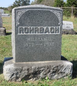
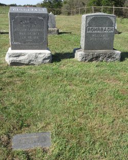
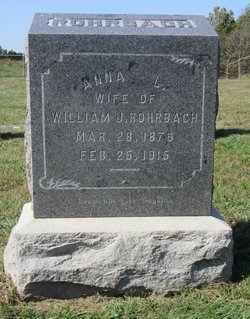
William John Rohrbach
| Birth | : | 8 Sep 1877 Moniteau County, Missouri, USA |
| Death | : | 30 Jan 1932 California, Moniteau County, Missouri, USA |
| Burial | : | Wakeeney City Cemetery, WaKeeney, Trego County, USA |
| Coordinate | : | 39.0158005, -99.8711014 |
frequently asked questions (FAQ):
-
Where is William John Rohrbach's memorial?
William John Rohrbach's memorial is located at: Wakeeney City Cemetery, WaKeeney, Trego County, USA.
-
When did William John Rohrbach death?
William John Rohrbach death on 30 Jan 1932 in California, Moniteau County, Missouri, USA
-
Where are the coordinates of the William John Rohrbach's memorial?
Latitude: 39.0158005
Longitude: -99.8711014
Family Members:
Parent

Spouse
Siblings

Children
Flowers:


Nearby Cemetories:
1. Wakeeney City Cemetery
WaKeeney, Trego County, USA
Coordinate: 39.0158005, -99.8711014
2. Christ the King Catholic Cemetery
WaKeeney, Trego County, USA
Coordinate: 39.0166500, -99.8712000
3. Kansas Veterans Cemetery at Wakeeney
WaKeeney, Trego County, USA
Coordinate: 39.0172200, -99.8715300
4. Ogallah Cemetery
Trego County, USA
Coordinate: 38.9925003, -99.7241974
5. Saline Valley Cemetery
Trego County, USA
Coordinate: 39.1180992, -99.9610977
6. Zion Lutheran Cemetery
Trego Center, Trego County, USA
Coordinate: 38.8782997, -99.8927994
7. Emanuel Lutheran Cemetery
Ogallah, Trego County, USA
Coordinate: 38.8800100, -99.7442700
8. Prairie Home Cemetery
Graham County, USA
Coordinate: 39.1903000, -99.8566971
9. Union Cemetery
Collyer, Trego County, USA
Coordinate: 39.0299988, -100.1125031
10. Saint Michaels Cemetery
Collyer, Trego County, USA
Coordinate: 39.0318985, -100.1153030
11. Leland Cemetery
Penokee, Graham County, USA
Coordinate: 39.2256012, -100.0149994
12. Saint Anthony Cemetery
Graham County, USA
Coordinate: 39.1892014, -100.0805969
13. Morlan Township Cemetery
Graham County, USA
Coordinate: 39.2263985, -99.6977997
14. Saint Johns Lutheran Cemetery
Ellis, Ellis County, USA
Coordinate: 39.0294450, -99.5401140
15. Old Order German Baptist Cemetery
Quinter, Gove County, USA
Coordinate: 39.0299988, -100.2052994
16. St. Mary's Cemetery
Ellis, Ellis County, USA
Coordinate: 38.9427200, -99.5491800
17. Mount Hope Cemetery
Ellis, Ellis County, USA
Coordinate: 38.9338989, -99.5481033
18. Quinter Cemetery
Quinter, Gove County, USA
Coordinate: 39.0736008, -100.2236023
19. Brush Creek Cemetery
Graham County, USA
Coordinate: 39.3011900, -99.9743400
20. Red Top Cemetery
Quinter, Gove County, USA
Coordinate: 38.9449997, -100.2431030
21. Samuel Cemetery
Graham County, USA
Coordinate: 39.3074989, -99.6782990
22. Mount Pleasant Community Cemetery
Studley, Sheridan County, USA
Coordinate: 39.2550011, -100.1635971
23. Cyrus Cemetery
Ransom, Ness County, USA
Coordinate: 38.6833000, -99.8491974
24. Penokee Cemetery
Penokee, Graham County, USA
Coordinate: 39.3425293, -99.9727402