

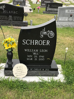
William Leon “Bill” Schroer
| Birth | : | 26 Nov 1941 Hastings, Adams County, Nebraska, USA |
| Death | : | 21 Mar 2015 Phoenix, Maricopa County, Arizona, USA |
| Burial | : | Sacred Heart Cemetery, Lawrence, Nuckolls County, USA |
| Coordinate | : | 40.2921982, -98.2268982 |
| Description | : | William “Bill” Leon Schroer, 73, of Phoenix, Arizona, formerly of Hastings and Lawrence, Nebraska passed away peacefully on March 21, 2015, surrounded by his loved ones. Bill was the son of Harold “Butch” and Leona (Ostdiek) Schroer. He was born in Hastings, Nebraska on November 26, 1941 and grew up in Lawrence and Hebron, Nebraska. Bill was a third generation John Deere Dealer, acquiring the business in 1973 from his father. He was the owner of Schroer Implement in Lawrence, Nebraska, South Central Equipment and co-owner of Oregon Trail Equipment in Fairfield, Nebraska. Bill retired in 2008. After retirement he moved... Read More |
frequently asked questions (FAQ):
-
Where is William Leon “Bill” Schroer's memorial?
William Leon “Bill” Schroer's memorial is located at: Sacred Heart Cemetery, Lawrence, Nuckolls County, USA.
-
When did William Leon “Bill” Schroer death?
William Leon “Bill” Schroer death on 21 Mar 2015 in Phoenix, Maricopa County, Arizona, USA
-
Where are the coordinates of the William Leon “Bill” Schroer's memorial?
Latitude: 40.2921982
Longitude: -98.2268982
Family Members:
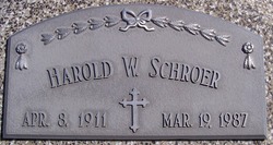
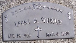
Parent
Spouse
Flowers:


Nearby Cemetories:
1. Sacred Heart Cemetery
Lawrence, Nuckolls County, USA
Coordinate: 40.2921982, -98.2268982
2. Evergreen Cemetery
Lawrence, Nuckolls County, USA
Coordinate: 40.2922401, -98.2723236
3. Saint Stephens Cemetery
Nuckolls County, USA
Coordinate: 40.2544899, -98.2562485
4. Liberty Creek Cemetery
Nuckolls County, USA
Coordinate: 40.3361015, -98.2035980
5. OBanion Cemetery
Blue Hill, Webster County, USA
Coordinate: 40.2850000, -98.3020000
6. Hannum Graves
Lawrence, Nuckolls County, USA
Coordinate: 40.3456500, -98.1766800
7. Saint Martin-Loucky Cemetery
Deweese, Clay County, USA
Coordinate: 40.3652496, -98.1948624
8. Zion Cemetery
Webster County, USA
Coordinate: 40.2277985, -98.2921982
9. Union Cemetery
Nuckolls County, USA
Coordinate: 40.3146706, -98.1236877
10. Assumption Church Cemetery
Deweese, Clay County, USA
Coordinate: 40.3507000, -98.1324000
11. Rosemont Presbyterian Cemetery
Rosemont, Webster County, USA
Coordinate: 40.2775002, -98.3475037
12. Oak Creek Cemetery
Webster County, USA
Coordinate: 40.3436012, -98.3293991
13. Spring Ranch Cemetery
Clay County, USA
Coordinate: 40.4065100, -98.2484100
14. Saint Aloysius Cemetery
Deweese, Clay County, USA
Coordinate: 40.3932991, -98.1278000
15. Smith Cemetery
Nelson, Nuckolls County, USA
Coordinate: 40.3078003, -98.0567017
16. Eckley Cemetery
Webster County, USA
Coordinate: 40.2057991, -98.3581009
17. Salem Cemetery
Webster County, USA
Coordinate: 40.2341995, -98.3855972
18. Beaver Creek Cemetery
Webster County, USA
Coordinate: 40.1617012, -98.2882996
19. Emmanuel Lutheran Cemetery
Webster County, USA
Coordinate: 40.2057991, -98.3728027
20. Nelson Cemetery
Nelson, Nuckolls County, USA
Coordinate: 40.2056084, -98.0791702
21. Walker Cemetery
Blue Hill, Webster County, USA
Coordinate: 40.2881012, -98.4255981
22. Fairfield Cemetery
Fairfield, Clay County, USA
Coordinate: 40.4094009, -98.0982971
23. Monia Cemetery
Webster County, USA
Coordinate: 40.1605988, -98.3296967
24. Howe Cemetery
Webster County, USA
Coordinate: 40.2341730, -98.4154440