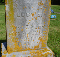
| Birth | : | 1840 Ohio, USA |
| Death | : | 2 Feb 1882 Osborne, Clayton County, Iowa, USA |
| Burial | : | Modesto Pioneer Cemetery, Modesto, Stanislaus County, USA |
| Coordinate | : | 37.6473350, -120.9829040 |
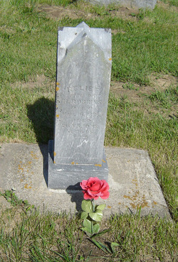
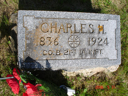
| Inscription | : | Co B 21st Iowa Inf, Vet 61-65, no dates |
| Description | : | Suggested edit: From National Archive military and pension records and regimental history: William enlisted on August 11, 1862, at Strawberry Point in Company B of the 21st regiment of Iowa's volunteer infantry. He was mustered in with the company on August 18th and the regiment was mustered into service on September 9th at Camp Franklin in Dubuque. On September 16th from the levee at the foot of Jones Street they boarded the sidewheel steamer Henry Clay and two barges tied alongside and started downriver. After one night on Rock Island, they continued their trip, debarked at Montrose, traveled by train... Read More |
frequently asked questions (FAQ):
-
Where is William Robbins's memorial?
William Robbins's memorial is located at: Modesto Pioneer Cemetery, Modesto, Stanislaus County, USA.
-
When did William Robbins death?
William Robbins death on 2 Feb 1882 in Osborne, Clayton County, Iowa, USA
-
Where are the coordinates of the William Robbins's memorial?
Latitude: 37.6473350
Longitude: -120.9829040
Family Members:
Parent
Spouse
Siblings
Children
Flowers:
Nearby Cemetories:
1. Modesto Pioneer Cemetery
Modesto, Stanislaus County, USA
Coordinate: 37.6473350, -120.9829040
2. Acacia Memorial Park
Modesto, Stanislaus County, USA
Coordinate: 37.6481080, -120.9836610
3. Modesto Citizens Cemetery
Modesto, Stanislaus County, USA
Coordinate: 37.6472930, -120.9845570
4. Saint Stanislaus Catholic Cemetery
Modesto, Stanislaus County, USA
Coordinate: 37.6473610, -120.9808440
5. Modesto County Cemetery
Modesto, Stanislaus County, USA
Coordinate: 37.6492400, -120.9813800
6. Ceres Memorial Park
Ceres, Stanislaus County, USA
Coordinate: 37.5958214, -120.9634399
7. Lakewood Memorial Park
Hughson, Stanislaus County, USA
Coordinate: 37.6199760, -120.8975983
8. Good Shepherd Catholic Cemetery
Modesto, Stanislaus County, USA
Coordinate: 37.6853130, -121.0672890
9. Wood Colony Cemetery
Salida, Stanislaus County, USA
Coordinate: 37.6893730, -121.0682144
10. Burwood Cemetery
Escalon, San Joaquin County, USA
Coordinate: 37.7616997, -120.9593964
11. Langworth Cemetery
Oakdale, Stanislaus County, USA
Coordinate: 37.7580986, -120.8957977
12. Ripon Cemetery
Ripon, San Joaquin County, USA
Coordinate: 37.7420311, -121.1238708
13. Oakdale Citizens Cemetery
Oakdale, Stanislaus County, USA
Coordinate: 37.7624600, -120.8388800
14. Oaklawn Memorial Park
Oakdale, Stanislaus County, USA
Coordinate: 37.7711945, -120.8486862
15. Saint John's Catholic Cemetery
Escalon, San Joaquin County, USA
Coordinate: 37.7994537, -121.0705185
16. Denair Cemetery
Denair, Stanislaus County, USA
Coordinate: 37.5293999, -120.8199997
17. Martin Cemetery
Waterford, Stanislaus County, USA
Coordinate: 37.6684360, -120.7582160
18. Turlock Memorial Park
Turlock, Stanislaus County, USA
Coordinate: 37.4937592, -120.8659821
19. Grayson Cemetery
Grayson, Stanislaus County, USA
Coordinate: 37.5594559, -121.1802826
20. Valley Home Memorial Park
Oakdale, Stanislaus County, USA
Coordinate: 37.8275528, -120.9333267
21. Saint Francis Episcopal Church Columbarium
Turlock, Stanislaus County, USA
Coordinate: 37.5014300, -120.8368400
22. Patterson District Cemetery
Patterson, Stanislaus County, USA
Coordinate: 37.5268135, -121.1728287
23. Atlanta Cemetery
Five Corners, San Joaquin County, USA
Coordinate: 37.8270035, -121.1420135
24. North Hilmar Cemetery
Hilmar, Merced County, USA
Coordinate: 37.4146614, -120.8864288


