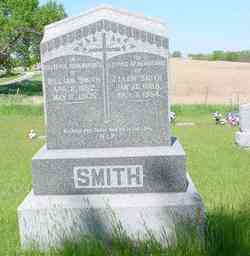
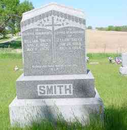
William Smith
| Birth | : | 11 Apr 1852 County Wicklow, Ireland |
| Death | : | 11 May 1905 Cass County, Nebraska, USA |
| Burial | : | Rochdale Cemetery, Rochdale, Metropolitan Borough of Rochdale, England |
| Coordinate | : | 53.6132698, -2.1833401 |
| Description | : | Son of John Henry Smyth and Catherine Collins of Bally Duff, County Wicklow, Ireland. Obituary: Died: Thursday, May 11, 1905, at his home four miles southwest of Elmwood, after a three week illness of blood poisoning. William Smith, age 53 and 1 month. For ten days death was expected, the fatal symptoms of blood poisoning having developed the attending physicians could give no hope to the family, still it was hoped against hope that something might intervene and if only by a miracle spare to the world, that has such need of such, the life of this good and noble man. But it... Read More |
frequently asked questions (FAQ):
-
Where is William Smith's memorial?
William Smith's memorial is located at: Rochdale Cemetery, Rochdale, Metropolitan Borough of Rochdale, England.
-
When did William Smith death?
William Smith death on 11 May 1905 in Cass County, Nebraska, USA
-
Where are the coordinates of the William Smith's memorial?
Latitude: 53.6132698
Longitude: -2.1833401
Family Members:
Parent
Spouse
Siblings
Children
Flowers:
Nearby Cemetories:
1. Rochdale Cemetery
Rochdale, Metropolitan Borough of Rochdale, England
Coordinate: 53.6132698, -2.1833401
2. Rochdale Crematorium
Rochdale, Metropolitan Borough of Rochdale, England
Coordinate: 53.6160820, -2.1830570
3. Denehurst Cemetery
Rochdale, Metropolitan Borough of Rochdale, England
Coordinate: 53.6206199, -2.1821104
4. Heywood Cemetery
Heywood, Metropolitan Borough of Rochdale, England
Coordinate: 53.6010610, -2.1931250
5. St. Paul's Churchyard
Norden, Metropolitan Borough of Rochdale, England
Coordinate: 53.6273006, -2.2126936
6. St Martin Churchyard
Castleton Moor, Metropolitan Borough of Rochdale, England
Coordinate: 53.5885050, -2.1756140
7. Christ Church Churchyard
Healey, Metropolitan Borough of Rochdale, England
Coordinate: 53.6378630, -2.1741198
8. St. James Ashworth
Rochdale, Metropolitan Borough of Rochdale, England
Coordinate: 53.6214693, -2.2261040
9. St. John's Churchyard Thornham
Middleton, Metropolitan Borough of Rochdale, England
Coordinate: 53.5760100, -2.1718300
10. St Bartholomew Churchyard
Whitworth, Rossendale Borough, England
Coordinate: 53.6553000, -2.1709700
11. St James the Apostle Churchyard
Wardle, Metropolitan Borough of Rochdale, England
Coordinate: 53.6497550, -2.1338420
12. Saint Andrew's
Dearnley, Metropolitan Borough of Rochdale, England
Coordinate: 53.6395100, -2.1168400
13. Littleborough Cemetery
Littleborough, Metropolitan Borough of Rochdale, England
Coordinate: 53.6407500, -2.1167500
14. Royton Cemetery
Royton, Metropolitan Borough of Oldham, England
Coordinate: 53.5727450, -2.1302850
15. St. Mary's Churchyard Birch-In-Hopwood
Heywood, Metropolitan Borough of Rochdale, England
Coordinate: 53.5662410, -2.2247560
16. St. Thomas Churchyard
Newhey, Metropolitan Borough of Rochdale, England
Coordinate: 53.6019166, -2.0958889
17. Whitworth Cemetery
Whitworth, Rossendale Borough, England
Coordinate: 53.6671650, -2.1674750
18. Boarshaw Cemetery and Crematorium
Middleton, Metropolitan Borough of Rochdale, England
Coordinate: 53.5584100, -2.1773100
19. Middleton Cemetery and Crematorium
Middleton, Metropolitan Borough of Rochdale, England
Coordinate: 53.5574400, -2.1829200
20. Saint Paul Churchyard
Royton, Metropolitan Borough of Oldham, England
Coordinate: 53.5653330, -2.1261450
21. Crompton Cemetery
Shaw, Metropolitan Borough of Oldham, England
Coordinate: 53.5799840, -2.1003410
22. St Matthew Churchyard
Chadderton, Metropolitan Borough of Oldham, England
Coordinate: 53.5565975, -2.1528452
23. Old Burial Grounds
Middleton, Metropolitan Borough of Rochdale, England
Coordinate: 53.5534036, -2.1948053
24. St Leonard's Churchyard
Middleton, Metropolitan Borough of Rochdale, England
Coordinate: 53.5530640, -2.1945060

