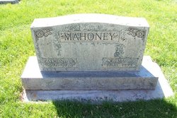
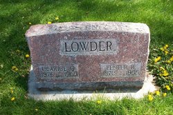
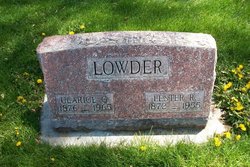
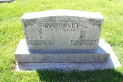
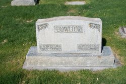
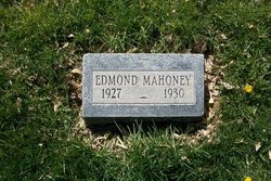
Wilma L Lowder Mahoney
| Birth | : | 6 Jun 1905 Tecumseh, Johnson County, Nebraska, USA |
| Death | : | 24 Apr 1999 Sterling, Logan County, Colorado, USA |
| Burial | : | Quaker Cemetery, West Hartford, Hartford County, USA |
| Coordinate | : | 41.7593575, -72.7289581 |
| Description | : | Wilma L. Mahoney, 93, of Sterling, died Sat urday, April 24, 1999 in Sterling. A funeral service will be held at 11 a.m. on Wednesday, April 28, at Chaney-Walters Funeral Home, with the Rev. T. L. Phillips officiating. Burial will be at Riverside Cemetery. Mrs. Mahoney was born on June 6, 1905 to Lester and Clarice (Green) Lowder in Tecumseh, Neb. The family moved in 1910 to a homestead northwest of Sterling, where she attended a country school. She attended high school in Willard and Sterling. She worked in a general store in Willard. On Aug. 3, 1925 she married R. W. "Mac" Mahoney... Read More |
frequently asked questions (FAQ):
-
Where is Wilma L Lowder Mahoney's memorial?
Wilma L Lowder Mahoney's memorial is located at: Quaker Cemetery, West Hartford, Hartford County, USA.
-
When did Wilma L Lowder Mahoney death?
Wilma L Lowder Mahoney death on 24 Apr 1999 in Sterling, Logan County, Colorado, USA
-
Where are the coordinates of the Wilma L Lowder Mahoney's memorial?
Latitude: 41.7593575
Longitude: -72.7289581
Family Members:
Parent
Spouse
Siblings
Children
Flowers:
Nearby Cemetories:
1. Quaker Cemetery
West Hartford, Hartford County, USA
Coordinate: 41.7593575, -72.7289581
2. Sisters of Saint Joseph Cemetery
West Hartford, Hartford County, USA
Coordinate: 41.7549400, -72.7181091
3. First Church Memorial Garden
West Hartford, Hartford County, USA
Coordinate: 41.7614480, -72.7414750
4. Saint Johns Episcopal Church Cloister Garden
West Hartford, Hartford County, USA
Coordinate: 41.7650240, -72.7174320
5. Old Center Cemetery
West Hartford, Hartford County, USA
Coordinate: 41.7642365, -72.7415085
6. North Cemetery
West Hartford, Hartford County, USA
Coordinate: 41.7672005, -72.7418976
7. Saint James's Memorial Garden
West Hartford, Hartford County, USA
Coordinate: 41.7607690, -72.7473780
8. Fairview Cemetery
West Hartford, Hartford County, USA
Coordinate: 41.7630997, -72.7553024
9. Immanuel Congregational Church Memorial Garden
Hartford, Hartford County, USA
Coordinate: 41.7681920, -72.7017000
10. Saint Mary Cemetery
West Hartford, Hartford County, USA
Coordinate: 41.7844391, -72.7279816
11. Westminster Presbyterian Church Memorial Garden
West Hartford, Hartford County, USA
Coordinate: 41.7538110, -72.7626650
12. Trinity Church Memorial Garden
Hartford, Hartford County, USA
Coordinate: 41.7688408, -72.6936417
13. Zion Hill Cemetery
Hartford, Hartford County, USA
Coordinate: 41.7550011, -72.6917038
14. Agudas Achim Cemetery
Hartford, Hartford County, USA
Coordinate: 41.7549200, -72.6915300
15. Congregation Adas Israel Cemetery
Hartford, Hartford County, USA
Coordinate: 41.7553291, -72.6898804
16. Beth Israel Cemetery
Hartford, Hartford County, USA
Coordinate: 41.7556700, -72.6893500
17. Asylum Hill Congregational Church
West Hartford, Hartford County, USA
Coordinate: 41.7699550, -72.6915950
18. Trinity College Chapel Memorial Garden
Hartford, Hartford County, USA
Coordinate: 41.7488870, -72.6902355
19. Teferes Israel Cemetery
West Hartford, Hartford County, USA
Coordinate: 41.7292252, -72.7171555
20. Unitarian Society of Hartford Memorial Garden
Hartford County, USA
Coordinate: 41.7888072, -72.7128570
21. Hartford Armory
Hartford, Hartford County, USA
Coordinate: 41.7643890, -72.6865692
22. Emanuel Lutheran Church Memorial Garden
Hartford, Hartford County, USA
Coordinate: 41.7631600, -72.6856660
23. Beth Jacob Cemetery
West Hartford, Hartford County, USA
Coordinate: 41.7270950, -72.7204920
24. Soldiers and Sailors Memorial Arch
Hartford, Hartford County, USA
Coordinate: 41.7656479, -72.6799469

