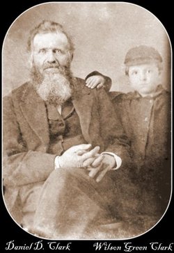
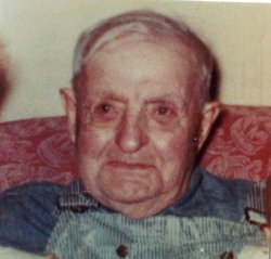
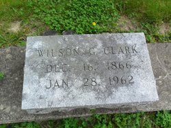
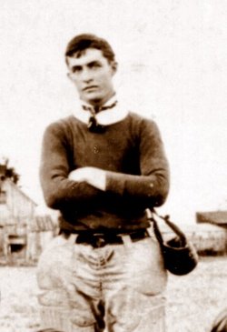
Wilson Guy Clark
| Birth | : | 16 Dec 1866 |
| Death | : | 28 Jan 1962 |
| Burial | : | Elmwood Cemetery, Ninety Six, Greenwood County, USA |
| Coordinate | : | 34.1822990, -82.0234130 |
| Description | : | Clarks-Hill — Wilson G. Clark, 95, son of the founder of the town of Clark’s Hill, died in Bowles nursing home here at 9 a.m. Sunday. In failing health some time, he was a patient in the nursing home only a day. Born at Clark’s Hill, he was the son of Daniel Dimock Clark, who platted Clarkville, later Clark’s Hill, on September 8, 1849. The name of the town was changed to Clark’s Hill in 1853 after it was discovered there was a town with the same name in Henry county. Daniel Dimock Clark was born... Read More |
frequently asked questions (FAQ):
-
Where is Wilson Guy Clark's memorial?
Wilson Guy Clark's memorial is located at: Elmwood Cemetery, Ninety Six, Greenwood County, USA.
-
When did Wilson Guy Clark death?
Wilson Guy Clark death on 28 Jan 1962 in
-
Where are the coordinates of the Wilson Guy Clark's memorial?
Latitude: 34.1822990
Longitude: -82.0234130
Family Members:
Parent
Spouse
Siblings
Children
Flowers:
Nearby Cemetories:
1. Elmwood Cemetery
Ninety Six, Greenwood County, USA
Coordinate: 34.1822990, -82.0234130
2. Ninety Six Presbyterian Church Cemetery
Ninety Six, Greenwood County, USA
Coordinate: 34.1773310, -82.0232650
3. Ninety Six Community Cemetery
Ninety Six, Greenwood County, USA
Coordinate: 34.1739800, -82.0125120
4. Ninety Six Mill Cemetery
Greenwood County, USA
Coordinate: 34.1698940, -82.0152760
5. Gaulden Family Burying Ground
Ninety Six, Greenwood County, USA
Coordinate: 34.1785680, -82.0024910
6. Siloam Baptist Church Cemetery
Greenwood, Greenwood County, USA
Coordinate: 34.2088060, -82.0392380
7. Dozier Field
Ninety Six, Greenwood County, USA
Coordinate: 34.1465020, -82.0189450
8. Fort Ninety Six Cemetery
Ninety Six, Greenwood County, USA
Coordinate: 34.1461740, -82.0183330
9. Ninety-Six National Historic Site
Greenwood County, USA
Coordinate: 34.1453540, -82.0243040
10. Coleman Family Cemetery
Ninety Six, Greenwood County, USA
Coordinate: 34.1607170, -81.9866860
11. Historic Ninety-Six Jail Cemetery
Ninety Six, Greenwood County, USA
Coordinate: 34.1449400, -82.0204710
12. Friendship Missionary Baptist Church Cemetery
Ninety Six, Greenwood County, USA
Coordinate: 34.2182830, -82.0362960
13. Mount Carmel UMC Cemetery #2
Ninety Six, Greenwood County, USA
Coordinate: 34.1954990, -81.9798540
14. Caldwell Family Cemetery
Greenwood County, USA
Coordinate: 34.1440830, -82.0295000
15. Chaney Family Cemetery
Ninety Six, Greenwood County, USA
Coordinate: 34.2105250, -81.9897570
16. Young's Chapel Baptist Church Cemetery
Greenwood, Greenwood County, USA
Coordinate: 34.1923360, -82.0721650
17. Pollard Family Cemetery
Ninety Six, Greenwood County, USA
Coordinate: 34.2278500, -82.0111400
18. Marshall Chapel Baptist Church Cemetery
Ninety Six, Greenwood County, USA
Coordinate: 34.1470100, -82.0620800
19. Greenwood Shores Baptist Church Cemetery
Ninety Six, Greenwood County, USA
Coordinate: 34.1810850, -81.9622630
20. Enoree Zion Baptist Church Cemetery
Ninety Six, Greenwood County, USA
Coordinate: 34.1334420, -81.9978240
21. McGehee Family Cemetery
Greenwood, Greenwood County, USA
Coordinate: 34.1416200, -82.0723800
22. Johnson Family Cemetery
Greenwood, Greenwood County, USA
Coordinate: 34.2311080, -82.0625190
23. Pleasant Rock Baptist Church Cemetery
Ninety Six, Greenwood County, USA
Coordinate: 34.1471930, -81.9658630
24. Waller-Hackett Family Cemetery
Greenwood, Greenwood County, USA
Coordinate: 34.1408350, -82.0757490

