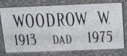
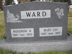
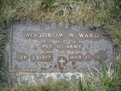
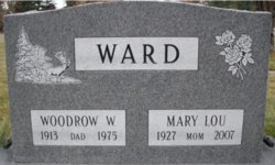
Woodrow Wilson “Woody” Ward
| Birth | : | 2 Sep 1913 |
| Death | : | 19 Mar 1975 Lincoln County, Montana, USA |
| Burial | : | Winton Cemetery, Winton, Southland District, New Zealand |
| Coordinate | : | -46.1289300, 168.3250400 |
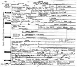
| Description | : | Montana, County Births and Deaths Name: Woodrow W . Ward Gender: Male Death Age: 61 Birth Date: 2 Sep 1913 Birth Place: West Virginia, USA Death Date: 19 Mar 1975 Death Place: Libby, Lincoln, Montana Father: A. I. Ward Mother: Rachel Ward Spouse: Mary Lou Ward |
frequently asked questions (FAQ):
-
Where is Woodrow Wilson “Woody” Ward's memorial?
Woodrow Wilson “Woody” Ward's memorial is located at: Winton Cemetery, Winton, Southland District, New Zealand.
-
When did Woodrow Wilson “Woody” Ward death?
Woodrow Wilson “Woody” Ward death on 19 Mar 1975 in Lincoln County, Montana, USA
-
Where are the coordinates of the Woodrow Wilson “Woody” Ward's memorial?
Latitude: -46.1289300
Longitude: 168.3250400
Family Members:
Spouse
Children
Nearby Cemetories:
1. Winton Cemetery
Winton, Southland District, New Zealand
Coordinate: -46.1289300, 168.3250400
2. East Winton Cemetery
Winton, Southland District, New Zealand
Coordinate: -46.1374640, 168.3557030
3. Forest Hill Cemetery
Southland District, New Zealand
Coordinate: -46.2049720, 168.3969970
4. Ryal Bush
Ryal Bush, Southland District, New Zealand
Coordinate: -46.2836700, 168.3256000
5. Calcium Cemetery
Isla Bank, Southland District, New Zealand
Coordinate: -46.2035710, 168.1279070
6. Wallacetown Old Cemetery
Wallacetown, Southland District, New Zealand
Coordinate: -46.3321840, 168.2861670
7. Wreys Bush Cemetery
Wreys Bush, Southland District, New Zealand
Coordinate: -45.9941900, 168.0974500
8. Wallacetown New Cemetery
Wallacetown, Southland District, New Zealand
Coordinate: -46.3374900, 168.2835700
9. Otautau New Cemetery
Otautau, Southland District, New Zealand
Coordinate: -46.1307300, 168.0066400
10. Otautau Old Cemetery
Otautau, Southland District, New Zealand
Coordinate: -46.1471300, 167.9940500
11. Dipton Cemetery
Dipton, Southland District, New Zealand
Coordinate: -45.8957730, 168.3508000
12. Saint Johns Cemetery
Invercargill, Invercargill City, New Zealand
Coordinate: -46.3748600, 168.3431480
13. All Saints Anglican Church
Invercargill, Invercargill City, New Zealand
Coordinate: -46.3906042, 168.3476728
14. Holy Trinity Anglican Church
Invercargill, Invercargill City, New Zealand
Coordinate: -46.3984736, 168.3660057
15. Woodlands Cemetery
Woodlands, Southland District, New Zealand
Coordinate: -46.3568800, 168.5463770
16. Wairio Cemetery
Nightcaps, Southland District, New Zealand
Coordinate: -45.9617230, 168.0078750
17. Eastern Cemetery
Invercargill, Invercargill City, New Zealand
Coordinate: -46.4070770, 168.3961480
18. Southland Crematorium
Invercargill, Invercargill City, New Zealand
Coordinate: -46.4109100, 168.3961330
19. Riverton Cemetery
Riverton, Southland District, New Zealand
Coordinate: -46.3316900, 168.0215500
20. Te Hau Mutunga Urupā
Invercargill, Invercargill City, New Zealand
Coordinate: -46.4288704, 168.4148361
21. Edendale Cemetery
Edendale, Southland District, New Zealand
Coordinate: -46.3080400, 168.7327360
22. Balfour Cemetery
Balfour, Southland District, New Zealand
Coordinate: -45.8391000, 168.5986640
23. Riversdale Cemetery
Riversdale, Southland District, New Zealand
Coordinate: -45.9180100, 168.7263600
24. Colac Bay Cemetery
Colac Bay, Southland District, New Zealand
Coordinate: -46.3679806, 167.8798528

