
| Memorials | : | 0 |
| Location | : | Rouez, Departement de la Sarthe, France |
| Coordinate | : | 48.1403000, -0.1128000 |
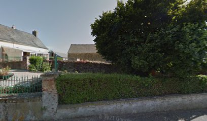
| Description | : | Remains of the Cistercian Abbey of Champagne founded in 1188 by Foulques Riboul, demolished partly with the exception of kitchens and the Western wing redesigned in 1740 and which includes a wine cellar (one vestige of the primitive of the 12th century Abbey) with a vault and the medieval pillars and murals depicting a landscape as well as a main oak staircase built in 1740 with his massive ramp and its 33 markets trimmed in the mass of wood. |
frequently asked questions (FAQ):
-
Where is Abbaye de Champagne?
Abbaye de Champagne is located at Rouez, Departement de la Sarthe ,Pays de la Loire ,France.
-
Abbaye de Champagne cemetery's updated grave count on graveviews.com?
0 memorials
-
Where are the coordinates of the Abbaye de Champagne?
Latitude: 48.1403000
Longitude: -0.1128000
Nearby Cemetories:
1. Abbaye d'Étival-en-Charnie
Chemire-en-Charnie, Departement de la Sarthe, France
Coordinate: 48.0541670, -0.2263890
2. Cimetiere de Saint-Thomas-de-Courceriers
Saint-Thomas-de-Courceriers, Departement de la Mayenne, France
Coordinate: 48.2760810, -0.2666760
3. Abbaye Notre-Dame d'Évron
Evron, Departement de la Mayenne, France
Coordinate: 48.1566670, -0.4033330
4. Chantenay Parish Cemetery
Chantenay-Villedieu, Departement de la Sarthe, France
Coordinate: 47.9176400, -0.1606800
5. Le Mans West Cemetery
Le Mans, Departement de la Sarthe, France
Coordinate: 48.0210228, 0.1901290
6. Cathédrale Saint Julien-Le Mans
Le Mans, Departement de la Sarthe, France
Coordinate: 48.0093510, 0.1987660
7. Collégiale Saint-Pierre-la-Cour
Le Mans, Departement de la Sarthe, France
Coordinate: 48.0069440, 0.1972220
8. L'Abbaye de l'Epau
Yvre-l'Eveque, Departement de la Sarthe, France
Coordinate: 47.9911110, 0.2419440
9. Yvre l'Eveque Communal Cemetery
Yvre-l'Eveque, Departement de la Sarthe, France
Coordinate: 48.0119100, 0.2642400
10. Circuit de la Sarthe
Le Mans, Departement de la Sarthe, France
Coordinate: 47.9517340, 0.2078000
11. Auvers-le-Hamon Communal Cemetery
Auvers-le-Hamon, Departement de la Sarthe, France
Coordinate: 47.9044500, -0.3543800
12. Église de Notre Dame du Parc
Saint-Denis-d'Orques, Departement de la Sarthe, France
Coordinate: 48.0281940, 0.2868630
13. Alencon St Leonard Cemetery
Alencon, Departement de l'Orne, France
Coordinate: 48.4277200, 0.0726400
14. Abbaye Saint-Pierre de Solesmes
Solesmes, Departement de la Sarthe, France
Coordinate: 47.8515830, -0.3033460
15. Notre-Dame d'Alencon
Alencon, Departement de l'Orne, France
Coordinate: 48.4298320, 0.0889160
16. Cimetiere Notre Dame
Alencon, Departement de l'Orne, France
Coordinate: 48.4268830, 0.0984640
17. Abbaye Sainte-Cécile de Solesmes
Solesmes, Departement de la Sarthe, France
Coordinate: 47.8480560, -0.3058330
18. Champagne Communal Cemetery
Champagne, Departement de la Sarthe, France
Coordinate: 48.0233000, 0.3350100
19. Malicorne-sur-Sarthe Cimetière Communal
Malicorne-sur-Sarthe, Departement de la Sarthe, France
Coordinate: 47.8128000, -0.0811300
20. Notre Dame du Chène
La Chapelle du Chene, Departement de la Mayenne, France
Coordinate: 47.8112740, -0.2763320
21. St Brice de Courcival Parish Cemetery
Courcival, Departement de la Sarthe, France
Coordinate: 48.2293900, 0.3961600
22. Abbaye de Perseigne
Neufchatel-en-Saosnois, Departement de la Sarthe, France
Coordinate: 48.3906000, 0.2622200
23. Église Saint-Ouen-en-Belin
Saint-Ouen-en-Belin, Departement de la Sarthe, France
Coordinate: 47.8336000, 0.2114000
24. Abbaye de Fontaine-Daniel
Saint-Georges-Buttavent, Departement de la Mayenne, France
Coordinate: 48.2777780, -0.6727780