
| Memorials | : | 0 |
| Location | : | Yvre-l'Eveque, Departement de la Sarthe, France |
| Coordinate | : | 48.0119100, 0.2642400 |
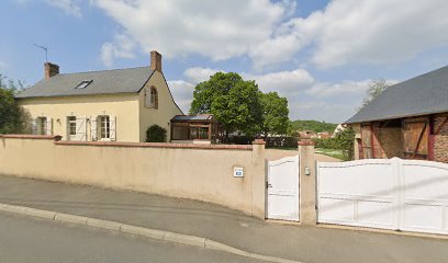
| Description | : | Yvre-l'Eveque is a village and commune about 7 kilometres east of Le Mans on the main road (N.23) to Chartres. The cemetery is on the south western side of the village on the road leading to Yvre-L'Eveque from the N.23 road. There is 1 Commonwealth burial of the 1939-1945 war here, in the north-western corner. |
frequently asked questions (FAQ):
-
Where is Yvre l'Eveque Communal Cemetery?
Yvre l'Eveque Communal Cemetery is located at Yvre-l'Eveque, Departement de la Sarthe ,Pays de la Loire ,France.
-
Yvre l'Eveque Communal Cemetery cemetery's updated grave count on graveviews.com?
0 memorials
-
Where are the coordinates of the Yvre l'Eveque Communal Cemetery?
Latitude: 48.0119100
Longitude: 0.2642400
Nearby Cemetories:
1. Église de Notre Dame du Parc
Saint-Denis-d'Orques, Departement de la Sarthe, France
Coordinate: 48.0281940, 0.2868630
2. L'Abbaye de l'Epau
Yvre-l'Eveque, Departement de la Sarthe, France
Coordinate: 47.9911110, 0.2419440
3. Cathédrale Saint Julien-Le Mans
Le Mans, Departement de la Sarthe, France
Coordinate: 48.0093510, 0.1987660
4. Collégiale Saint-Pierre-la-Cour
Le Mans, Departement de la Sarthe, France
Coordinate: 48.0069440, 0.1972220
5. Champagne Communal Cemetery
Champagne, Departement de la Sarthe, France
Coordinate: 48.0233000, 0.3350100
6. Le Mans West Cemetery
Le Mans, Departement de la Sarthe, France
Coordinate: 48.0210228, 0.1901290
7. Circuit de la Sarthe
Le Mans, Departement de la Sarthe, France
Coordinate: 47.9517340, 0.2078000
8. Église Saint-Ouen-en-Belin
Saint-Ouen-en-Belin, Departement de la Sarthe, France
Coordinate: 47.8336000, 0.2114000
9. Le Grand-Luce War Cemetery
Le Grand-Luce, Departement de la Sarthe, France
Coordinate: 47.8642900, 0.4616300
10. St Brice de Courcival Parish Cemetery
Courcival, Departement de la Sarthe, France
Coordinate: 48.2293900, 0.3961600
11. La Bosse Communal Cemetery
La Bosse, Departement de la Sarthe, France
Coordinate: 48.1714400, 0.5271400
12. Abbaye de Champagne
Rouez, Departement de la Sarthe, France
Coordinate: 48.1403000, -0.1128000
13. Chantenay Parish Cemetery
Chantenay-Villedieu, Departement de la Sarthe, France
Coordinate: 47.9176400, -0.1606800
14. Malicorne-sur-Sarthe Cimetière Communal
Malicorne-sur-Sarthe, Departement de la Sarthe, France
Coordinate: 47.8128000, -0.0811300
15. Abbaye d'Étival-en-Charnie
Chemire-en-Charnie, Departement de la Sarthe, France
Coordinate: 48.0541670, -0.2263890
16. Chateau-du-Loir Communal Cemetery
Chateau-du-Loir, Departement de la Sarthe, France
Coordinate: 47.6955300, 0.4247800
17. Abbaye de Perseigne
Neufchatel-en-Saosnois, Departement de la Sarthe, France
Coordinate: 48.3906000, 0.2622200
18. Cimetière Saint-Pierre-de-Chevillé
Saint-Pierre-de-Cheville, Departement de la Sarthe, France
Coordinate: 47.6479690, 0.4383210
19. La Fleche Communal Cemetery
La Fleche, Departement de la Sarthe, France
Coordinate: 47.6989200, -0.0849300
20. Souge-sur-Braye Communal Cemetery
Souge, Departement du Loir-et-Cher, France
Coordinate: 47.7701400, 0.7302300
21. Abbaye Saint-Pierre de Solesmes
Solesmes, Departement de la Sarthe, France
Coordinate: 47.8515830, -0.3033460
22. Collégiale de Bueil-en-Touraine
Bueil-en-Touraine, Departement d'Indre-et-Loire, France
Coordinate: 47.6455560, 0.5508330
23. Notre Dame du Chène
La Chapelle du Chene, Departement de la Mayenne, France
Coordinate: 47.8112740, -0.2763320
24. Abbaye Sainte-Cécile de Solesmes
Solesmes, Departement de la Sarthe, France
Coordinate: 47.8480560, -0.3058330