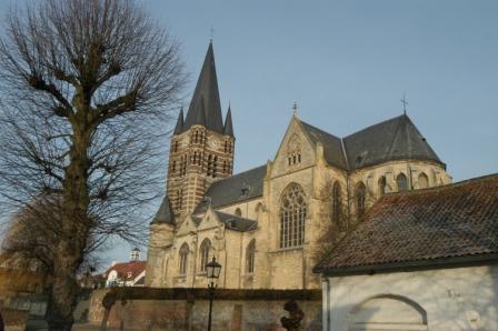
| Memorials | : | 0 |
| Location | : | Thorn, Maasgouw Municipality, Netherlands |
| Coordinate | : | 51.1606200, 5.8416700 |
frequently asked questions (FAQ):
-
Where is Abdijkerk?
Abdijkerk is located at Thorn, Maasgouw Municipality ,Limburg ,Netherlands.
-
Abdijkerk cemetery's updated grave count on graveviews.com?
0 memorials
-
Where are the coordinates of the Abdijkerk?
Latitude: 51.1606200
Longitude: 5.8416700
Nearby Cemetories:
1. Kessenich Churchyard
Kinrooi, Arrondissement Maaseik, Belgium
Coordinate: 51.1509000, 5.8249600
2. Wessem Begraafplaats
Wessem, Maasgouw Municipality, Netherlands
Coordinate: 51.1588700, 5.8777600
3. Medarduskerkhof
Wessem, Maasgouw Municipality, Netherlands
Coordinate: 51.1579900, 5.8789900
4. Maasbracht Kerkhof
Maasbracht, Maasgouw Municipality, Netherlands
Coordinate: 51.1500400, 5.8877900
5. Hunsel Roman Catholic Churchyard
Hunsel, Leudal Municipality, Netherlands
Coordinate: 51.1883600, 5.8113600
6. Henry Eric Harden Memorial
Brachterbeek, Maasgouw Municipality, Netherlands
Coordinate: 51.1440720, 5.9203340
7. Algemene begraafplaats Bergerkamp
Linne, Maasgouw Municipality, Netherlands
Coordinate: 51.1559829, 5.9302404
8. Linne Roman Catholic Churchyard
Linne, Maasgouw Municipality, Netherlands
Coordinate: 51.1578400, 5.9371900
9. Molenbeersel Churchyard
Kinrooi, Arrondissement Maaseik, Belgium
Coordinate: 51.1698500, 5.7374600
10. Aldeneik Cemetery
Maaseik, Arrondissement Maaseik, Belgium
Coordinate: 51.0984475, 5.8027711
11. Kinrooi Cemetery
Kinrooi, Arrondissement Maaseik, Belgium
Coordinate: 51.1469900, 5.7361800
12. Maaseik Egelsveld Cemetery
Maaseik, Arrondissement Maaseik, Belgium
Coordinate: 51.1078500, 5.7731100
13. Katholieke Begraafplaats
Pey, Echt-Susteren Municipality, Netherlands
Coordinate: 51.0974900, 5.8873700
14. Pey Begraafplaats
Pey, Echt-Susteren Municipality, Netherlands
Coordinate: 51.0937535, 5.8733765
15. Maaseik Old Cemetery
Maaseik, Arrondissement Maaseik, Belgium
Coordinate: 51.0997700, 5.7764300
16. Stramproy Rooms-Katholieke Begraafplaats
Stramproy, Weert Municipality, Netherlands
Coordinate: 51.1915100, 5.7259200
17. R.K. Begraafplaats Herten
Herten, Roermond Municipality, Netherlands
Coordinate: 51.1816113, 5.9643287
18. Roosteren Begraafplaats
Roosteren, Echt-Susteren Municipality, Netherlands
Coordinate: 51.0799350, 5.8308374
19. Swartbroek Churchyard
Swartbroek, Weert Municipality, Netherlands
Coordinate: 51.2298200, 5.7713800
20. Dieteren Cemetery
Susteren, Echt-Susteren Municipality, Netherlands
Coordinate: 51.0766609, 5.8440000
21. Tungelroij Roman Catholic Churchyard
Tungelroy, Weert Municipality, Netherlands
Coordinate: 51.2126400, 5.7309200
22. Sint Odiliënberg Roman Catholic Cemetery
Sint Odiliënberg, Roerdalen Municipality, Netherlands
Coordinate: 51.1486600, 5.9988100
23. St. Amelberga Roman Catholic Churchyard
Susteren, Echt-Susteren Municipality, Netherlands
Coordinate: 51.0610500, 5.8505700
24. Oud Joods Begraafplaats
Roermond, Roermond Municipality, Netherlands
Coordinate: 51.1810500, 6.0000700

