| Memorials | : | 0 |
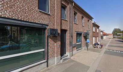
| Location | : | Kinrooi, Arrondissement Maaseik, Belgium |
| Coordinate | : | 51.1698500, 5.7374600 |
| Description | : | The village of Molenbeersel is located north-west of the town of Maaseik on the N73. From the motorway E313, which runs between Antwerpen and Liege, turn off at junction 25 Kwaadmechelen. Turn onto the N141 direction Oostham, through the village of Oostham and the road joins with the N73 in the village of Heppen. Follow the N73 to the town of Bree. At the junction with the N76 follow the N76/N73 direction Kinrooi. In Kinrooi turn left onto the N762 direction Molenbeersel, on entering the village the church is on the right and the cemetery is behind the church. The... Read More |
frequently asked questions (FAQ):
-
Where is Molenbeersel Churchyard?
Molenbeersel Churchyard is located at Kinrooi, Arrondissement Maaseik ,Limburg ,Belgium.
-
Molenbeersel Churchyard cemetery's updated grave count on graveviews.com?
0 memorials
-
Where are the coordinates of the Molenbeersel Churchyard?
Latitude: 51.1698500
Longitude: 5.7374600
Nearby Cemetories:
1. Stramproy Rooms-Katholieke Begraafplaats
Stramproy, Weert Municipality, Netherlands
Coordinate: 51.1915100, 5.7259200
2. Kinrooi Cemetery
Kinrooi, Arrondissement Maaseik, Belgium
Coordinate: 51.1469900, 5.7361800
3. Tungelroij Roman Catholic Churchyard
Tungelroy, Weert Municipality, Netherlands
Coordinate: 51.2126400, 5.7309200
4. Hunsel Roman Catholic Churchyard
Hunsel, Leudal Municipality, Netherlands
Coordinate: 51.1883600, 5.8113600
5. Kessenich Churchyard
Kinrooi, Arrondissement Maaseik, Belgium
Coordinate: 51.1509000, 5.8249600
6. Swartbroek Churchyard
Swartbroek, Weert Municipality, Netherlands
Coordinate: 51.2298200, 5.7713800
7. Maaseik Egelsveld Cemetery
Maaseik, Arrondissement Maaseik, Belgium
Coordinate: 51.1078500, 5.7731100
8. Abdijkerk
Thorn, Maasgouw Municipality, Netherlands
Coordinate: 51.1606200, 5.8416700
9. Maaseik Old Cemetery
Maaseik, Arrondissement Maaseik, Belgium
Coordinate: 51.0997700, 5.7764300
10. Neeroeteren Cemetery
Maaseik, Arrondissement Maaseik, Belgium
Coordinate: 51.0935100, 5.7008100
11. Opitter Cemetery
Bree, Arrondissement Maaseik, Belgium
Coordinate: 51.1174200, 5.6406900
12. Aldeneik Cemetery
Maaseik, Arrondissement Maaseik, Belgium
Coordinate: 51.0984475, 5.8027711
13. Sint Martinus Kerkhof
Weert, Weert Municipality, Netherlands
Coordinate: 51.2544500, 5.7019900
14. Wessem Begraafplaats
Wessem, Maasgouw Municipality, Netherlands
Coordinate: 51.1588700, 5.8777600
15. Medarduskerkhof
Wessem, Maasgouw Municipality, Netherlands
Coordinate: 51.1579900, 5.8789900
16. Bree Communal Cemetery
Bree, Arrondissement Maaseik, Belgium
Coordinate: 51.1440200, 5.5994300
17. Maasbracht Kerkhof
Maasbracht, Maasgouw Municipality, Netherlands
Coordinate: 51.1500400, 5.8877900
18. Gerdingen Communal Cemetery
Bree, Arrondissement Maaseik, Belgium
Coordinate: 51.1447700, 5.5875100
19. Bocholt Cemetery
Bocholt, Arrondissement Maaseik, Belgium
Coordinate: 51.1679900, 5.5811600
20. Elen Cemetery
Dilsen-Stokkem, Arrondissement Maaseik, Belgium
Coordinate: 51.0673900, 5.7599200
21. Roosteren Begraafplaats
Roosteren, Echt-Susteren Municipality, Netherlands
Coordinate: 51.0799350, 5.8308374
22. Neerglabbeek Churchyard
Meeuwen-Gruitrode, Arrondissement Maaseik, Belgium
Coordinate: 51.0918300, 5.6140900
23. Nederweert Saint Lambert Roman Catholic cemetery
Nederweert, Nederweert Municipality, Netherlands
Coordinate: 51.2833328, 5.7500000
24. Nederweert Saint Lambert Roman Catholic cemetery
Nederweert, Nederweert Municipality, Netherlands
Coordinate: 51.2833328, 5.7500000

