
| Memorials | : | 2 |
| Location | : | Lucerne, Gilmer County, USA |
| Coordinate | : | 39.0184000, -80.8856806 |
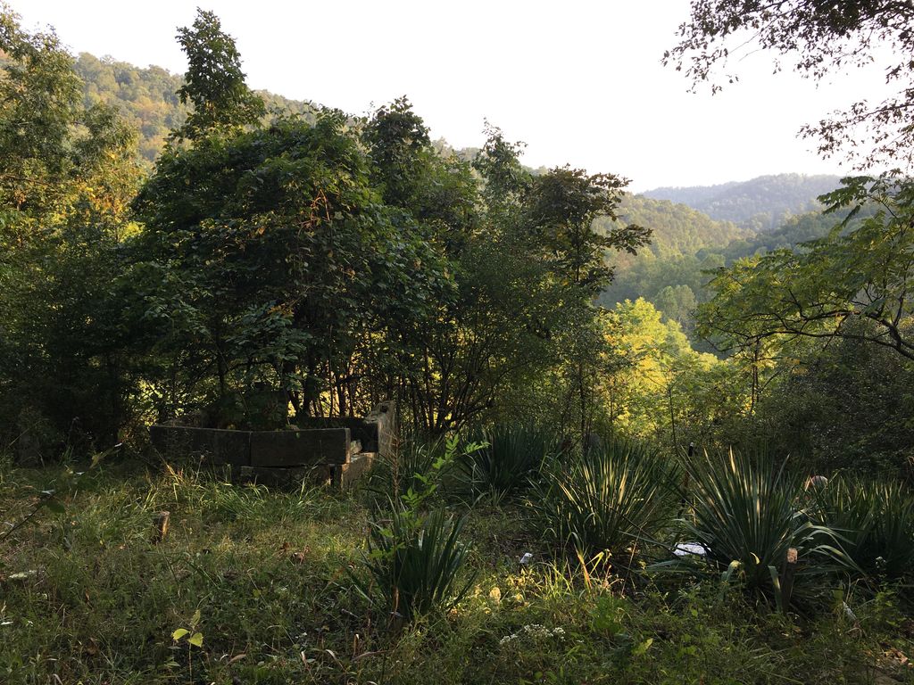
| Description | : | The Abraham Bush Cemetery (also referred to as the Lockard Cemetery, Valentine Cemetery, or Powell Cemetery) is located on the old I.J. Powell farm on Sinking Creek, and is located on a point on the start of the ridge between Mound Run and Garfield's Run (which was referred to as Bush's Run at one time). The cemetery is fenced with old woven wire fencing with cut sandstone fence posts. The oldest two (marked) graves are that of Abraham and Rachel Bush, Rachel having died in 1849. Their graves are contained in a very curious cut stone cairn. For more... Read More |
frequently asked questions (FAQ):
-
Where is Abraham Bush Cemetery?
Abraham Bush Cemetery is located at Sinking Creek Rd Lucerne, Gilmer County ,West Virginia , 26342USA.
-
Abraham Bush Cemetery cemetery's updated grave count on graveviews.com?
2 memorials
-
Where are the coordinates of the Abraham Bush Cemetery?
Latitude: 39.0184000
Longitude: -80.8856806
Nearby Cemetories:
1. Bush Cemetery
Gilmer County, USA
Coordinate: 39.0203018, -80.8783035
2. Union Baptist Church Cemetery
Lucerne, Gilmer County, USA
Coordinate: 39.0200800, -80.8779200
3. Matthews Cemetery
Lucerne, Gilmer County, USA
Coordinate: 39.0112200, -80.8839100
4. Cooper Chapel Cemetery
Tanner, Gilmer County, USA
Coordinate: 39.0057800, -80.9161500
5. Newberne Cemetery
Gilmer County, USA
Coordinate: 39.0465510, -80.8910940
6. Cooper Family Cemetery
Tanner, Gilmer County, USA
Coordinate: 39.0083050, -80.9255920
7. Woodford Farm Cemetery
Lucerne, Gilmer County, USA
Coordinate: 38.9819600, -80.8880900
8. Wilson Cemetery
Lucerne, Gilmer County, USA
Coordinate: 38.9744900, -80.9013700
9. Horn Creek Baptist Church Cemetery
Gilmer County, USA
Coordinate: 39.0605700, -80.8633500
10. New Mount Olive Cemetery
Burnt House, Ritchie County, USA
Coordinate: 39.0446100, -80.9340200
11. Fisher Cemetery
Troy, Gilmer County, USA
Coordinate: 39.0480500, -80.8400000
12. Mount Olive Cemetery
Burnt House, Ritchie County, USA
Coordinate: 39.0531006, -80.9257965
13. Holbert Cemetery
Gilmer County, USA
Coordinate: 38.9686012, -80.8944016
14. Roseville Church Cemetery
Gilmer County, USA
Coordinate: 39.0207880, -80.9547600
15. Cather Cemetery - Leading Creek
De Kalb, Gilmer County, USA
Coordinate: 38.9632780, -80.8707920
16. Leading Creek Baptist Church Cemetery
Alice, Gilmer County, USA
Coordinate: 38.9969000, -80.8183700
17. Good Shepherd Catholic Cemetery
Tanner, Gilmer County, USA
Coordinate: 38.9811830, -80.9447050
18. Mount Liberty Cemetery
Tanner, Gilmer County, USA
Coordinate: 39.0086390, -80.9616440
19. Tanner Baptist Church Cemetery
Gilmer County, USA
Coordinate: 38.9814310, -80.9480630
20. Spruce Creek Cemetery
Auburn, Ritchie County, USA
Coordinate: 39.0807300, -80.9083700
21. Riddle Cemetery
Gilmer County, USA
Coordinate: 38.9547005, -80.9049988
22. Meadow Lane Cemetery
Glenville, Gilmer County, USA
Coordinate: 38.9491997, -80.8775024
23. Woodford Cemetery
Gilmer County, USA
Coordinate: 38.9482994, -80.8778000
24. Three Poplar Cemetery
Glenville, Gilmer County, USA
Coordinate: 38.9628600, -80.9445500