
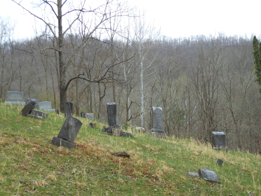
| Memorials | : | 7 |
| Location | : | Lucerne, Gilmer County, USA |
| Coordinate | : | 39.0200800, -80.8779200 |
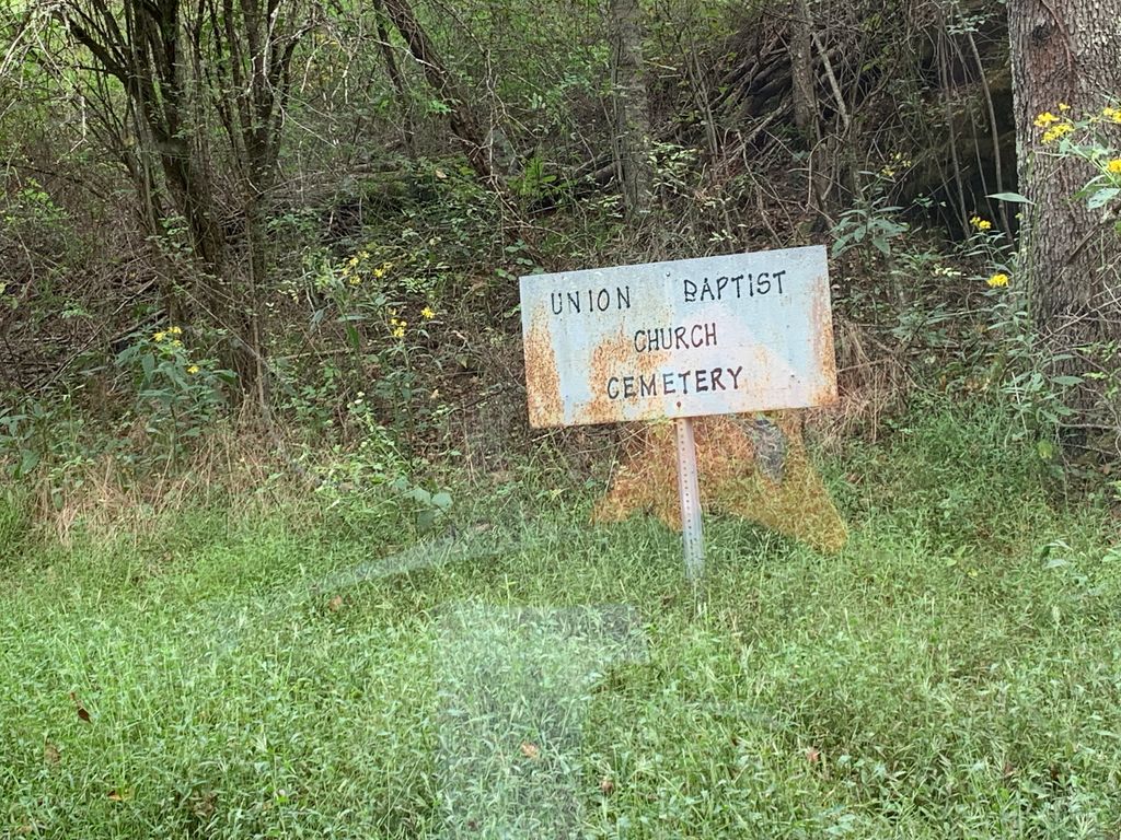
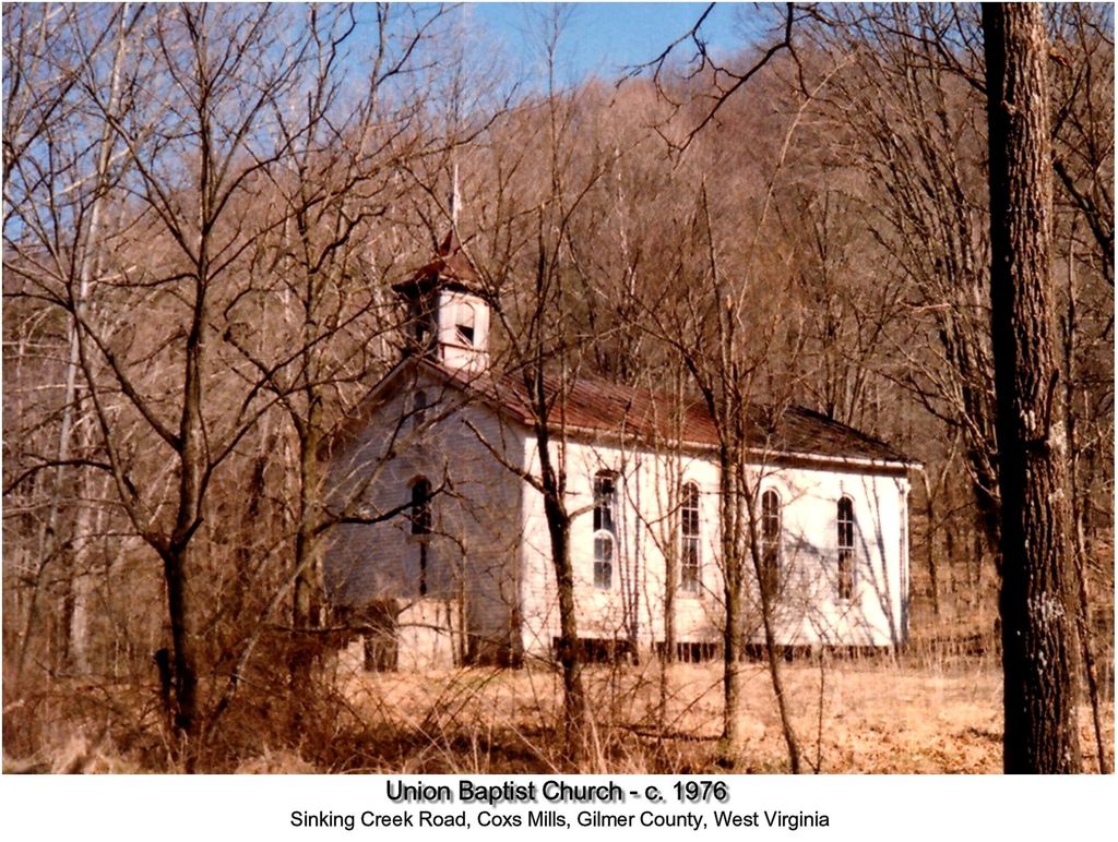
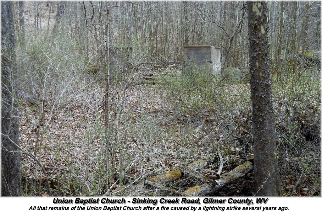
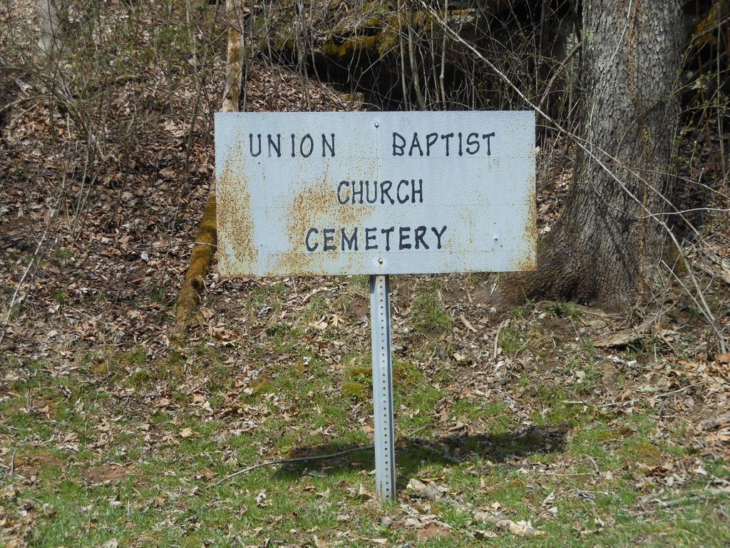
| Description | : | The Union Baptist Church Cemetery is located on Sinking Creek, DeKalb District of Gilmer County, West Virginia. Traveling north on the Sinking Creek Road, the cemetery is about two miles past the abandoned town of Lucerne, situated on the left side of the road, near the bottom of a hill. A metal Union Baptist Church Cemetery sign is located on the left side of Sinking Creek Road. The cemetery is plainly visible from the road. Just a little past this sign and on the right side of the road the concrete steps are still visible where the Union... Read More |
frequently asked questions (FAQ):
-
Where is Union Baptist Church Cemetery?
Union Baptist Church Cemetery is located at Lucerne, Gilmer County ,West Virginia ,USA.
-
Union Baptist Church Cemetery cemetery's updated grave count on graveviews.com?
7 memorials
-
Where are the coordinates of the Union Baptist Church Cemetery?
Latitude: 39.0200800
Longitude: -80.8779200
Nearby Cemetories:
1. Bush Cemetery
Gilmer County, USA
Coordinate: 39.0203018, -80.8783035
2. Abraham Bush Cemetery
Lucerne, Gilmer County, USA
Coordinate: 39.0184000, -80.8856806
3. Matthews Cemetery
Lucerne, Gilmer County, USA
Coordinate: 39.0112200, -80.8839100
4. Newberne Cemetery
Gilmer County, USA
Coordinate: 39.0465510, -80.8910940
5. Cooper Chapel Cemetery
Tanner, Gilmer County, USA
Coordinate: 39.0057800, -80.9161500
6. Cooper Family Cemetery
Tanner, Gilmer County, USA
Coordinate: 39.0083050, -80.9255920
7. Woodford Farm Cemetery
Lucerne, Gilmer County, USA
Coordinate: 38.9819600, -80.8880900
8. Fisher Cemetery
Troy, Gilmer County, USA
Coordinate: 39.0480500, -80.8400000
9. Horn Creek Baptist Church Cemetery
Gilmer County, USA
Coordinate: 39.0605700, -80.8633500
10. Wilson Cemetery
Lucerne, Gilmer County, USA
Coordinate: 38.9744900, -80.9013700
11. Mount Olive Cemetery
Burnt House, Ritchie County, USA
Coordinate: 39.0531006, -80.9257965
12. New Mount Olive Cemetery
Burnt House, Ritchie County, USA
Coordinate: 39.0446100, -80.9340200
13. Leading Creek Baptist Church Cemetery
Alice, Gilmer County, USA
Coordinate: 38.9969000, -80.8183700
14. Holbert Cemetery
Gilmer County, USA
Coordinate: 38.9686012, -80.8944016
15. Cather Cemetery - Leading Creek
De Kalb, Gilmer County, USA
Coordinate: 38.9632780, -80.8707920
16. Roseville Church Cemetery
Gilmer County, USA
Coordinate: 39.0207880, -80.9547600
17. Good Shepherd Catholic Cemetery
Tanner, Gilmer County, USA
Coordinate: 38.9811830, -80.9447050
18. Spruce Creek Cemetery
Auburn, Ritchie County, USA
Coordinate: 39.0807300, -80.9083700
19. Mount Liberty Cemetery
Tanner, Gilmer County, USA
Coordinate: 39.0086390, -80.9616440
20. Tanner Baptist Church Cemetery
Gilmer County, USA
Coordinate: 38.9814310, -80.9480630
21. Riddle Cemetery
Gilmer County, USA
Coordinate: 38.9547005, -80.9049988
22. Hall Cemetery
Gilmer County, USA
Coordinate: 39.0816994, -80.8383026
23. Auburn Baptist Church Cemetery
Auburn, Ritchie County, USA
Coordinate: 39.0819200, -80.8384600
24. Meadow Lane Cemetery
Glenville, Gilmer County, USA
Coordinate: 38.9491997, -80.8775024