
| Memorials | : | 0 |
| Location | : | Batesville, Panola County, USA |
| Coordinate | : | 34.3088920, -89.7405320 |
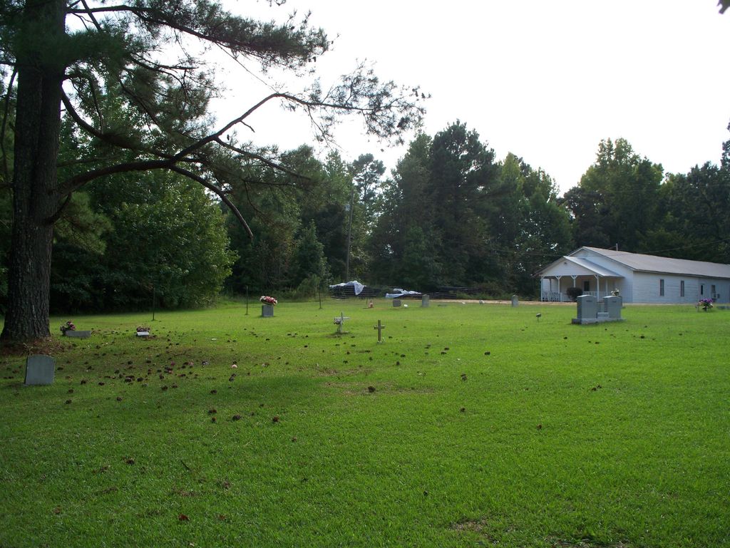
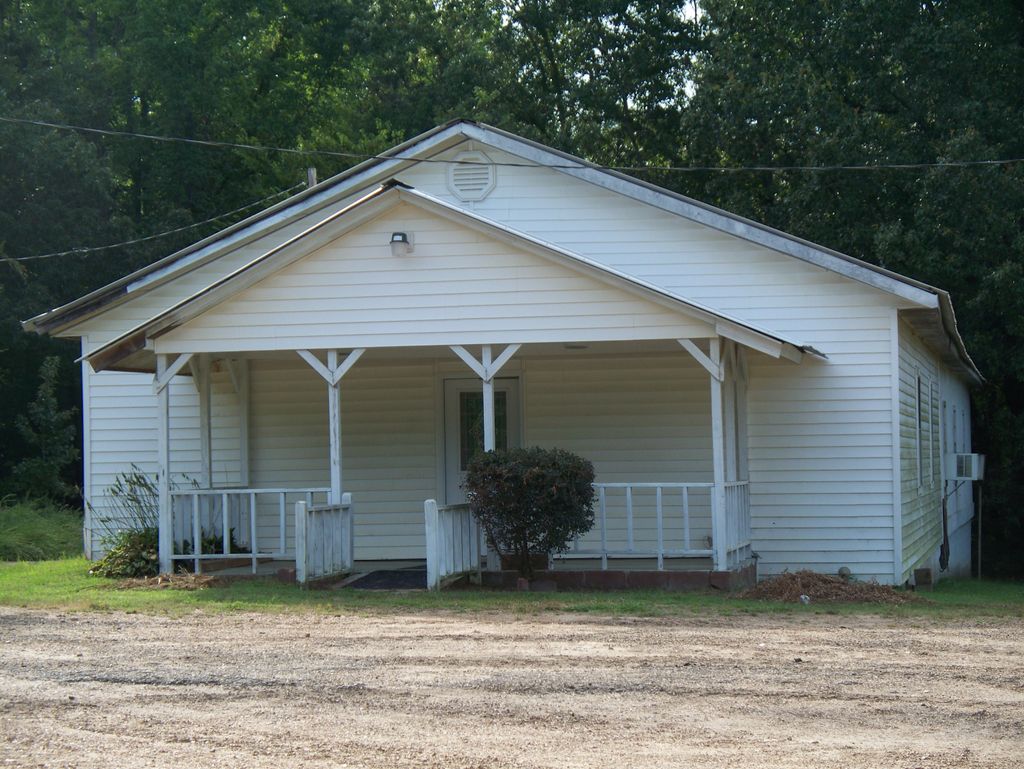
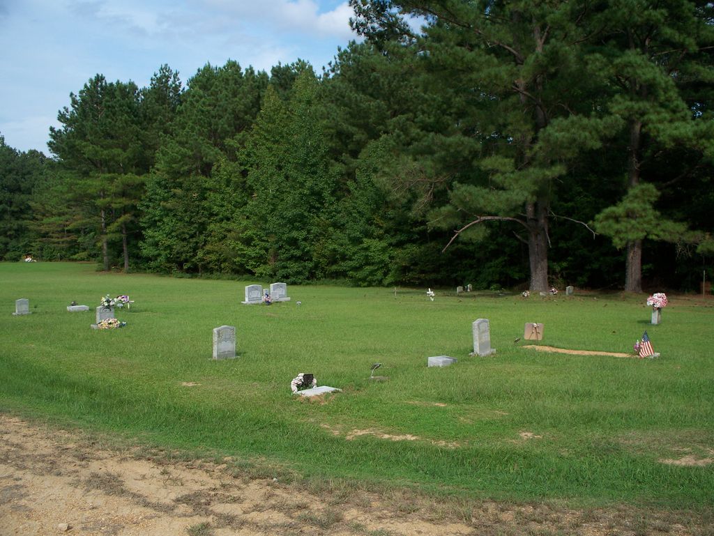
| Description | : | Acree Hill Holiness Church Cemetery 1092 Tramell Road B Batesville, MS 38606 All the credit for finding the location of this cemetery, the survey of this cemetery, and all the pictures for the cemetery and graves, goes to Find A Grave Volunteer and Contributor, Everett Baranowski, #48413099. Everett took the time to find this small, unknown cemetery for me because I have family members buried there. Everett has noted that this cemetery is down a country back road, in a secluded area, and that the residents "have a strong neighbor hood watch", watching the church and the cemetery, but more closely-the residents of... Read More |
frequently asked questions (FAQ):
-
Where is Acree Hill Holiness Church Cemetery?
Acree Hill Holiness Church Cemetery is located at Batesville, Panola County ,Mississippi ,USA.
-
Acree Hill Holiness Church Cemetery cemetery's updated grave count on graveviews.com?
0 memorials
-
Where are the coordinates of the Acree Hill Holiness Church Cemetery?
Latitude: 34.3088920
Longitude: -89.7405320


Nearby Cemetories:
1. Shady Grove Baptist Church Cemetery
Batesville, Panola County, USA
Coordinate: 34.3232790, -89.7369700
2. Mount Olivet Cemetery
Panola County, USA
Coordinate: 34.2952995, -89.7891998
3. Black Jack Cemetery
Sardis, Panola County, USA
Coordinate: 34.3496600, -89.7591400
4. Orwood Cemetery
Taylor, Lafayette County, USA
Coordinate: 34.2580370, -89.7171050
5. Orwood Cemetery
Taylor, Lafayette County, USA
Coordinate: 34.2578545, -89.7173615
6. Forrest Memorial Park
Batesville, Panola County, USA
Coordinate: 34.3283005, -89.8082962
7. Harrisonville Cemetery
Oxford, Lafayette County, USA
Coordinate: 34.3570700, -89.6960500
8. Pilgrims Rest Cemetery
Panola County, USA
Coordinate: 34.2494500, -89.7555800
9. Bluff Springs Cemetery
Batesville, Panola County, USA
Coordinate: 34.3460999, -89.8091965
10. McMinn Cemetery
Taylor, Lafayette County, USA
Coordinate: 34.2448190, -89.7039800
11. Saint Peter M.B. Church Cemetery
Batesville, Panola County, USA
Coordinate: 34.3795500, -89.7756400
12. Clear Creek Baptist Church Cemetery
Oxford, Lafayette County, USA
Coordinate: 34.3484680, -89.6592520
13. Concord Cemetery
Batesville, Panola County, USA
Coordinate: 34.2910000, -89.8327070
14. Clear Creek Missionary Baptist Church Cemetery
Oxford, Lafayette County, USA
Coordinate: 34.3502800, -89.6575700
15. New Providence M.B. Church Cemetery
Pope, Panola County, USA
Coordinate: 34.2243230, -89.7412200
16. Cold Springs Cemetery
Sardis, Panola County, USA
Coordinate: 34.3755600, -89.8037700
17. New Hope Missionary Baptist Church Cemetery
Como, Panola County, USA
Coordinate: 34.2935400, -89.8414000
18. New Hope MB Church Cemetery
Batesville, Panola County, USA
Coordinate: 34.2934490, -89.8415190
19. Bynum Cemetery
Shuford, Panola County, USA
Coordinate: 34.2153870, -89.7561993
20. Old Bynum Cemetery
Panola County, USA
Coordinate: 34.2153015, -89.7561035
21. South Hopewell Memorial Cemetery
Splinter, Lafayette County, USA
Coordinate: 34.2546840, -89.6461690
22. Browning Cemetery
Lafayette County, USA
Coordinate: 34.2546997, -89.6457977
23. Kind Providence Cemetery
Panola County, USA
Coordinate: 34.2125015, -89.7485962
24. Middleton Cemetery
Panola County, USA
Coordinate: 34.2543068, -89.8371277