
| Memorials | : | 0 |
| Location | : | Taylor, Lafayette County, USA |
| Coordinate | : | 34.2578545, -89.7173615 |
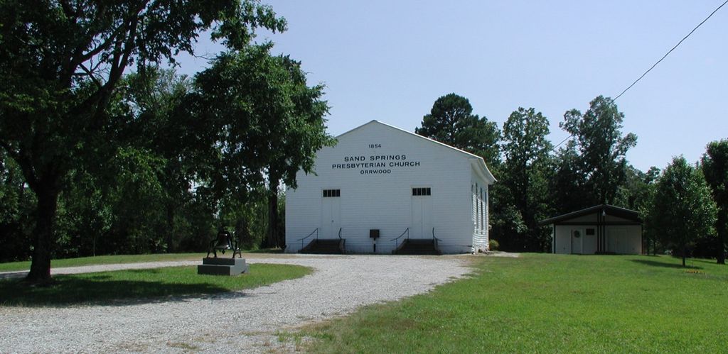
| Description | : | African American Cemetery. From the intersection of Highway 7 and 315 (at the Shell Station) travel northwest on Highway 315 for 5.2 mles to Highway 328. Turn right and travel 0.9 miles to CR 333. Travel 1.4 miles on 333 to the STOP sign at CR354. Turn left and travel 1.7 miles and you will see the Sand Springs Presbyterian Church - Orwood. Keep on going another 0.1 miles and the Orwood Cemetery will be on your left. Turn in the driveway and the "Black" section will be on your left and the "White" section will be on your right. |
frequently asked questions (FAQ):
-
Where is Orwood Cemetery?
Orwood Cemetery is located at Taylor, Lafayette County ,Mississippi ,USA.
-
Orwood Cemetery cemetery's updated grave count on graveviews.com?
0 memorials
-
Where are the coordinates of the Orwood Cemetery?
Latitude: 34.2578545
Longitude: -89.7173615


Nearby Cemetories:
1. Orwood Cemetery
Taylor, Lafayette County, USA
Coordinate: 34.2580370, -89.7171050
2. McMinn Cemetery
Taylor, Lafayette County, USA
Coordinate: 34.2448190, -89.7039800
3. Pilgrims Rest Cemetery
Panola County, USA
Coordinate: 34.2494500, -89.7555800
4. New Providence M.B. Church Cemetery
Pope, Panola County, USA
Coordinate: 34.2243230, -89.7412200
5. Pleasant Green M. B. Church Cemetery
Water Valley, Yalobusha County, USA
Coordinate: 34.2143920, -89.7140410
6. Pleasant Green Cemetery
Lafayette County, USA
Coordinate: 34.2143100, -89.7139200
7. Moore Cemetery
Lafayette County, USA
Coordinate: 34.2080360, -89.7204360
8. Kind Providence Cemetery
Panola County, USA
Coordinate: 34.2125015, -89.7485962
9. Bynum Community Cemetery
Panola County, USA
Coordinate: 34.2117540, -89.7478910
10. Bynum Cemetery
Shuford, Panola County, USA
Coordinate: 34.2153870, -89.7561993
11. Old Bynum Cemetery
Panola County, USA
Coordinate: 34.2153015, -89.7561035
12. Acree Hill Holiness Church Cemetery
Batesville, Panola County, USA
Coordinate: 34.3088920, -89.7405320
13. South Hopewell Memorial Cemetery
Splinter, Lafayette County, USA
Coordinate: 34.2546840, -89.6461690
14. Browning Cemetery
Lafayette County, USA
Coordinate: 34.2546997, -89.6457977
15. Shady Grove Baptist Church Cemetery
Batesville, Panola County, USA
Coordinate: 34.3232790, -89.7369700
16. Mount Olivet Cemetery
Panola County, USA
Coordinate: 34.2952995, -89.7891998
17. Camp Ground Cemetery
Springdale, Lafayette County, USA
Coordinate: 34.2065010, -89.6432037
18. Pisgah Cemetery
Batesville, Panola County, USA
Coordinate: 34.2247009, -89.8086014
19. Yocona African American Cemetery
Lafayette County, USA
Coordinate: 34.2699013, -89.6150970
20. Love Joy Cemetery
Panola County, USA
Coordinate: 34.1889000, -89.7786026
21. Yocona Cemetery
Lafayette County, USA
Coordinate: 34.2705994, -89.6128006
22. Jones Cemetery
Lafayette County, USA
Coordinate: 34.2584000, -89.6073990
23. Mount Hope Baptist Church Cemetery
Taylor, Lafayette County, USA
Coordinate: 34.3007180, -89.6149630
24. Black Jack Cemetery
Sardis, Panola County, USA
Coordinate: 34.3496600, -89.7591400