
| Memorials | : | 0 |
| Location | : | Horse Cave, Hart County, USA |
| Coordinate | : | 37.2078600, -85.8845300 |
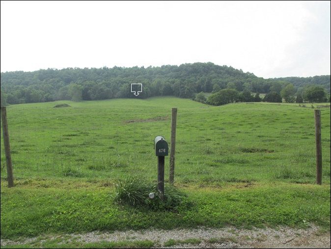
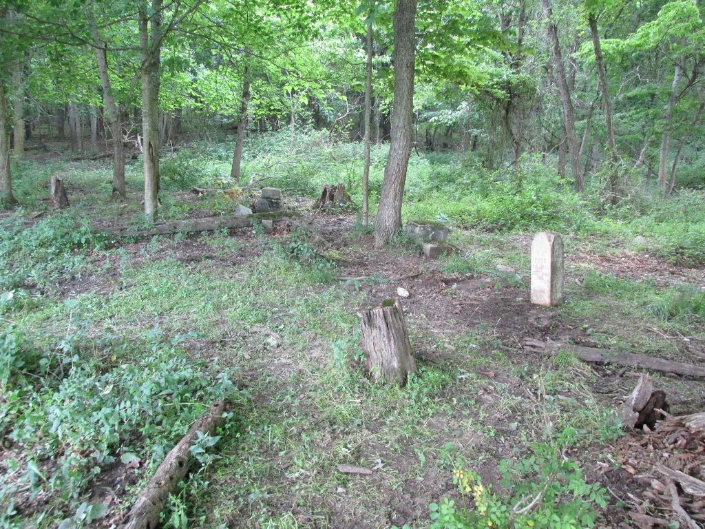
| Description | : | This cemetery is located in the edge of the woods (knob) on the west side of Cedar Cliff Church Road north of Horse Cave, KY; approximate GPS Coordinates: Latitude: 37.20786, Longitude: -85.88453. Only two engraved tombstones were found May 2017, both were on the ground; one tombstone engraved one side only and one tombstone engraved all four sides. A few field stones were found; there appear to be about 10 or so graves, 9 interments have been identified by tombstones/death certificates. Those known to be interred in this cemetery include Albert and Susan Page, six of their known children, and Susan's... Read More |
frequently asked questions (FAQ):
-
Where is Albert Page Family Cemetery?
Albert Page Family Cemetery is located at Cedar Cliff Church Road Horse Cave, Hart County ,Kentucky , 42749USA.
-
Albert Page Family Cemetery cemetery's updated grave count on graveviews.com?
0 memorials
-
Where are the coordinates of the Albert Page Family Cemetery?
Latitude: 37.2078600
Longitude: -85.8845300
Nearby Cemetories:
1. Harper Cemetery #2
Horse Cave, Hart County, USA
Coordinate: 37.2025000, -85.8782300
2. Cedar Cliff Cemetery
Horse Cave, Hart County, USA
Coordinate: 37.2160700, -85.8743700
3. Providence Church Cemetery
Horse Cave, Hart County, USA
Coordinate: 37.2022690, -85.8702220
4. Harper Cemetery
Horse Cave, Hart County, USA
Coordinate: 37.1951990, -85.8987370
5. Miller Cemetery
Horse Cave, Hart County, USA
Coordinate: 37.1846000, -85.8923100
6. Crain Family Cemetery
Horse Cave, Hart County, USA
Coordinate: 37.2116570, -85.8539320
7. Horse Cave Cemetery
Horse Cave, Hart County, USA
Coordinate: 37.1860440, -85.9027110
8. Horse Cave Municipal Cemetery
Horse Cave, Hart County, USA
Coordinate: 37.1795006, -85.8987122
9. Caudill Family Cemetery
Jeremiah, Letcher County, USA
Coordinate: 37.1906528, -85.9186583
10. Grinstead Cemetery
Horse Cave, Hart County, USA
Coordinate: 37.1746630, -85.8953800
11. Light House Full Gospel Church Cemetery
Hart County, USA
Coordinate: 37.1730550, -85.8949840
12. Confederate Soldier Gravesite
Horse Cave, Hart County, USA
Coordinate: 37.1939580, -85.9269860
13. Garvin Family Cemetery
Horse Cave, Hart County, USA
Coordinate: 37.2316740, -85.9221240
14. Bearwallow Baptist Cemetery
Horse Cave, Hart County, USA
Coordinate: 37.1833630, -85.8282710
15. Berry Perry Cemetery
Hart County, USA
Coordinate: 37.2463450, -85.9314920
16. Glenn Cemetery
Hart County, USA
Coordinate: 37.2235500, -85.9567100
17. Denison Cemetery
Horse Cave, Hart County, USA
Coordinate: 37.1774210, -85.9515090
18. Echo Mission Church Cemetery
Hart County, USA
Coordinate: 37.2200900, -85.9602780
19. Bunnell Family Cemetery
Bunnell Crossing, Hart County, USA
Coordinate: 37.2316440, -85.8048460
20. Hatcher Cemetery
Cave City, Barren County, USA
Coordinate: 37.1438980, -85.9294800
21. Pleasant View United Baptist Church Cemetery
Kessinger, Hart County, USA
Coordinate: 37.2171510, -85.9762440
22. Little Blue Springs Baptist Church Cemetery
Hart County, USA
Coordinate: 37.1861620, -85.7944670
23. Wilson Cemetery #4
Bear Wallow, Barren County, USA
Coordinate: 37.1405560, -85.8391670
24. Cabell Cemetery
Cave City, Barren County, USA
Coordinate: 37.1393760, -85.9423830