
| Memorials | : | 3 |
| Location | : | Horse Cave, Hart County, USA |
| Coordinate | : | 37.2160700, -85.8743700 |
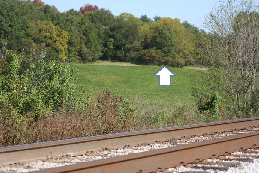
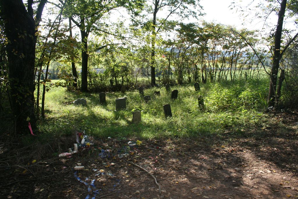
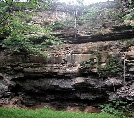
| Description | : | Cedar Cliff Cemetery aka Nichols Cemetery is located about 3 miles NE (32°) of Horse Cave on the east side of an abandoned section of the old Glasgow Munfordville Road. The first known interment was 1858 and the last known interment was 2011; only five people have been buried in this cemetery since 1931, Crit Nichols and members of his family. The death certificate of Barker T. Nichols (d:1931) and the obituary of Bessie L. Nichols Sturgeon (d: 2011) list the name of this cemetery as Cedar Cliff. The Cedar Cliff name is derived from a nearby cliff/bluff; no connection... Read More |
frequently asked questions (FAQ):
-
Where is Cedar Cliff Cemetery?
Cedar Cliff Cemetery is located at Horse Cave, Hart County ,Kentucky ,USA.
-
Cedar Cliff Cemetery cemetery's updated grave count on graveviews.com?
3 memorials
-
Where are the coordinates of the Cedar Cliff Cemetery?
Latitude: 37.2160700
Longitude: -85.8743700
Nearby Cemetories:
1. Albert Page Family Cemetery
Horse Cave, Hart County, USA
Coordinate: 37.2078600, -85.8845300
2. Harper Cemetery #2
Horse Cave, Hart County, USA
Coordinate: 37.2025000, -85.8782300
3. Providence Church Cemetery
Horse Cave, Hart County, USA
Coordinate: 37.2022690, -85.8702220
4. Crain Family Cemetery
Horse Cave, Hart County, USA
Coordinate: 37.2116570, -85.8539320
5. Harper Cemetery
Horse Cave, Hart County, USA
Coordinate: 37.1951990, -85.8987370
6. Miller Cemetery
Horse Cave, Hart County, USA
Coordinate: 37.1846000, -85.8923100
7. Horse Cave Cemetery
Horse Cave, Hart County, USA
Coordinate: 37.1860440, -85.9027110
8. Garvin Family Cemetery
Horse Cave, Hart County, USA
Coordinate: 37.2316740, -85.9221240
9. Horse Cave Municipal Cemetery
Horse Cave, Hart County, USA
Coordinate: 37.1795006, -85.8987122
10. Caudill Family Cemetery
Jeremiah, Letcher County, USA
Coordinate: 37.1906528, -85.9186583
11. Grinstead Cemetery
Horse Cave, Hart County, USA
Coordinate: 37.1746630, -85.8953800
12. Light House Full Gospel Church Cemetery
Hart County, USA
Coordinate: 37.1730550, -85.8949840
13. Confederate Soldier Gravesite
Horse Cave, Hart County, USA
Coordinate: 37.1939580, -85.9269860
14. Bearwallow Baptist Cemetery
Horse Cave, Hart County, USA
Coordinate: 37.1833630, -85.8282710
15. Berry Perry Cemetery
Hart County, USA
Coordinate: 37.2463450, -85.9314920
16. Bunnell Family Cemetery
Bunnell Crossing, Hart County, USA
Coordinate: 37.2316440, -85.8048460
17. Glenn Cemetery
Hart County, USA
Coordinate: 37.2235500, -85.9567100
18. Echo Mission Church Cemetery
Hart County, USA
Coordinate: 37.2200900, -85.9602780
19. Little Blue Springs Baptist Church Cemetery
Hart County, USA
Coordinate: 37.1861620, -85.7944670
20. Denison Cemetery
Horse Cave, Hart County, USA
Coordinate: 37.1774210, -85.9515090
21. Dawson Cemetery
Hart County, USA
Coordinate: 37.2890300, -85.8633250
22. Burks Cemetery
Hart County, USA
Coordinate: 37.2411370, -85.7808900
23. Allen Seminary Baptist Church Cemetery
Hart County, USA
Coordinate: 37.2378230, -85.7793630
24. Wilson Cemetery #4
Bear Wallow, Barren County, USA
Coordinate: 37.1405560, -85.8391670