
| Memorials | : | 2 |
| Location | : | Greene County, USA |
| Coordinate | : | 36.2630997, -90.7482986 |
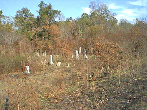
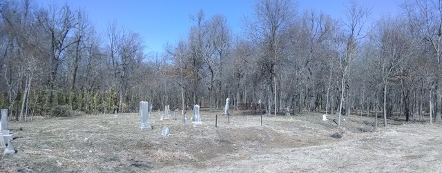
| Description | : | At Delaplaine, go toward the Brookings Community. Turn left on the unnamed County Road going to Lake Ashbaugh and proceed about two miles to the Lake Ashbaugh turn-off road. A field road leading to Wise/Wyse Cemetery is about fifty feet before you get to the road that leads to the lake. The cemetery is at the back of the field and may not be visible from the road. The road leading back to the cemetery is rough but may be driven providing the weather is dry. |
frequently asked questions (FAQ):
-
Where is Albrite Cemetery?
Albrite Cemetery is located at Greene County ,Arkansas ,USA.
-
Albrite Cemetery cemetery's updated grave count on graveviews.com?
1 memorials
-
Where are the coordinates of the Albrite Cemetery?
Latitude: 36.2630997
Longitude: -90.7482986
Nearby Cemetories:
1. Brownie Chapel Cemetery
Peach Orchard, Clay County, USA
Coordinate: 36.2706200, -90.7085200
2. Jones Ridge Cemetery
Delaplaine, Greene County, USA
Coordinate: 36.2305984, -90.6980972
3. Cherry Cemetery
Randolph County, USA
Coordinate: 36.3222008, -90.7592010
4. Luttrell Cemetery
Biggers, Randolph County, USA
Coordinate: 36.3120100, -90.8014300
5. Lawnbird Cemetery
Biggers, Randolph County, USA
Coordinate: 36.3177986, -90.7932968
6. Hite Cemetery
Biggers, Randolph County, USA
Coordinate: 36.2985990, -90.8198230
7. Old Reyno Cemetery
Randolph County, USA
Coordinate: 36.3314018, -90.7592010
8. Pirtle Cemetery
Peach Orchard, Clay County, USA
Coordinate: 36.2957580, -90.6700160
9. Dunn Cemetery #2
Biggers, Randolph County, USA
Coordinate: 36.2916900, -90.8316900
10. Osborn Cemetery
Biggers, Randolph County, USA
Coordinate: 36.3320800, -90.7875000
11. Bond Cemetery
Greene County, USA
Coordinate: 36.1885986, -90.7144012
12. Brimmage Cemetery
Randolph County, USA
Coordinate: 36.2801100, -90.8485500
13. Johnson-McIlroy Cemetery
Randolph County, USA
Coordinate: 36.2972400, -90.8421800
14. Serge Cemetery (Defunct)
Randolph County, USA
Coordinate: 36.2303009, -90.8432999
15. Shaver Cemetery
Randolph County, USA
Coordinate: 36.3034800, -90.8404100
16. Scott Cemetery
Biggers, Randolph County, USA
Coordinate: 36.3300018, -90.8139038
17. Sparkman Cemetery
Biggers, Randolph County, USA
Coordinate: 36.3048500, -90.8441700
18. Yellow Hall Cemetery
Biggers, Randolph County, USA
Coordinate: 36.3258018, -90.8283005
19. Blount Cemetery
Reyno, Randolph County, USA
Coordinate: 36.3518982, -90.7718964
20. Allen Cemetery
Knobel, Clay County, USA
Coordinate: 36.3119011, -90.6505966
21. Nelson Clay Cemetery
Clay County, USA
Coordinate: 36.3576800, -90.7396700
22. Liberty Cemetery
Randolph County, USA
Coordinate: 36.2207985, -90.8542023
23. Sharum Cemetery
Pocahontas, Randolph County, USA
Coordinate: 36.2207985, -90.8544006
24. Johnston Cemetery
Reyno, Randolph County, USA
Coordinate: 36.3568993, -90.7716980