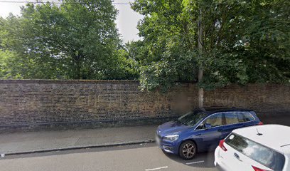
| Memorials | : | 145 |
| Location | : | Bethnal Green, London Borough of Tower Hamlets, England |
| Coordinate | : | 51.5232120, -0.0448120 |
| Description | : | The United Synagogue Burial Society is responsible for all the activities surrounding the burial of its members. It organises, oversees and advises on the various processes that are required by both Jewish and English law.They are also responsible for maintaining the infrastructure of burial grounds and mortuaries.They maintain eleven cemeteries, both active and disused. It is not always practical due to the ever-present threat of vandalism and Health and Safety legislation to keep all the cemeteries permanently open. (Those that are permanently open are Bushey, Waltham Abbey, Willesden and East Ham Cemetery) In this God's Acre lie the mortal remains of... Read More |
frequently asked questions (FAQ):
-
Where is Alderney Road Jewish Cemetery?
Alderney Road Jewish Cemetery is located at Alderney Road Bethnal Green, London Borough of Tower Hamlets ,Greater London ,England.
-
Alderney Road Jewish Cemetery cemetery's updated grave count on graveviews.com?
145 memorials
-
Where are the coordinates of the Alderney Road Jewish Cemetery?
Latitude: 51.5232120
Longitude: -0.0448120
Nearby Cemetories:
1. Old Velho Cemetery Sephardi Velho
Mile End, London Borough of Tower Hamlets, England
Coordinate: 51.5229030, -0.0437630
2. Bancroft Almshouses Cemetery
Stepney, London Borough of Tower Hamlets, England
Coordinate: 51.5243340, -0.0402940
3. Sephardi New Cemetery
Mile End, London Borough of Tower Hamlets, England
Coordinate: 51.5244320, -0.0393860
4. Meath Gardens
Bethnal Green, London Borough of Tower Hamlets, England
Coordinate: 51.5279430, -0.0446320
5. St Dunstan and All Saints Churchyard
Stepney, London Borough of Tower Hamlets, England
Coordinate: 51.5167850, -0.0418280
6. Maiden Lane Jewish Cemetery
Mile End, London Borough of Tower Hamlets, England
Coordinate: 51.5290640, -0.0348040
7. Stepney Meeting House Burial Ground
Stepney, London Borough of Tower Hamlets, England
Coordinate: 51.5150701, -0.0403304
8. Tower Hamlets Cemetery Park
Tower Hamlets, London Borough of Tower Hamlets, England
Coordinate: 51.5236730, -0.0304200
9. Brady Street Cemetery
Whitechapel, London Borough of Tower Hamlets, England
Coordinate: 51.5218390, -0.0604950
10. Wycliffe Congregational Church
Tower Hamlets, London Borough of Tower Hamlets, England
Coordinate: 51.5164124, -0.0582821
11. Rose Lane Chapel Chapelyard
Limehouse, London Borough of Tower Hamlets, England
Coordinate: 51.5124510, -0.0403730
12. Vallance Road Recreation Ground
Whitechapel, London Borough of Tower Hamlets, England
Coordinate: 51.5200860, -0.0629160
13. St. Matthew's Churchyard
Bethnal Green, London Borough of Tower Hamlets, England
Coordinate: 51.5251190, -0.0672250
14. Lauriston Road Jewish Cemetery
Hackney, London Borough of Hackney, England
Coordinate: 51.5373490, -0.0436210
15. St Anne's Limehouse Churchyard
Limehouse, London Borough of Tower Hamlets, England
Coordinate: 51.5120818, -0.0298991
16. St. Paul's with St. James Churchyard
Shadwell, London Borough of Tower Hamlets, England
Coordinate: 51.5093840, -0.0520990
17. St. George-in-the-East Churchyard
Stepney, London Borough of Tower Hamlets, England
Coordinate: 51.5099610, -0.0599100
18. St. Mary Matfelon Church
Whitechapel, London Borough of Tower Hamlets, England
Coordinate: 51.5162030, -0.0684970
19. St. Leonard's Churchyard
Bromley-by-Bow, London Borough of Tower Hamlets, England
Coordinate: 51.5284920, -0.0132780
20. St. Leonard Churchyard
Shoreditch, London Borough of Hackney, England
Coordinate: 51.5268230, -0.0773640
21. Execution Dock
Wapping, London Borough of Tower Hamlets, England
Coordinate: 51.5035600, -0.0564090
22. Holywell Priory
Shoreditch, London Borough of Hackney, England
Coordinate: 51.5238050, -0.0785300
23. Abbey of the Minoresses of St. Clare without Aldgate Churchyard
Aldgate, City of London, England
Coordinate: 51.5125370, -0.0749860
24. St Botolph without Aldgate Churchyard
Aldgate, City of London, England
Coordinate: 51.5140120, -0.0763420

