
| Memorials | : | 3 |
| Location | : | Groede, Sluis Municipality, Netherlands |
| Coordinate | : | 51.3797900, 3.5031400 |
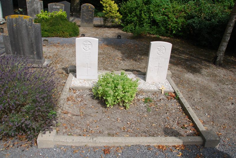
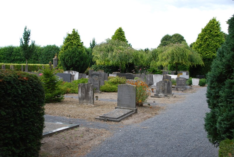
| Description | : | Groede is a village south of the Schelde estuary. It is part of the Sluis Municipality, located in the province of Zeeland in the south-western Netherlands. It lies approx 30km west of Terneuzen. The 3 graves can be found at the rear right corner of the cemetery. Two sailors and one soldier from the United Kingdom are buried here. One of the sailors is unidentified. The cemetery address is:- Nieuwstraat / Traverse, Groede |
frequently asked questions (FAQ):
-
Where is Algemene begraafplaats Groede?
Algemene begraafplaats Groede is located at Groede, Sluis Municipality ,Zeeland ,Netherlands.
-
Algemene begraafplaats Groede cemetery's updated grave count on graveviews.com?
3 memorials
-
Where are the coordinates of the Algemene begraafplaats Groede?
Latitude: 51.3797900
Longitude: 3.5031400
Nearby Cemetories:
1. Groede Churchyard
Groede, Sluis Municipality, Netherlands
Coordinate: 51.3780127, 3.5080917
2. Begraafplaats Nieuwvliet
Sluis Municipality, Netherlands
Coordinate: 51.3716363, 3.4730114
3. Breskens Old General Cemetery
Breskens, Sluis Municipality, Netherlands
Coordinate: 51.3926500, 3.5490100
4. Schoondijke General Cemetery
Schoondijke, Sluis Municipality, Netherlands
Coordinate: 51.3553900, 3.5545400
5. Zuidzande Cemetery
Zuidzande, Sluis Municipality, Netherlands
Coordinate: 51.3424800, 3.4488500
6. Oostburg Communal Cemetery
Oostburg, Sluis Municipality, Netherlands
Coordinate: 51.3280630, 3.4833740
7. Cadzand General Cemetery
Cadzand, Sluis Municipality, Netherlands
Coordinate: 51.3696400, 3.4087600
8. Retranchement Cemetery
Retranchement, Sluis Municipality, Netherlands
Coordinate: 51.3498900, 3.3851500
9. Oude Joodse Begraafplaats Julianalaan
Vlissingen Municipality, Netherlands
Coordinate: 51.4506380, 3.5633720
10. Vlissingen Noorderbegraafplaats
Vlissingen, Vlissingen Municipality, Netherlands
Coordinate: 51.4528313, 3.5796549
11. Ijzendijke General Cemetery
IJzendijke, Sluis Municipality, Netherlands
Coordinate: 51.3240700, 3.6149800
12. Hoofdplaat Roman Catholic Cemetery
Hoofdplaat, Sluis Municipality, Netherlands
Coordinate: 51.3691587, 3.6648077
13. Sint-Margriete Cemetery
Sint-Laureins, Arrondissement Eeklo, Belgium
Coordinate: 51.2820200, 3.5468000
14. Waterland-Oudeman Churchyard
Waterland-Oudeman, Arrondissement Eeklo, Belgium
Coordinate: 51.2874724, 3.5891668
15. Sint Kruis Churchyard
Sint Kruis, Sluis Municipality, Netherlands
Coordinate: 51.2720648, 3.4958090
16. Aardenburg Roman Catholic Cemetery
Aardenburg, Sluis Municipality, Netherlands
Coordinate: 51.2745700, 3.4419100
17. Aardenburg General Cemetery
Aardenburg, Sluis Municipality, Netherlands
Coordinate: 51.2709900, 3.4495600
18. Sint-Jan-in-Eremo Churchyard
Sint-Laureins, Arrondissement Eeklo, Belgium
Coordinate: 51.2683100, 3.5800200
19. Biggekerke Communal Cemetery
Biggekerke, Veere Municipality, Netherlands
Coordinate: 51.5020500, 3.5208200
20. Zoutelande General Cemetery
Zoutelande, Veere Municipality, Netherlands
Coordinate: 51.5019500, 3.4800200
21. Biervliet Algemene Begraafplaats
Biervliet, Terneuzen Municipality, Netherlands
Coordinate: 51.3302700, 3.6846400
22. R.K. Begraafplaats
Biervliet, Terneuzen Municipality, Netherlands
Coordinate: 51.3323944, 3.6889988
23. Notre-Dame de l'Assomption de Watervliet
Sint-Laureins, Arrondissement Eeklo, Belgium
Coordinate: 51.2760420, 3.6277780
24. Watervliet Communal Cemetery
Sint-Laureins, Arrondissement Eeklo, Belgium
Coordinate: 51.2759800, 3.6276600