
| Memorials | : | 0 |
| Location | : | Zoutelande, Veere Municipality, Netherlands |
| Coordinate | : | 51.5019500, 3.4800200 |
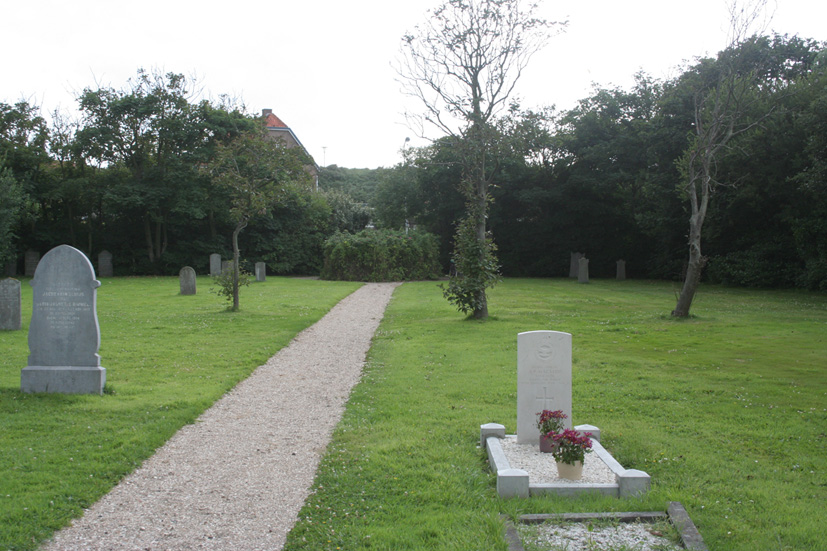
| Description | : | Zoutelande is a village on the western coast of the former Walcheren Island. It is part of the Veere Municipality, located in the province of Zeeland in the south-western Netherlands. It lies approx 11km west of Middelburg. |
frequently asked questions (FAQ):
-
Where is Zoutelande General Cemetery?
Zoutelande General Cemetery is located at Zoutelande, Veere Municipality ,Zeeland ,Netherlands.
-
Zoutelande General Cemetery cemetery's updated grave count on graveviews.com?
0 memorials
-
Where are the coordinates of the Zoutelande General Cemetery?
Latitude: 51.5019500
Longitude: 3.4800200
Nearby Cemetories:
1. Biggekerke Communal Cemetery
Biggekerke, Veere Municipality, Netherlands
Coordinate: 51.5020500, 3.5208200
2. Westkapelle General Cemetery
Westkapelle, Veere Municipality, Netherlands
Coordinate: 51.5291200, 3.4469300
3. Oude Joodse Begraafplaats Julianalaan
Vlissingen Municipality, Netherlands
Coordinate: 51.4506380, 3.5633720
4. Portugees-Joodse begraafplaats Jodengang
Middelburg Municipality, Netherlands
Coordinate: 51.5006540, 3.6037420
5. Joodse Begraafplaats Walensingel
Middelburg Municipality, Netherlands
Coordinate: 51.5001460, 3.6058240
6. Vlissingen Noorderbegraafplaats
Vlissingen, Vlissingen Municipality, Netherlands
Coordinate: 51.4528313, 3.5796549
7. Oostkapelle General Cemetery
Oostkapelle, Veere Municipality, Netherlands
Coordinate: 51.5671500, 3.5547700
8. Middelburg Abbey
Middelburg, Middelburg Municipality, Netherlands
Coordinate: 51.5000000, 3.6166670
9. Algemene Begraafplaats
Serooskerke, Veere Municipality, Netherlands
Coordinate: 51.5531700, 3.5993600
10. Middelburg Algemene Begraafplaats
Middelburg, Middelburg Municipality, Netherlands
Coordinate: 51.4973900, 3.6271800
11. Vrouwenpolder Cemetery
Vrouwenpolder, Veere Municipality, Netherlands
Coordinate: 51.5762700, 3.6247700
12. Begraafplaats Kerkhofring
Zanddijk, Veere Municipality, Netherlands
Coordinate: 51.5400512, 3.6583653
13. Breskens Old General Cemetery
Breskens, Sluis Municipality, Netherlands
Coordinate: 51.3926500, 3.5490100
14. Algemene begraafplaats Groede
Groede, Sluis Municipality, Netherlands
Coordinate: 51.3797900, 3.5031400
15. Groede Churchyard
Groede, Sluis Municipality, Netherlands
Coordinate: 51.3780127, 3.5080917
16. Begraafplaats Nieuwvliet
Sluis Municipality, Netherlands
Coordinate: 51.3716363, 3.4730114
17. Cadzand General Cemetery
Cadzand, Sluis Municipality, Netherlands
Coordinate: 51.3696400, 3.4087600
18. Schoondijke General Cemetery
Schoondijke, Sluis Municipality, Netherlands
Coordinate: 51.3553900, 3.5545400
19. Kamperland General Cemetery
Kamperland, Noord-Beveland Municipality, Netherlands
Coordinate: 51.5720500, 3.7028400
20. Zuidzande Cemetery
Zuidzande, Sluis Municipality, Netherlands
Coordinate: 51.3424800, 3.4488500
21. Retranchement Cemetery
Retranchement, Sluis Municipality, Netherlands
Coordinate: 51.3498900, 3.3851500
22. Nieuwdorp Dutch Reformed Cemetery
Nieuwdorp, Borsele Municipality, Netherlands
Coordinate: 51.4768900, 3.7438300
23. Nieuwdorp Algemene Begraafplaats
Nieuwdorp, Borsele Municipality, Netherlands
Coordinate: 51.4775300, 3.7466800
24. Lewedorp Kerkhof
Lewedorp, Borsele Municipality, Netherlands
Coordinate: 51.4940600, 3.7502800