
| Memorials | : | 0 |
| Location | : | High Roding, Uttlesford District, England |
| Coordinate | : | 51.8246620, 0.3083740 |
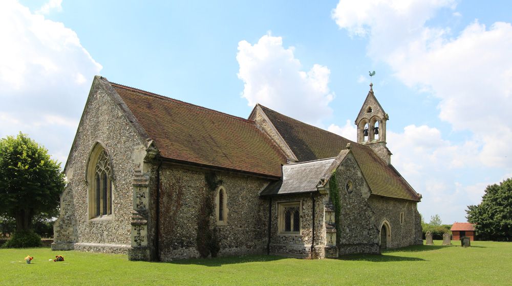
| Description | : | High Roding, also known as High Roothing is a straggling village, on the east side of the vale of the Roding, about 5 miles South South West of Dunmow. It was held by Ely Abbey, but the monks were deprived of it by William the Conqueror, for giving shelter to their fugitive countrymen. It was given at the Conquest to Wm. de Warren, Earl of Surrey. It afterwards passed to the Blois, Plantaganet, Fitzalan, Boleyn, and Stafford families. It was sold in 1554 by Sir Wm. Stafford, to Thomas Jocelyn, an ancestor of the Earl of Roden. All Saints Church... Read More |
frequently asked questions (FAQ):
-
Where is All Saints Churchyard?
All Saints Churchyard is located at High Roding, Uttlesford District ,Essex ,England.
-
All Saints Churchyard cemetery's updated grave count on graveviews.com?
0 memorials
-
Where are the coordinates of the All Saints Churchyard?
Latitude: 51.8246620
Longitude: 0.3083740
Nearby Cemetories:
1. St Mary the Virgin Churchyard
Aythorpe Roding, Uttlesford District, England
Coordinate: 51.8143370, 0.2971010
2. St Mary Churchyard
Great Canfield, Uttlesford District, England
Coordinate: 51.8388000, 0.3110930
3. St Mary the Virgin Churchyard
High Easter, Uttlesford District, England
Coordinate: 51.8078590, 0.3485370
4. St. Martin Churchyard
White Roding, Epping Forest District, England
Coordinate: 51.7970300, 0.2640600
5. All Saints Churchyard
Little Canfield, Uttlesford District, England
Coordinate: 51.8645410, 0.3033900
6. St Mary the Virgin Churchyard
Hatfield Broad Oak, Uttlesford District, England
Coordinate: 51.8268330, 0.2430400
7. St Margaret of Antioch Churchyard
Margaret Roding, Uttlesford District, England
Coordinate: 51.7836800, 0.3169400
8. St Edmund Churchyard
Abbess Roding, Epping Forest District, England
Coordinate: 51.7794180, 0.2771470
9. St Andrew Churchyard
Good Easter, Chelmsford Borough, England
Coordinate: 51.7836890, 0.3564820
10. St Paul Churchyard
Highwood, Chelmsford Borough, England
Coordinate: 51.7939100, 0.3788800
11. All Saints churchyard
Berners Roding, Epping Forest District, England
Coordinate: 51.7660070, 0.3201910
12. Hatfield Heath United Reformed Churchyard
Hatfield Heath, Uttlesford District, England
Coordinate: 51.8120100, 0.2141100
13. St Mary the Virgin Churchyard
Little Easton, Uttlesford District, England
Coordinate: 51.8869280, 0.3299070
14. Holy Trinity Churchyard
Hatfield Heath, Uttlesford District, England
Coordinate: 51.8123400, 0.2067800
15. St Mary the Virgin Churchyard
Great Dunmow, Uttlesford District, England
Coordinate: 51.8813920, 0.3660360
16. Holy Trinity Churchyard
Pleshey, Chelmsford Borough, England
Coordinate: 51.8024580, 0.4107000
17. Great Dunmow Cemetery
Great Dunmow, Uttlesford District, England
Coordinate: 51.8825180, 0.3652100
18. Mashbury Churchyard
Mashbury, Chelmsford Borough, England
Coordinate: 51.7809900, 0.3931400
19. St Mary Churchyard
Little Dunmow, Uttlesford District, England
Coordinate: 51.8654120, 0.4036350
20. St Mary the Virgin Churchyard
Matching, Epping Forest District, England
Coordinate: 51.7855000, 0.2098000
21. St Mary the Virgin Churchyard
Little Laver, Epping Forest District, England
Coordinate: 51.7642100, 0.2372400
22. St Giles Churchyard
Great Hallingbury, Uttlesford District, England
Coordinate: 51.8546820, 0.1932020
23. Ss Peter & Paul Churchyard
Shellow Bowells, Epping Forest District, England
Coordinate: 51.7465000, 0.3262700
24. St Mary the Virgin Churchyard
Sheering, Epping Forest District, England
Coordinate: 51.8008590, 0.1863380