
| Memorials | : | 0 |
| Location | : | Abbess Roding, Epping Forest District, England |
| Coordinate | : | 51.7794180, 0.2771470 |
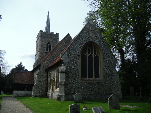
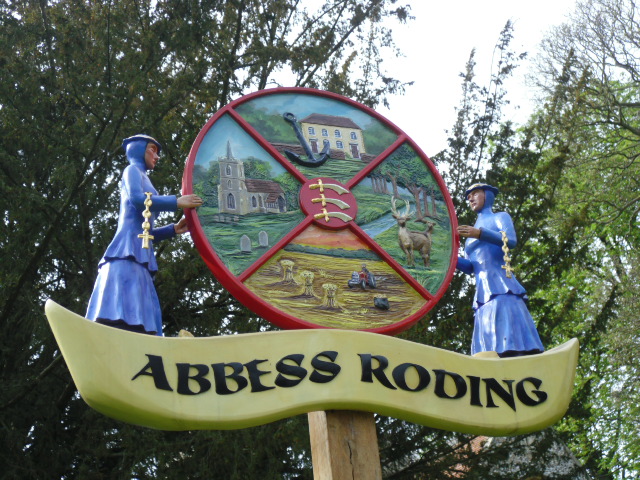
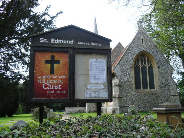
| Description | : | St Edmund at Abbess Roding/Roothing Abbess Roding is one of eight hamlets and villages called The Rodings in Essex, England. Its name derives from the Abbess of Barking who was a patron of the parish church of St. Edmund in the Middle Ages. Abbess Roding is located in the west of Essex, 5 miles north of Chipping Ongar, between Harlow in the west and 9 miles from the county town of Chelmsford in the east. The village is in the district of Epping Forest and in the parliamentary constituency of Brentwood & Ongar. The village is served by Abbess Beauchamp and Berners Roding... Read More |
frequently asked questions (FAQ):
-
Where is St Edmund Churchyard?
St Edmund Churchyard is located at Abbess Roding, Epping Forest District ,Essex ,England.
-
St Edmund Churchyard cemetery's updated grave count on graveviews.com?
0 memorials
-
Where are the coordinates of the St Edmund Churchyard?
Latitude: 51.7794180
Longitude: 0.2771470
Nearby Cemetories:
1. St. Martin Churchyard
White Roding, Epping Forest District, England
Coordinate: 51.7970300, 0.2640600
2. St Margaret of Antioch Churchyard
Margaret Roding, Uttlesford District, England
Coordinate: 51.7836800, 0.3169400
3. St Mary the Virgin Churchyard
Little Laver, Epping Forest District, England
Coordinate: 51.7642100, 0.2372400
4. All Saints churchyard
Berners Roding, Epping Forest District, England
Coordinate: 51.7660070, 0.3201910
5. St Mary the Virgin Churchyard
Aythorpe Roding, Uttlesford District, England
Coordinate: 51.8143370, 0.2971010
6. St Nicholas Churchyard
Fyfield, Epping Forest District, England
Coordinate: 51.7374230, 0.2760330
7. St Mary the Virgin Churchyard
Matching, Epping Forest District, England
Coordinate: 51.7855000, 0.2098000
8. St Andrew and All Saints Churchyard
Willingale, Epping Forest District, England
Coordinate: 51.7417800, 0.3106800
9. Ss Peter & Paul Churchyard
Shellow Bowells, Epping Forest District, England
Coordinate: 51.7465000, 0.3262700
10. All Saints Churchyard
High Laver, Epping Forest District, England
Coordinate: 51.7559060, 0.2117340
11. All Saints Churchyard
High Roding, Uttlesford District, England
Coordinate: 51.8246620, 0.3083740
12. St Andrew Churchyard
Good Easter, Chelmsford Borough, England
Coordinate: 51.7836890, 0.3564820
13. Hatfield Heath United Reformed Churchyard
Hatfield Heath, Uttlesford District, England
Coordinate: 51.8120100, 0.2141100
14. St Mary the Virgin Churchyard
Hatfield Broad Oak, Uttlesford District, England
Coordinate: 51.8268330, 0.2430400
15. St Mary the Virgin Churchyard
High Easter, Uttlesford District, England
Coordinate: 51.8078590, 0.3485370
16. Holy Trinity Churchyard
Hatfield Heath, Uttlesford District, England
Coordinate: 51.8123400, 0.2067800
17. St Mary the Virgin Churchyard
Sheering, Epping Forest District, England
Coordinate: 51.8008590, 0.1863380
18. St Mary Churchyard
Great Canfield, Uttlesford District, England
Coordinate: 51.8388000, 0.3110930
19. St Paul Churchyard
Highwood, Chelmsford Borough, England
Coordinate: 51.7939100, 0.3788800
20. St Mary the Virgin Churchyard
High Ongar, Epping Forest District, England
Coordinate: 51.7107790, 0.2641610
21. St Michael and All Angels Churchyard
Roxwell, Chelmsford Borough, England
Coordinate: 51.7509320, 0.3823170
22. Mashbury Churchyard
Mashbury, Chelmsford Borough, England
Coordinate: 51.7809900, 0.3931400
23. Ongar Town Cemetery
Ongar, Epping Forest District, England
Coordinate: 51.7083700, 0.2460300
24. Harlow Baptist Burial Ground
Harlow, Harlow District, England
Coordinate: 51.7619700, 0.1584330