| Memorials | : | 1 |
| Location | : | Shorthampton, West Oxfordshire District, England |
| Coordinate | : | 51.8785411, -1.5245927 |
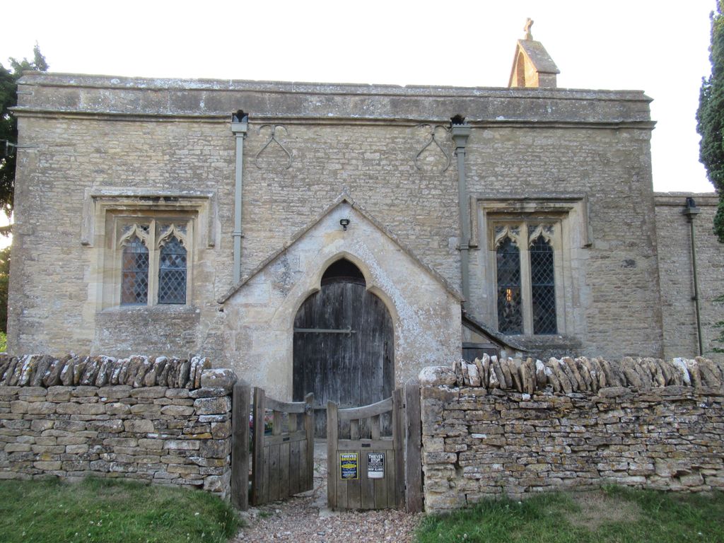
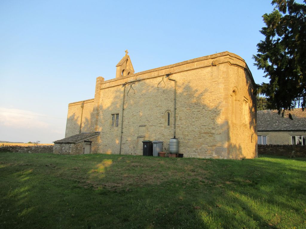
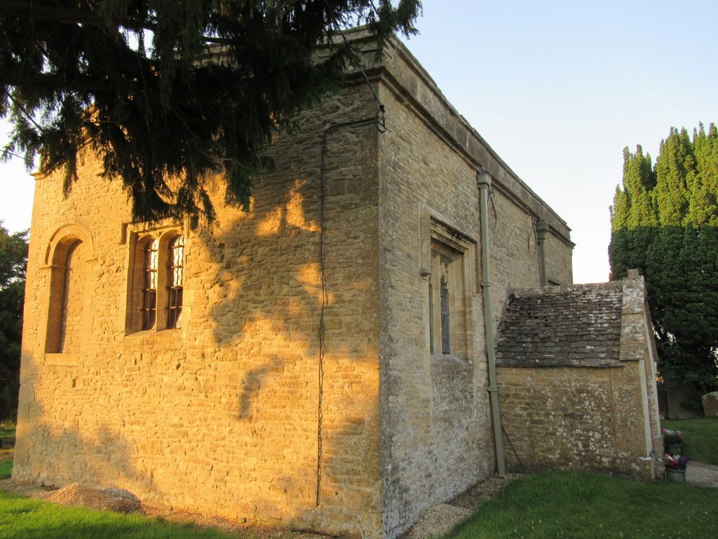
| Description | : | The hamlet of Shorthampton in Chilson civil parish is about 2 miles (3 km) west of Charlbury in Oxfordshire England. It is little more than a farm and the church. All Saints Church is a Grade II listed building listed 27 August 1957. All Saints Church is small and humble and lies at the end of a cup-de-sac to the east of Chilson, and approached from the minor road leading from Charlbury to the Burford road. It has no tower or spire and an unusual boxlike appearance with shallow roofs and square headed windows. The church is... Read More |
frequently asked questions (FAQ):
-
Where is All Saints Churchyard?
All Saints Churchyard is located at Shorthampton, West Oxfordshire District ,Oxfordshire , OX7 3HWEngland.
-
All Saints Churchyard cemetery's updated grave count on graveviews.com?
1 memorials
-
Where are the coordinates of the All Saints Churchyard?
Latitude: 51.8785411
Longitude: -1.5245927
Nearby Cemetories:
1. St. Nicholas Church
Chadlington, West Oxfordshire District, England
Coordinate: 51.8959090, -1.5160180
2. All Saints Churchyard
Spelsbury, West Oxfordshire District, England
Coordinate: 51.8909988, -1.4941750
3. Charlbury Cemetery
Charlbury, West Oxfordshire District, England
Coordinate: 51.8753600, -1.4855300
4. St. Mary the Virgin Churchyard
Charlbury, West Oxfordshire District, England
Coordinate: 51.8722050, -1.4846970
5. Holy Trinity Churchyard
Ascott under Wychwood, West Oxfordshire District, England
Coordinate: 51.8660100, -1.5644700
6. Holy Trinity Churchyard
Finstock, West Oxfordshire District, England
Coordinate: 51.8459910, -1.4801260
7. St James' Church
Sarsden, West Oxfordshire District, England
Coordinate: 51.9048470, -1.5806760
8. Saint Michaels and All Angels Churchyard
Leafield, West Oxfordshire District, England
Coordinate: 51.8355550, -1.5390810
9. Saint Mary the Virgin Churchyard and Vaults
Shipton-under-Wychwood, West Oxfordshire District, England
Coordinate: 51.8597520, -1.5952810
10. St James's Church
Ramsden, West Oxfordshire District, England
Coordinate: 51.8340622, -1.4841064
11. All Saints Churchyard
Churchill, West Oxfordshire District, England
Coordinate: 51.9146590, -1.5898010
12. Milton-under-Wychwood Friends Burial Ground
Milton-under-Wychwood, West Oxfordshire District, England
Coordinate: 51.8638040, -1.6109590
13. Milton-under-Wychwood Cemetery
Milton-under-Wychwood, West Oxfordshire District, England
Coordinate: 51.8684380, -1.6176370
14. St. Simon-St. Jude
Milton-under-Wychwood, West Oxfordshire District, England
Coordinate: 51.8660230, -1.6170140
15. Saint James the Great Churchyard
Stonesfield, West Oxfordshire District, England
Coordinate: 51.8510437, -1.4303250
16. St. Kenelms Churchyard
Enstone, West Oxfordshire District, England
Coordinate: 51.9232490, -1.4494010
17. Friends Burial Ground
Chipping Norton, West Oxfordshire District, England
Coordinate: 51.9415950, -1.5498310
18. Stonesfield Cemetery
Stonesfield, West Oxfordshire District, England
Coordinate: 51.8497110, -1.4301480
19. St Kenelm's Churchyard Extension
Enstone, West Oxfordshire District, England
Coordinate: 51.9240960, -1.4484250
20. Chipping Norton Cemetery
Chipping Norton, West Oxfordshire District, England
Coordinate: 51.9414200, -1.5555900
21. Holy Trinity Catholic Churchyard
Chipping Norton, West Oxfordshire District, England
Coordinate: 51.9439300, -1.5388200
22. St. Mary the Virgin Churchyard
Chipping Norton, West Oxfordshire District, England
Coordinate: 51.9434900, -1.5476200
23. St Andrew's Churchyard
Kingham, West Oxfordshire District, England
Coordinate: 51.9113760, -1.6255990
24. St John the Evangelist
Hailey, West Oxfordshire District, England
Coordinate: 51.8107740, -1.4879260


