
| Memorials | : | 0 |
| Location | : | Newmarket, Forest Heath District, England |
| Coordinate | : | 52.2430900, 0.4071700 |
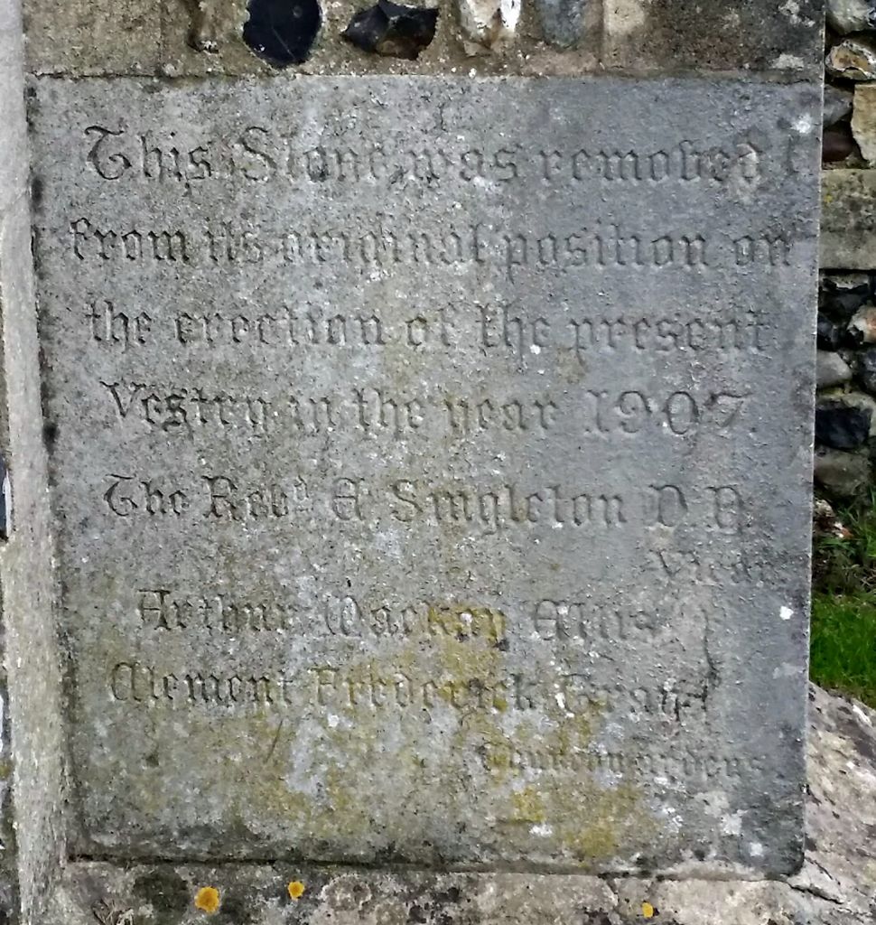
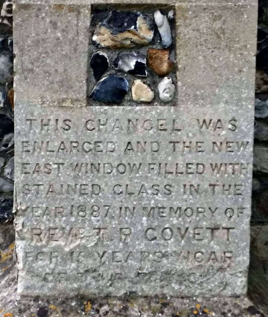
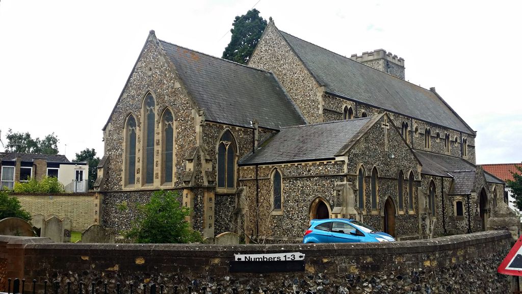
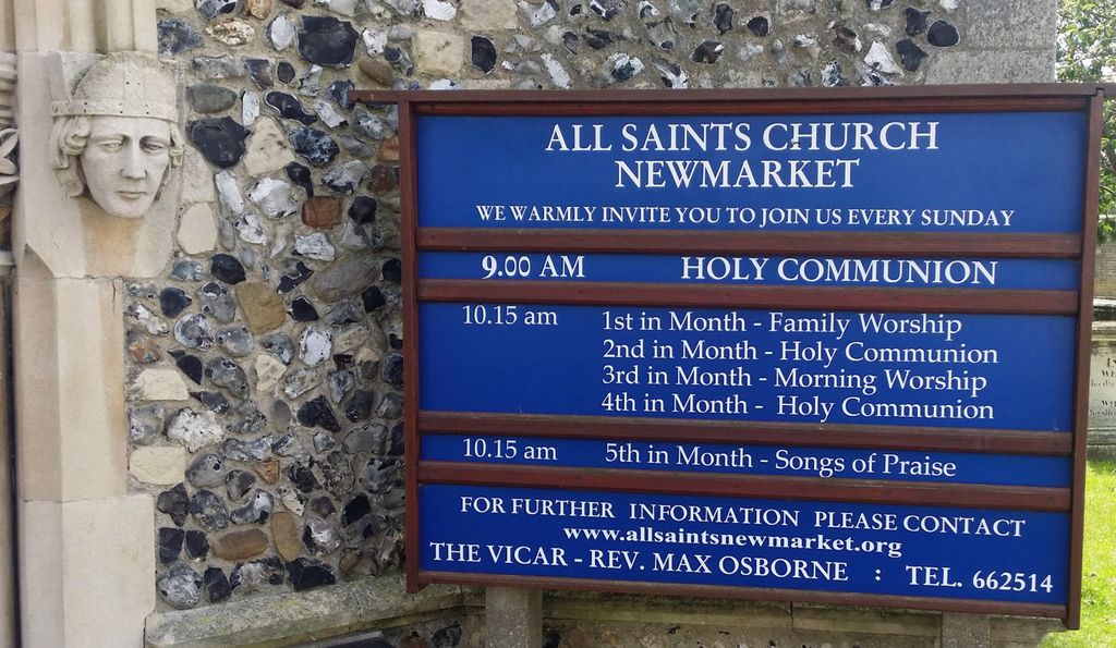
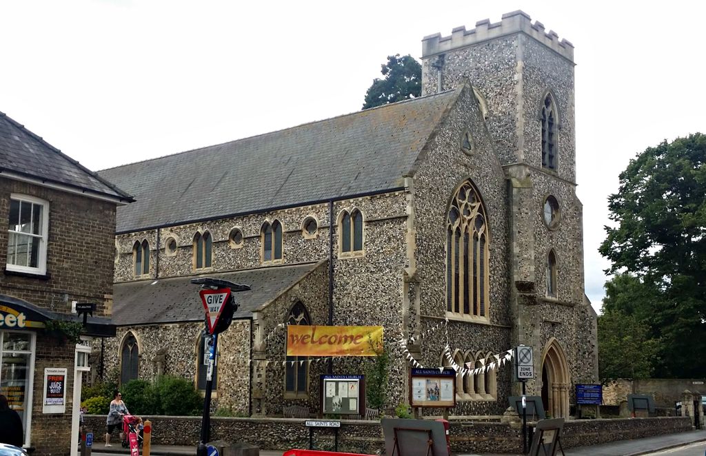
| Description | : | The Church of ALL SAINTS 1877-1977. The land on which All Saints is built was first used for worship from around the 13th century, but to understand the origin of All Saints, the origins of Newmarket and St Mary’s must be understood. At the end of 12th century Newmarket began its life as a market town after a “shrewd Lord of the Manor” saw the area was ideally placed on the main road from London to Norwich being more or less equally distant from Cambridge, Ely, Bury St Edmunds, and Mildenhall. Newmarket was originally carved out of the parishes of Exning and Woodditton. Around... Read More |
frequently asked questions (FAQ):
-
Where is All Saints Churchyard?
All Saints Churchyard is located at All Saints Rd Newmarket, Forest Heath District ,Suffolk , CB8 8ESEngland.
-
All Saints Churchyard cemetery's updated grave count on graveviews.com?
0 memorials
-
Where are the coordinates of the All Saints Churchyard?
Latitude: 52.2430900
Longitude: 0.4071700
Nearby Cemetories:
1. National Horseracing Museum
Newmarket, Forest Heath District, England
Coordinate: 52.2436200, 0.4074990
2. St. Mary's Churchyard
Newmarket, Forest Heath District, England
Coordinate: 52.2445260, 0.4026590
3. Newmarket Town Cemetery
Newmarket, Forest Heath District, England
Coordinate: 52.2405780, 0.3976210
4. Exning Cemetery
Newmarket, Forest Heath District, England
Coordinate: 52.2622310, 0.3814570
5. Dalham Hall Stud
Newmarket, Forest Heath District, England
Coordinate: 52.2242200, 0.4349510
6. Beech House Stud
Newmarket, Forest Heath District, England
Coordinate: 52.2318930, 0.4475510
7. St Martin Churchyard
Exning, Forest Heath District, England
Coordinate: 52.2639000, 0.3745000
8. Exning New Cemetery
Exning, Forest Heath District, England
Coordinate: 52.2600090, 0.3665360
9. National Stud Equine Cemetery
Newmarket, Forest Heath District, England
Coordinate: 52.2272000, 0.3644800
10. St. Peter Churchyard
Snailwell, East Cambridgeshire District, England
Coordinate: 52.2815100, 0.4059500
11. Wood Ditton Cemetery
Woodditton, East Cambridgeshire District, England
Coordinate: 52.2056250, 0.4273720
12. St Mary Churchyard
Cheveley, East Cambridgeshire District, England
Coordinate: 52.2199960, 0.4648940
13. St Nicholas Churchyard
Landwade, Forest Heath District, England
Coordinate: 52.2870860, 0.3784460
14. St. Peter's Churchyard
Moulton, Forest Heath District, England
Coordinate: 52.2492360, 0.4879740
15. Banstead Manor Stud Equine Cemetery
Cheveley, East Cambridgeshire District, England
Coordinate: 52.2114800, 0.4719900
16. St. Mary the Virgin Churchyard
Dullingham, East Cambridgeshire District, England
Coordinate: 52.1934500, 0.3850600
17. St Mary Churchyard
Ashley, East Cambridgeshire District, England
Coordinate: 52.2270430, 0.4876430
18. St Mary the Virgin Churchyard
Burwell, East Cambridgeshire District, England
Coordinate: 52.2697130, 0.3280880
19. St. Mary's Churchyard
Lakenheath, Forest Heath District, England
Coordinate: 52.2457189, 0.3143020
20. Burwell Cemetery
Burwell, East Cambridgeshire District, England
Coordinate: 52.2802890, 0.3337960
21. St Margaret Churchyard
Chippenham, East Cambridgeshire District, England
Coordinate: 52.3010950, 0.4381590
22. All Saints Churchyard
Kirtling, East Cambridgeshire District, England
Coordinate: 52.1909900, 0.4663280
23. St. Mary Churchyard
Kentford, Forest Heath District, England
Coordinate: 52.2726600, 0.4997800
24. Burwell Baptist Churchyard
Burwell, East Cambridgeshire District, England
Coordinate: 52.2852900, 0.3255400