
| Memorials | : | 0 |
| Location | : | Ashley, East Cambridgeshire District, England |
| Coordinate | : | 52.2270430, 0.4876430 |
| Description | : | Ashley is a small picturesque and historical village. Its name means ‘clearing in the meadow’. Ashley is a village and civil parish in the East Cambridgeshire district of Cambridgeshire, England, about 4 miles east of Newmarket. The modern village consists of the two ancient parishes of Ashley and Silverley. Ashley and Silverley were both mentioned in the Domesday Book. In the 13th century, the manors of both Ashley and Silverley were owned by the Knights Hospitallers of Chippenham. Silverley was the larger of the two villages and so the villages at that time were known as Silverley cum Ashley. However,... Read More |
frequently asked questions (FAQ):
-
Where is St Mary Churchyard?
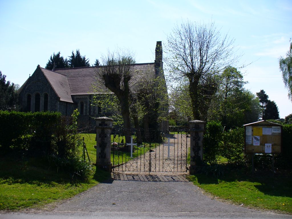
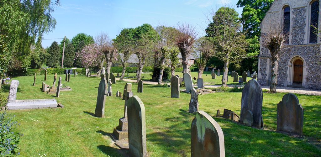
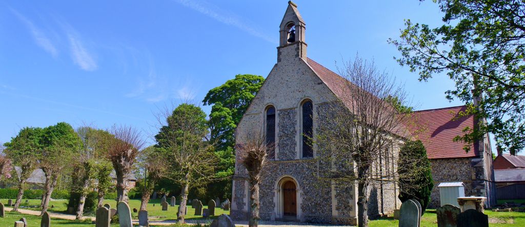
St Mary Churchyard is located at Church Street Ashley, East Cambridgeshire District ,Cambridgeshire , CB8 9EEEngland.
-
St Mary Churchyard cemetery's updated grave count on graveviews.com?
0 memorials
-
Where are the coordinates of the St Mary Churchyard?
Latitude: 52.2270430
Longitude: 0.4876430
Nearby Cemetories:
1. St Mary Churchyard
Cheveley, East Cambridgeshire District, England
Coordinate: 52.2199960, 0.4648940
2. Banstead Manor Stud Equine Cemetery
Cheveley, East Cambridgeshire District, England
Coordinate: 52.2114800, 0.4719900
3. St. Peter's Churchyard
Moulton, Forest Heath District, England
Coordinate: 52.2492360, 0.4879740
4. Saint Mary Churchyard
Dalham, Forest Heath District, England
Coordinate: 52.2341640, 0.5236290
5. Dalham Cemetery
Dalham, Forest Heath District, England
Coordinate: 52.2340230, 0.5242530
6. Beech House Stud
Newmarket, Forest Heath District, England
Coordinate: 52.2318930, 0.4475510
7. All Saints Churchyard
Gazeley, Forest Heath District, England
Coordinate: 52.2479000, 0.5182000
8. Dalham Hall Stud
Newmarket, Forest Heath District, England
Coordinate: 52.2242200, 0.4349510
9. St Mary Churchyard
Lidgate, St Edmundsbury Borough, England
Coordinate: 52.1944600, 0.5160100
10. St Peter's Churchyard
Ousden, St Edmundsbury Borough, England
Coordinate: 52.2074469, 0.5393223
11. All Saints Churchyard
Kirtling, East Cambridgeshire District, England
Coordinate: 52.1909900, 0.4663280
12. Wood Ditton Cemetery
Woodditton, East Cambridgeshire District, England
Coordinate: 52.2056250, 0.4273720
13. St. Mary Churchyard
Kentford, Forest Heath District, England
Coordinate: 52.2726600, 0.4997800
14. St Barnabas Churchyard
Ousden, St Edmundsbury Borough, England
Coordinate: 52.2040730, 0.5538260
15. St Mary's Churchyard
Denham, Mid Suffolk District, England
Coordinate: 52.2266100, 0.5693100
16. National Horseracing Museum
Newmarket, Forest Heath District, England
Coordinate: 52.2436200, 0.4074990
17. All Saints Churchyard
Newmarket, Forest Heath District, England
Coordinate: 52.2430900, 0.4071700
18. St. Stephen Churchyard
Higham, Forest Heath District, England
Coordinate: 52.2606300, 0.5575500
19. St. Mary's Churchyard
Newmarket, Forest Heath District, England
Coordinate: 52.2445260, 0.4026590
20. Newmarket Town Cemetery
Newmarket, Forest Heath District, England
Coordinate: 52.2405780, 0.3976210
21. St. Nicholas Churchyard
Kennett, East Cambridgeshire District, England
Coordinate: 52.2870190, 0.4904830
22. St Edmund's Churchyard
Hargrave, St Edmundsbury Borough, England
Coordinate: 52.2174280, 0.5851170
23. All Saints Churchyard
Barrow, St Edmundsbury Borough, England
Coordinate: 52.2515891, 0.5786771
24. Barrow Cemetery
Barrow, St Edmundsbury Borough, England
Coordinate: 52.2514210, 0.5813940