
| Memorials | : | 27 |
| Location | : | Vulcan, Strathmore Census Division, Canada |
| Coordinate | : | 50.1652820, -113.2450470 |
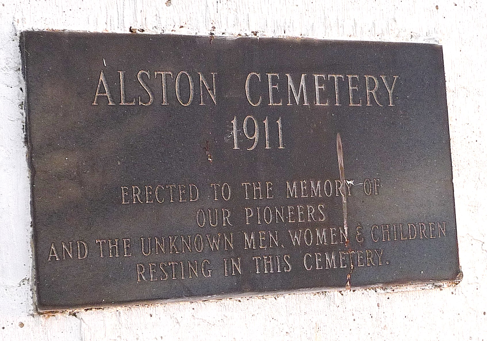
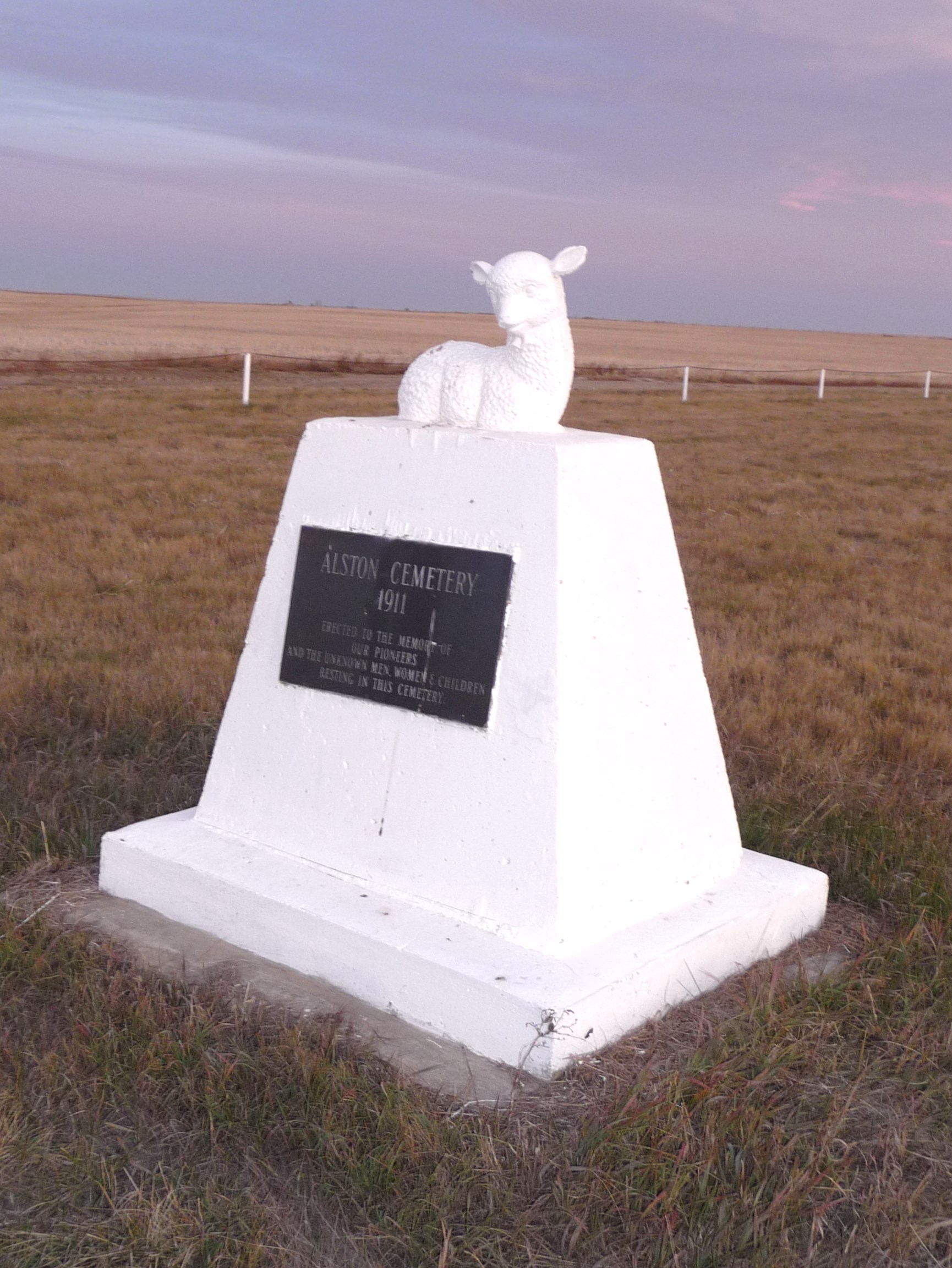
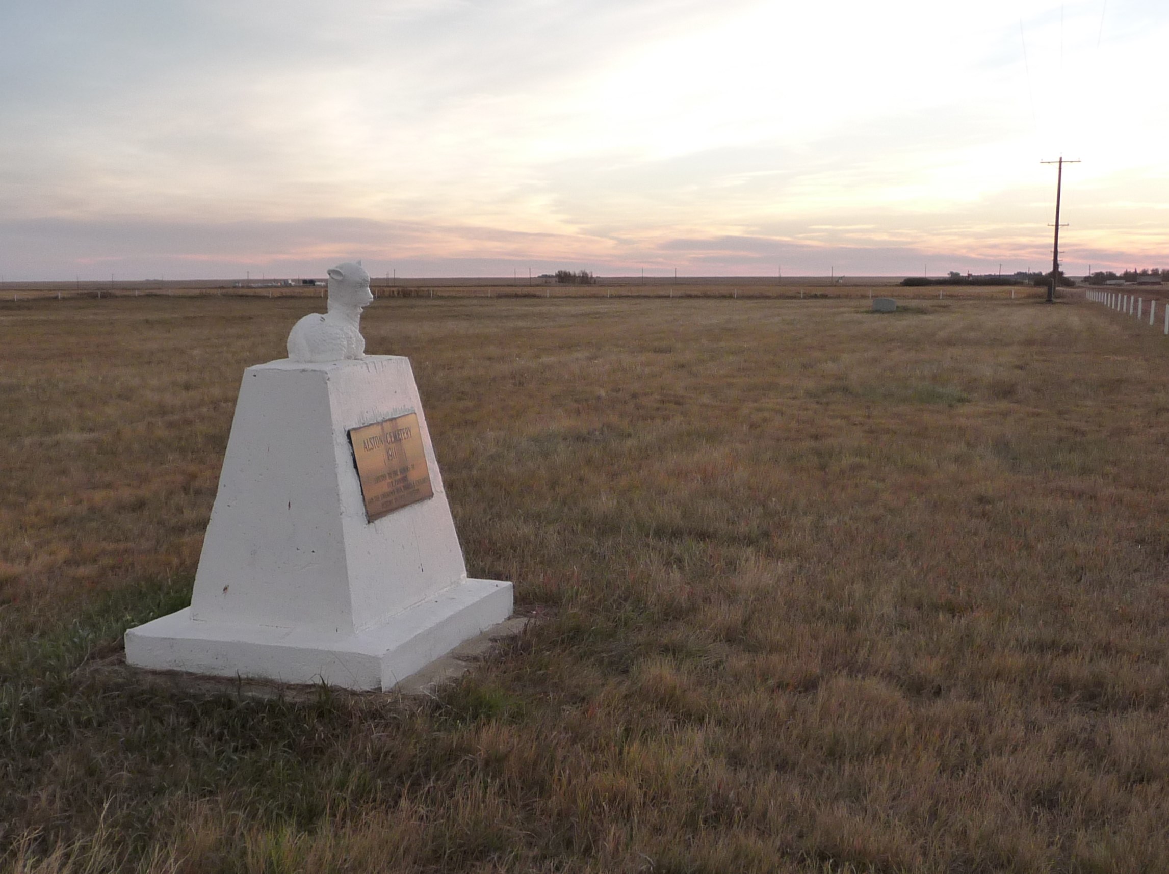
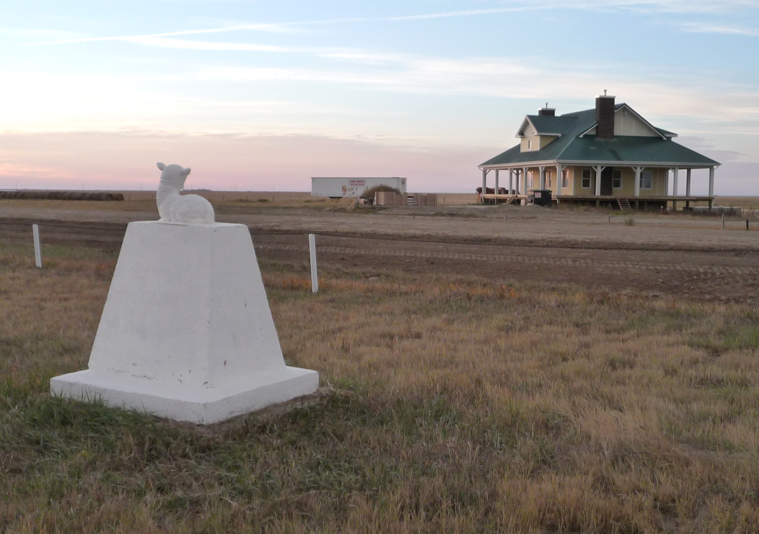
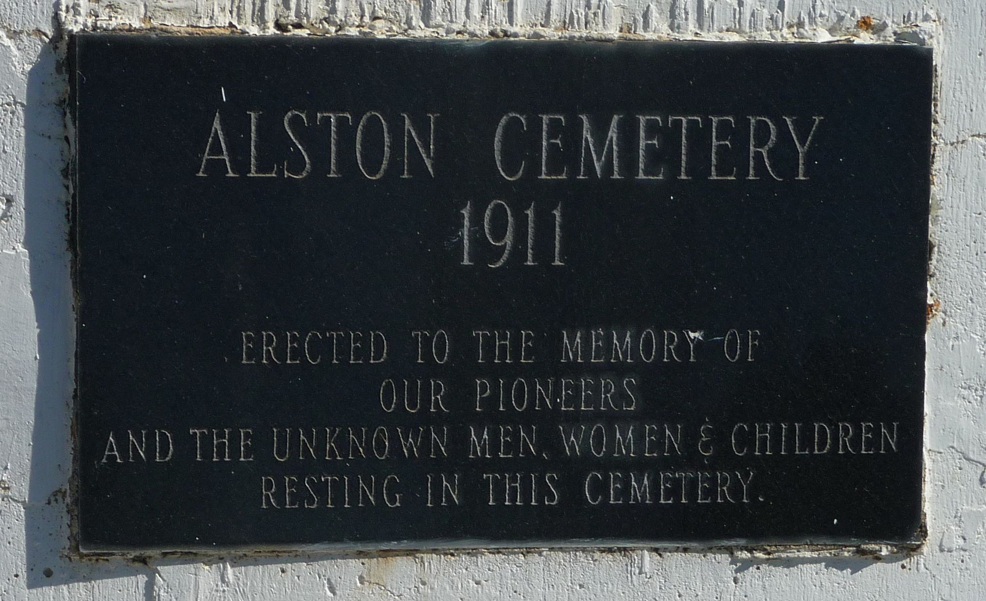
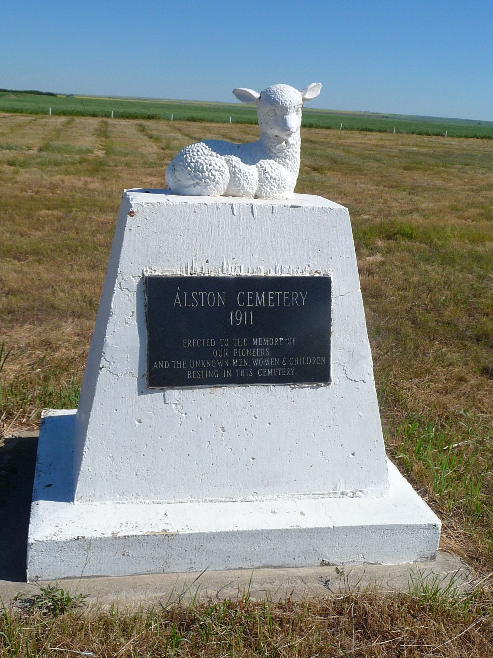
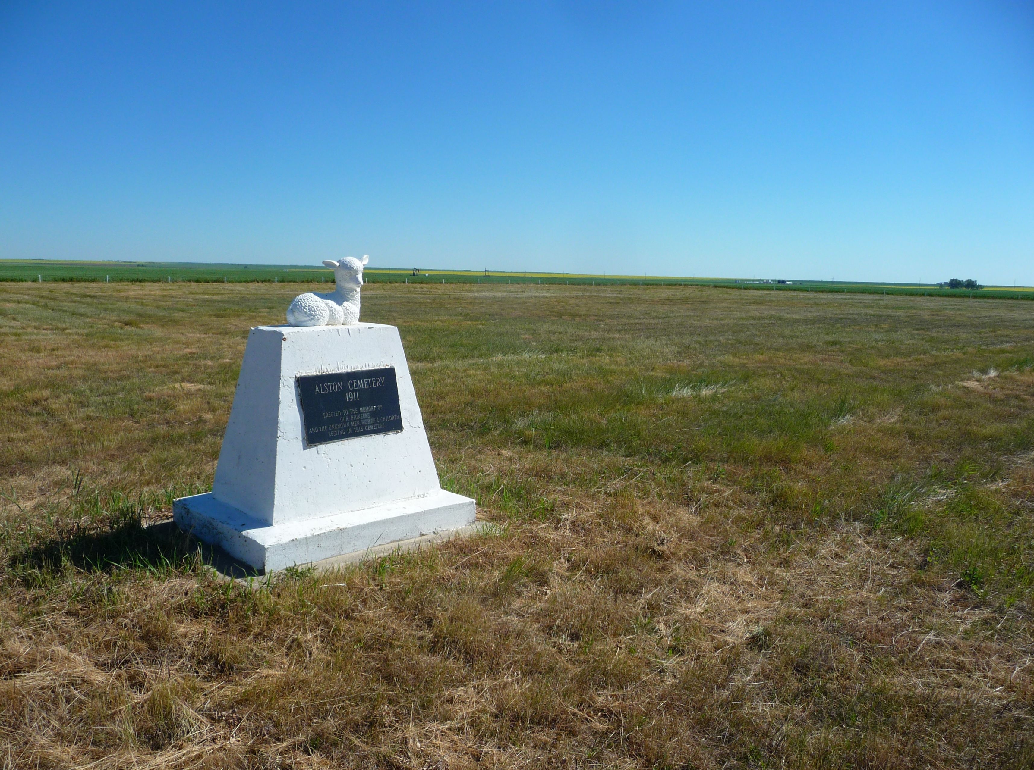
| Description | : | Alston Cemetery The cemetery is located on S.W. 29-15-25. When the cemetery plot was purchased, in order to get the title to the piece of land, someone had to be listed as owners, so it was registered in the names: Eliza Mallory, Emma Jane Hennon - wife of Norman Hennon, Annie Elizabeth Patton - wife of John Patton, and Elizabeth Annie Zang - wife of Julius Zang. On the back of the title are written the words: All of Lawrence, Alberta, as joint tenants. Buried there: Mr. and Mrs. Julius Zang, Mrs. Patton, Mrs. Hennon, Donald Kelvin Carnegie, Mrs. Voisey (mother of... Read More |
frequently asked questions (FAQ):
-
Where is Alston Cemetery?
Alston Cemetery is located at County of Vulcan Vulcan, Strathmore Census Division ,Alberta ,Canada.
-
Alston Cemetery cemetery's updated grave count on graveviews.com?
27 memorials
-
Where are the coordinates of the Alston Cemetery?
Latitude: 50.1652820
Longitude: -113.2450470
Nearby Cemetories:
1. Isol Russell Grave
Champion, Strathmore Census Division, Canada
Coordinate: 50.1792300, -113.2102100
2. Fath Hill Catholic Cemetery
Champion, Strathmore Census Division, Canada
Coordinate: 50.2153400, -113.2544200
3. Carmangay Cemetery
Carmangay, Strathmore Census Division, Canada
Coordinate: 50.1214300, -113.1434300
4. Little Bow Hutterite Cemetery
Stavely, Claresholm Census Division, Canada
Coordinate: 50.2142141, -113.3694417
5. Champion Cemetery
Champion, Strathmore Census Division, Canada
Coordinate: 50.2329200, -113.1441800
6. Cleverville Cemetery
Champion, Strathmore Census Division, Canada
Coordinate: 50.2736100, -113.1661700
7. Elinor Cemetery
Barons, Lethbridge Census Division, Canada
Coordinate: 50.0271520, -113.2340240
8. Carmangay Hutterite Cemetery
Carmangay, Strathmore Census Division, Canada
Coordinate: 50.0841743, -113.0067984
9. Saint Peter's Lutheran Cemetery
Claresholm, Claresholm Census Division, Canada
Coordinate: 50.0487620, -113.4822460
10. Five Mile Cemetery
Claresholm, Claresholm Census Division, Canada
Coordinate: 50.0188250, -113.4705730
11. Barons Cemetery
Barons, Lethbridge Census Division, Canada
Coordinate: 49.9756500, -113.0993100
12. Shadow Ranch Hutterite Cemetery
Champion, Strathmore Census Division, Canada
Coordinate: 50.1820466, -112.8929664
13. Keho Lake Hutterite Cemetery
Barons, Lethbridge Census Division, Canada
Coordinate: 49.9891594, -113.0160634
14. Vulcan Cemetery
Vulcan, Strathmore Census Division, Canada
Coordinate: 50.4032200, -113.2774100
15. White Lake Hutterite Cemetery
Nobleford, Lethbridge Census Division, Canada
Coordinate: 49.9154153, -113.2084160
16. Bowville Cemetery
Carmangay, Strathmore Census Division, Canada
Coordinate: 50.0847700, -112.8720800
17. Saint Vincent Roman Catholic Cemetery
Stavely, Claresholm Census Division, Canada
Coordinate: 50.1717670, -113.6409830
18. White Lake Cemetery
Nobleford, Lethbridge Census Division, Canada
Coordinate: 49.9018700, -113.2107750
19. Stavely Cemetery
Stavely, Claresholm Census Division, Canada
Coordinate: 50.1646700, -113.6625600
20. Stavely Cemetery Cremation Cairn
Stavely, Claresholm Census Division, Canada
Coordinate: 50.1646700, -113.6625600
21. Reid Hill Cemetery
Vulcan, Strathmore Census Division, Canada
Coordinate: 50.3974000, -113.0295500
22. Claresholm Cemetery
Claresholm, Claresholm Census Division, Canada
Coordinate: 50.0114784, -113.5946503
23. Albion Ridge Cemetery
Barons, Lethbridge Census Division, Canada
Coordinate: 49.9598350, -112.9169650
24. Granum Christian Reformed Church Cemetery
Granum, Claresholm Census Division, Canada
Coordinate: 49.8622100, -113.3436600