
| Memorials | : | 47 |
| Location | : | Vulcan, Strathmore Census Division, Canada |
| Coordinate | : | 50.3974000, -113.0295500 |
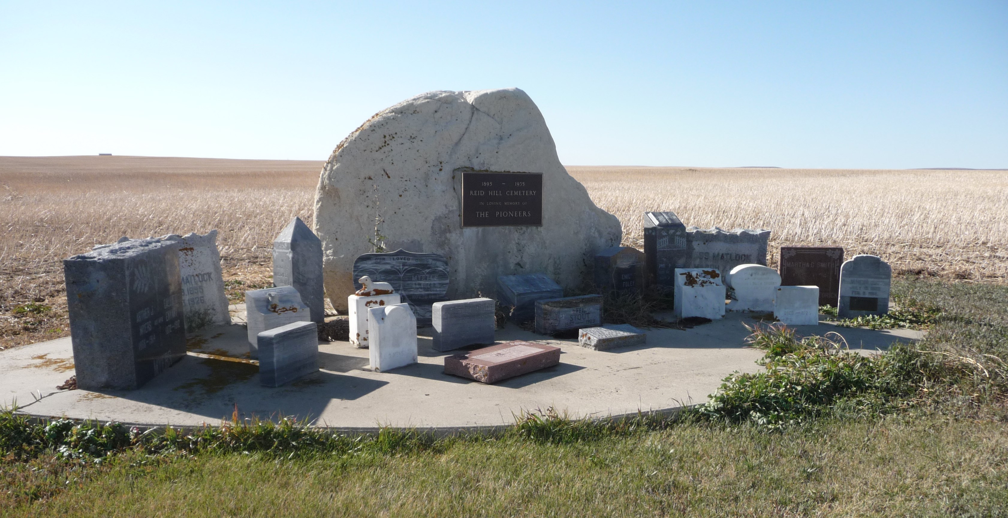
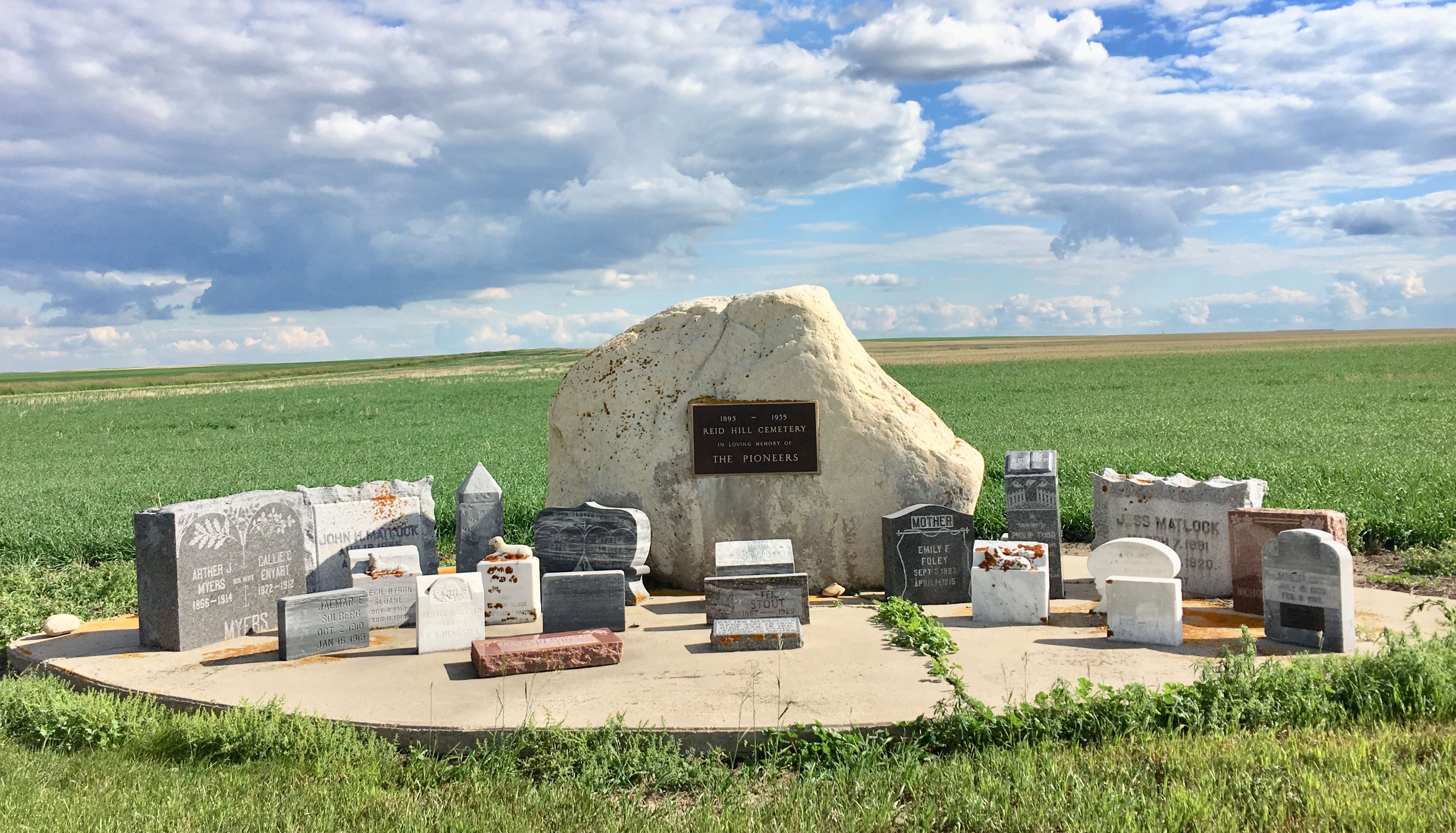
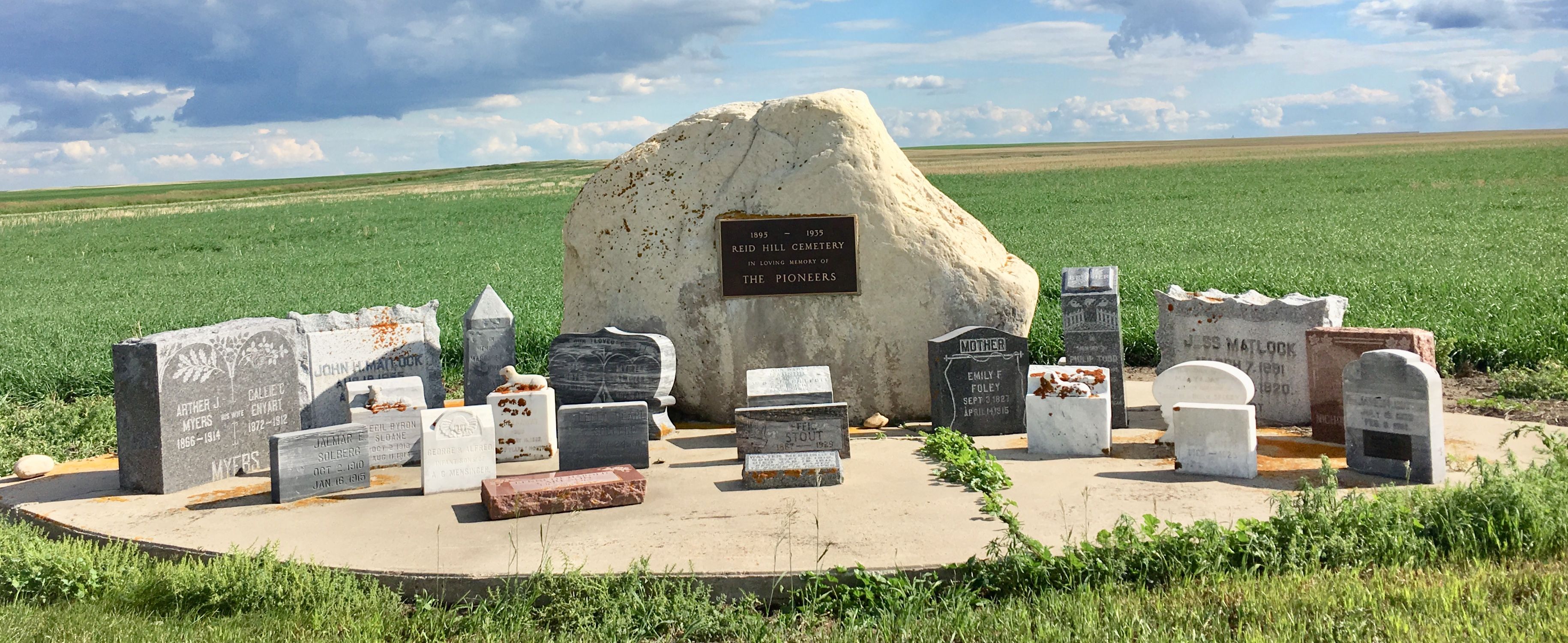
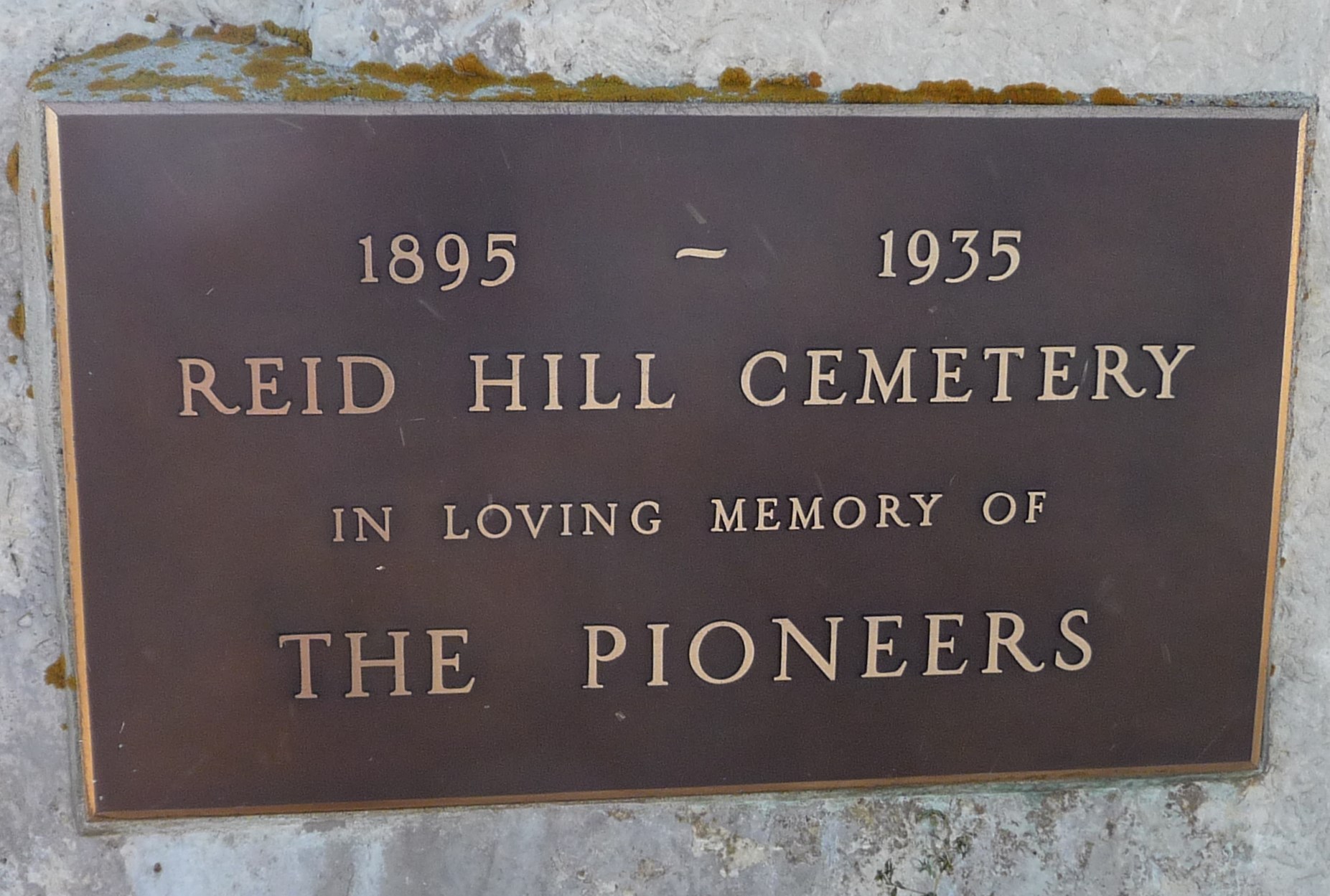
| Description | : | Reid Hill Cemetery is located approximately 11 kilometers east of Vulcan on Road #534 at the corner of Range Road #230. Across from the Reid Hill Hall, on the south side of the road, are the headstones from the Reid Hill Cemetery, where people were interred between 1895 and 1935. Due to neglect, of the original two-acre cemetery became choked with weeds. Mae L. Todd secured a grant from the province to improve the site and she contacted families to get their permission to move the headstones. Unfortunately, most of the graves were unmarked and the few remaining stones are... Read More |
frequently asked questions (FAQ):
-
Where is Reid Hill Cemetery?
Reid Hill Cemetery is located at Vulcan, Strathmore Census Division ,Alberta ,Canada.
-
Reid Hill Cemetery cemetery's updated grave count on graveviews.com?
47 memorials
-
Where are the coordinates of the Reid Hill Cemetery?
Latitude: 50.3974000
Longitude: -113.0295500
Nearby Cemetories:
1. Cleverville Cemetery
Champion, Strathmore Census Division, Canada
Coordinate: 50.2736100, -113.1661700
2. Vulcan Cemetery
Vulcan, Strathmore Census Division, Canada
Coordinate: 50.4032200, -113.2774100
3. Highland Cemetery
Vulcan, Strathmore Census Division, Canada
Coordinate: 50.4845700, -113.2659100
4. Champion Cemetery
Champion, Strathmore Census Division, Canada
Coordinate: 50.2329200, -113.1441800
5. Krasivaya Dolina Cemetery
Queenstown, Strathmore Census Division, Canada
Coordinate: 50.5908100, -112.9593600
6. Hope Lutheran Cemetery
Milo, Strathmore Census Division, Canada
Coordinate: 50.6013300, -112.9238900
7. O Perfect Peace Cemetery
Milo, Strathmore Census Division, Canada
Coordinate: 50.5863570, -112.8218440
8. Fath Hill Catholic Cemetery
Champion, Strathmore Census Division, Canada
Coordinate: 50.2153400, -113.2544200
9. Shadow Ranch Hutterite Cemetery
Champion, Strathmore Census Division, Canada
Coordinate: 50.1820466, -112.8929664
10. Lomond Cemetery
Lomond, Strathmore Census Division, Canada
Coordinate: 50.3607300, -112.6614300
11. Isol Russell Grave
Champion, Strathmore Census Division, Canada
Coordinate: 50.1792300, -113.2102100
12. Alston Cemetery
Vulcan, Strathmore Census Division, Canada
Coordinate: 50.1652820, -113.2450470
13. Little Bow Hutterite Cemetery
Stavely, Claresholm Census Division, Canada
Coordinate: 50.2142141, -113.3694417
14. Carmangay Cemetery
Carmangay, Strathmore Census Division, Canada
Coordinate: 50.1214300, -113.1434300
15. Carmangay Hutterite Cemetery
Carmangay, Strathmore Census Division, Canada
Coordinate: 50.0841743, -113.0067984
16. Brant Cemetery
Brant, Strathmore Census Division, Canada
Coordinate: 50.5067400, -113.5068000
17. Bowville Cemetery
Carmangay, Strathmore Census Division, Canada
Coordinate: 50.0847700, -112.8720800
18. Arrowwood Cemetery
Arrowwood, Strathmore Census Division, Canada
Coordinate: 50.7211418, -113.1209030
19. Christian Community of Universal Brotherhood
Arrowwood, Strathmore Census Division, Canada
Coordinate: 50.7277500, -113.0288800
20. Travers Cemetery
Lomond, Strathmore Census Division, Canada
Coordinate: 50.2757784, -112.5479619
21. Travers Cemetery
Travers, Strathmore Census Division, Canada
Coordinate: 50.2641454, -112.5482600
22. Arrowwood Hutterite Cemetery
Herronton, Strathmore Census Division, Canada
Coordinate: 50.6368299, -113.4157544
23. Sharon Cemetery
Brant, Strathmore Census Division, Canada
Coordinate: 50.4555300, -113.5740800
24. Lomond Hutterite Cemetery
Lomond, Strathmore Census Division, Canada
Coordinate: 50.3399014, -112.4272615