
| Memorials | : | 0 |
| Location | : | Wando, Berkeley County, USA |
| Coordinate | : | 32.8728860, -79.8972400 |
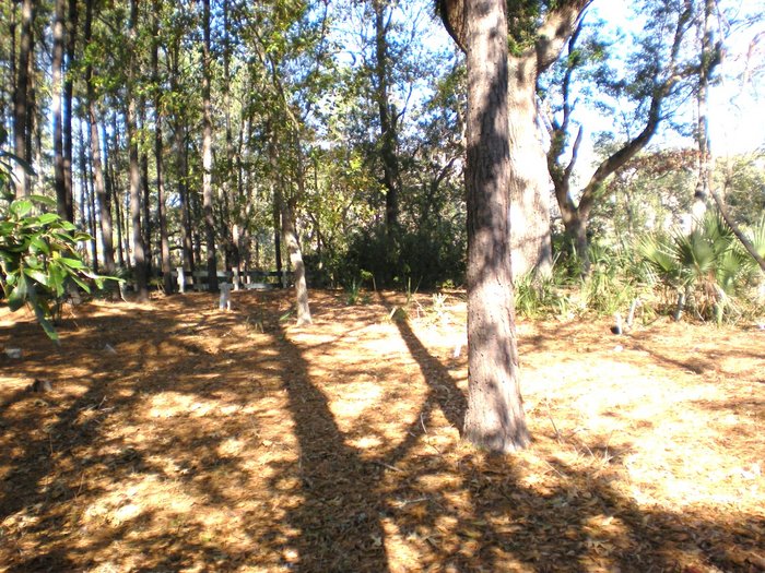
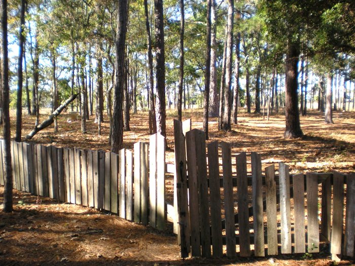
| Description | : | Cemetery is on Ralston Creek Street, on the Daniel Island Park side of the island. |
frequently asked questions (FAQ):
-
Where is Alston Cemetery?
Alston Cemetery is located at Wando, Berkeley County ,South Carolina ,USA.
-
Alston Cemetery cemetery's updated grave count on graveviews.com?
0 memorials
-
Where are the coordinates of the Alston Cemetery?
Latitude: 32.8728860
Longitude: -79.8972400

Nearby Cemetories:
1. Lesesne Family Cemetery
Wando, Berkeley County, USA
Coordinate: 32.8605500, -79.9000000
2. Nowell Creek
Charleston County, USA
Coordinate: 32.8755989, -79.8756027
3. Simmons Cemetery
Cainhoy, Berkeley County, USA
Coordinate: 32.8545889, -79.9061133
4. Intercession Reformed Episcopal Church Cemetery
Wando, Berkeley County, USA
Coordinate: 32.8766320, -79.9325970
5. Holy Rock Temple of God Holiness Church
Wando, Berkeley County, USA
Coordinate: 32.8941803, -79.9233322
6. New Mary Ann Missionary Baptist Church Cemetery
Berkeley County, USA
Coordinate: 32.8879471, -79.9296112
7. Campbell Cemetery
Berkeley County, USA
Coordinate: 32.9031280, -79.9242990
8. Saint John AME Church Cemetery
Wando, Berkeley County, USA
Coordinate: 32.9218930, -79.8988420
9. Pritchard Family Cemetery
Mount Pleasant, Charleston County, USA
Coordinate: 32.8224640, -79.8917770
10. I'on Cemetery
Hobcaw Point, Charleston County, USA
Coordinate: 32.8204780, -79.8838770
11. Scanlonville Cemetery
Mount Pleasant, Charleston County, USA
Coordinate: 32.8140700, -79.8981700
12. Saint Peters Catholic Church Cemetery
North Charleston, Charleston County, USA
Coordinate: 32.8484612, -79.9612656
13. Nelliefield Creek Cemetery
Berkeley County, USA
Coordinate: 32.9207993, -79.8553009
14. Long Point Missionary Baptist Church Cemetery
Mount Pleasant, Charleston County, USA
Coordinate: 32.8444670, -79.8350290
15. Mount Pleasant Memorial Gardens
Mount Pleasant, Charleston County, USA
Coordinate: 32.8209991, -79.8553848
16. Boone Hall Plantation
Charleston County, USA
Coordinate: 32.8555350, -79.8233930
17. Olive Branch AME Church Cemetery
Mount Pleasant, Charleston County, USA
Coordinate: 32.8263550, -79.8379974
18. Jerusalem Baptist Cemetery
North Charleston, Charleston County, USA
Coordinate: 32.8522758, -79.9758606
19. Monrovia Union Cemetery
Charleston, Charleston County, USA
Coordinate: 32.8213270, -79.9527970
20. Reserved Fellowship Cemetery
Charleston, Charleston County, USA
Coordinate: 32.8174150, -79.9476650
21. Magnolia Cemetery
Charleston, Charleston County, USA
Coordinate: 32.8164210, -79.9467160
22. Morris Brown A.M.E. Church Cemetery
Charleston, Charleston County, USA
Coordinate: 32.8174324, -79.9484787
23. Brith Sholom Congregation Cemetery 1856
Charleston, Charleston County, USA
Coordinate: 32.8169600, -79.9479400
24. Racker Hill Cemetery
North Charleston, Charleston County, USA
Coordinate: 32.8507710, -79.9767150