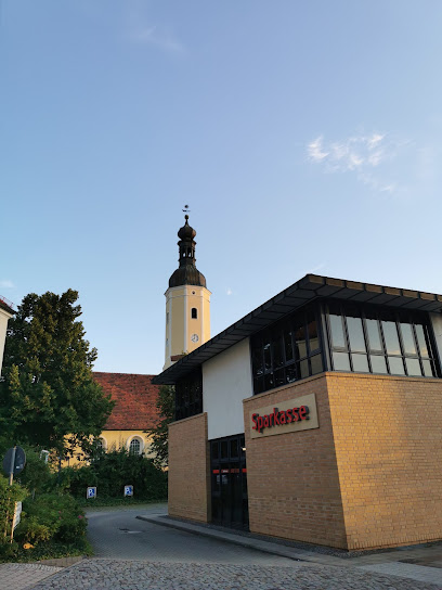
| Memorials | : | 0 |
| Location | : | Lauchhammer, Landkreis Oberspreewald-Lausitz, Germany |
| Coordinate | : | 51.4973637, 13.7616508 |
| Description | : | AKA Alter Bockwitzer Friedhof Lauchhammer (Lower Sorbian: Łuchow) is a town in the Oberspreewald-Lausitz district, in southern Brandenburg, Germany. It is situated on the "Schwarze Elster" river and has about 14,000 inhabitants. It was created in 1953 when several smaller communities combined to form this new city. Contact: Friedhofsverwaltung Lauchhammer (Friedhofsamt) Liebenwerdaer Str. 69 01979 Lauchhammer GERMANY Phone: (03574) 488 408 E-Mail: [email protected] The above cemetery administration of Lauchhammer manages the following cemeteries: ► Alter Friedhof Lauchhammer-Mitte (Alter Bockwitzer Friedhof) ► Zentralfriedhof Lauchhammer-Mitte ► Heidefriedhof Lauchhammer-West ► Friedhof Lauchhammer-Ost ► Friedhof Lauchhammer-Süd ► Friedhof Kleinleipisch ► Friedhof Grünewalde ► Friedhof Kostebrau This is the listing for the former cemetery of the village of Bockwitz, which in 1953 formed... Read More |
frequently asked questions (FAQ):
-
Where is Alter Friedhof Lauchhammer-Mitte?
Alter Friedhof Lauchhammer-Mitte is located at Friedhofgasse Lauchhammer, Landkreis Oberspreewald-Lausitz ,Brandenburg , 01979Germany.
-
Alter Friedhof Lauchhammer-Mitte cemetery's updated grave count on graveviews.com?
0 memorials
-
Where are the coordinates of the Alter Friedhof Lauchhammer-Mitte?
Latitude: 51.4973637
Longitude: 13.7616508
Nearby Cemetories:
1. Zentralfriedhof Lauchhammer-Mitte
Lauchhammer, Landkreis Oberspreewald-Lausitz, Germany
Coordinate: 51.5025403, 13.7628037
2. Friedhof Lauchhammer-Ost
Lauchhammer, Landkreis Oberspreewald-Lausitz, Germany
Coordinate: 51.5002611, 13.7846875
3. Friedhof Kleinleipisch
Lauchhammer, Landkreis Oberspreewald-Lausitz, Germany
Coordinate: 51.5142802, 13.7557213
4. Heidefriedhof Lauchhammer-West
Lauchhammer, Landkreis Oberspreewald-Lausitz, Germany
Coordinate: 51.4782219, 13.7181368
5. Schwarzheide Concentration Camp
Schwarzheide, Landkreis Oberspreewald-Lausitz, Germany
Coordinate: 51.4830560, 13.8666670
6. Friedhof Sallgast
Sallgast, Landkreis Elbe-Elster, Germany
Coordinate: 51.5930372, 13.8433619
7. Bergfriedhof, Elsterwerda
Elsterwerda, Landkreis Elbe-Elster, Germany
Coordinate: 51.4675525, 13.5340305
8. Friedhof Fnsterwalde
Finsterwalde, Landkreis Elbe-Elster, Germany
Coordinate: 51.6407129, 13.7055179
9. Kloster Dobrilugk
Landkreis Elbe-Elster, Germany
Coordinate: 51.6110640, 13.5453890
10. Friedhof Kirchhain
Kirchhain, Landkreis Elbe-Elster, Germany
Coordinate: 51.6406880, 13.5599880
11. Friedhof Bronkow
Bronkow, Landkreis Oberspreewald-Lausitz, Germany
Coordinate: 51.6726649, 13.9148347
12. Friedhof Wainsdorfer Straße
Gröditz, Landkreis Meißen, Germany
Coordinate: 51.4151770, 13.4596360
13. Gröditz Sub-Camp
Gröditz, Landkreis Meißen, Germany
Coordinate: 51.4069240, 13.4438500
14. Jüdischer Friedhof Tröbitz
Tröbitz, Landkreis Elbe-Elster, Germany
Coordinate: 51.5936720, 13.4233600
15. Stadtfriedhof
Bad Liebenwerda, Landkreis Elbe-Elster, Germany
Coordinate: 51.5188038, 13.3858724
16. Friedhof Großenhain
Landkreis Meißen, Germany
Coordinate: 51.2859350, 13.5302870
17. Friedhof Grossenhain
Grossenhain, Landkreis Meißen, Germany
Coordinate: 51.2849515, 13.5294924
18. Friedhof Reinersdorf
Reinersdorf, Landkreis Meißen, Germany
Coordinate: 51.2549157, 13.6193148
19. Friedhof Welzow
Welzow, Landkreis Spree-Neiße, Germany
Coordinate: 51.5866647, 14.1643826
20. Elsterheide-Nardt Friedhof
Nardt, Landkreis Bautzen, Germany
Coordinate: 51.4561111, 14.1917222
21. Soldatenfriedhof Neuburxdorf
Bad Liebenwerda, Landkreis Elbe-Elster, Germany
Coordinate: 51.4658474, 13.3011657
22. Friedhof
Zschaiten, Landkreis Meißen, Germany
Coordinate: 51.2991721, 13.4087653
23. Glaubitz
Glaubitz, Landkreis Meißen, Germany
Coordinate: 51.3181763, 13.3801959
24. Urnenfriedhof
Nünchritz, Landkreis Meißen, Germany
Coordinate: 51.3081548, 13.3872660

