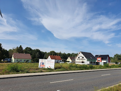
| Memorials | : | 0 |
| Location | : | Schwarzheide, Landkreis Oberspreewald-Lausitz, Germany |
| Coordinate | : | 51.4830560, 13.8666670 |
| Description | : | Located 50 km north of Dresden, Germany. Schwarzheide Concentration Camp was a sub-camp of Sachsenhausen. It was established in July, 1944 initially to house 1000 Jewish slave laborers who were to work in the Braunkohlen-Benzinwerkes (Brabag) nearby. Because this factory produced oil and diesel from lignite coal, it was deemed essential to the German war effort. It was bombed by the Allies on several occasions and in June, 1944 it was completely put out of action. Once the complex had resumed operation, plans were made to transfer inmates from Auschwitz, who had all lost their families in the aftermath... Read More |
frequently asked questions (FAQ):
-
Where is Schwarzheide Concentration Camp?
Schwarzheide Concentration Camp is located at Schwarzheide, Landkreis Oberspreewald-Lausitz ,Brandenburg ,Germany.
-
Schwarzheide Concentration Camp cemetery's updated grave count on graveviews.com?
0 memorials
-
Where are the coordinates of the Schwarzheide Concentration Camp?
Latitude: 51.4830560
Longitude: 13.8666670
Nearby Cemetories:
1. Friedhof Lauchhammer-Ost
Lauchhammer, Landkreis Oberspreewald-Lausitz, Germany
Coordinate: 51.5002611, 13.7846875
2. Alter Friedhof Lauchhammer-Mitte
Lauchhammer, Landkreis Oberspreewald-Lausitz, Germany
Coordinate: 51.4973637, 13.7616508
3. Zentralfriedhof Lauchhammer-Mitte
Lauchhammer, Landkreis Oberspreewald-Lausitz, Germany
Coordinate: 51.5025403, 13.7628037
4. Friedhof Kleinleipisch
Lauchhammer, Landkreis Oberspreewald-Lausitz, Germany
Coordinate: 51.5142802, 13.7557213
5. Heidefriedhof Lauchhammer-West
Lauchhammer, Landkreis Oberspreewald-Lausitz, Germany
Coordinate: 51.4782219, 13.7181368
6. Friedhof Sallgast
Sallgast, Landkreis Elbe-Elster, Germany
Coordinate: 51.5930372, 13.8433619
7. Friedhof Fnsterwalde
Finsterwalde, Landkreis Elbe-Elster, Germany
Coordinate: 51.6407129, 13.7055179
8. Friedhof Bronkow
Bronkow, Landkreis Oberspreewald-Lausitz, Germany
Coordinate: 51.6726649, 13.9148347
9. Elsterheide-Nardt Friedhof
Nardt, Landkreis Bautzen, Germany
Coordinate: 51.4561111, 14.1917222
10. Bergfriedhof, Elsterwerda
Elsterwerda, Landkreis Elbe-Elster, Germany
Coordinate: 51.4675525, 13.5340305
11. Friedhof Welzow
Welzow, Landkreis Spree-Neiße, Germany
Coordinate: 51.5866647, 14.1643826
12. Kloster Dobrilugk
Landkreis Elbe-Elster, Germany
Coordinate: 51.6110640, 13.5453890
13. Friedhof Kirchhain
Kirchhain, Landkreis Elbe-Elster, Germany
Coordinate: 51.6406880, 13.5599880
14. Kriegsgräberstätte
Hoyerswerda, Landkreis Bautzen, Germany
Coordinate: 51.4377732, 14.2570215
15. St. Just Friedhof
Kamenz, Landkreis Bautzen, Germany
Coordinate: 51.2716472, 14.0888695
16. Katholische Pfarrkirche St. Mariä Himmelfahrt"
Wittichenau, Landkreis Bautzen, Germany
Coordinate: 51.3857402, 14.2447198
17. Waldfriedhof Hoyerswerda
Hoyerswerda, Landkreis Bautzen, Germany
Coordinate: 51.4417670, 14.2828800
18. Friedhof Wainsdorfer Straße
Gröditz, Landkreis Meißen, Germany
Coordinate: 51.4151770, 13.4596360
19. Gröditz Sub-Camp
Gröditz, Landkreis Meißen, Germany
Coordinate: 51.4069240, 13.4438500
20. Friedhof Oberlichtenau
Oberlichtenau, Landkreis Bautzen, Germany
Coordinate: 51.2196432, 13.9897039
21. Friedhof Reinersdorf
Reinersdorf, Landkreis Meißen, Germany
Coordinate: 51.2549157, 13.6193148
22. Friedhof Großenhain
Landkreis Meißen, Germany
Coordinate: 51.2859350, 13.5302870
23. Friedhof Grossenhain
Grossenhain, Landkreis Meißen, Germany
Coordinate: 51.2849515, 13.5294924
24. Friedhof Schwarze Pumpe
Spremberg, Landkreis Spree-Neiße, Germany
Coordinate: 51.5238342, 14.3264520

