
| Memorials | : | 0 |
| Location | : | Alvdal, Alvdal kommune, Norway |
| Coordinate | : | 62.1035700, 10.6335600 |
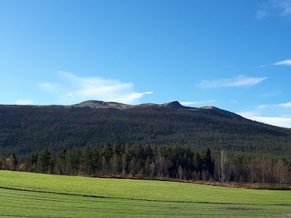
| Description | : | Alvdal Gamle Kirkegård (Alvdal old cemetery) is located on Randmælen farm close to the river Glomma. This is the first known location for a church in Alvdal. St. Nicolai Kirke (Church) was inaugurated in 1639, and is one of few churches build after the lutheran reformation that was given the name of a saint. This church was build because it was to far to Tylldalen, special for burials, since there were no roads for wagon. At this time a lot of churches was started to build, at it could be an affect of the visit of the king, Christian IVs... Read More |
frequently asked questions (FAQ):
-
Where is Alvdal Gamle Kirkegård?
Alvdal Gamle Kirkegård is located at Alvdal, Alvdal kommune ,Hedmark fylke ,Norway.
-
Alvdal Gamle Kirkegård cemetery's updated grave count on graveviews.com?
0 memorials
-
Where are the coordinates of the Alvdal Gamle Kirkegård?
Latitude: 62.1035700
Longitude: 10.6335600
Nearby Cemetories:
1. Alvdal Kirke
Alvdal, Alvdal kommune, Norway
Coordinate: 62.1094173, 10.6299431
2. Tylldalen
Tyldal, Tynset kommune, Norway
Coordinate: 62.1375980, 10.7949710
3. Brydalen Kirke
Tynset, Tynset kommune, Norway
Coordinate: 62.1878415, 10.9882493
4. Finstad Gravplass
Rendalen kommune, Norway
Coordinate: 62.1019500, 11.0336160
5. Tynset Cemetery
Tynset, Tynset kommune, Norway
Coordinate: 62.2851063, 10.7539129
6. Folldal Church Cemetery
Folldal, Folldal kommune, Norway
Coordinate: 62.1272260, 10.0378220
7. Hanestad Kirke
Rendalen kommune, Norway
Coordinate: 61.8392977, 10.8892410
8. Øvre Rendal
Rendalen kommune, Norway
Coordinate: 61.8894690, 11.0783840
9. Sollia kirke
Sollia, Stor-Elvdal kommune, Norway
Coordinate: 61.7804470, 10.4001850
10. Tolga Church
Tolga, Tolga kommune, Norway
Coordinate: 62.4152342, 10.9939295
11. Ytre Rendal Kirke
Otnes, Rendalen kommune, Norway
Coordinate: 61.7595301, 11.1808755
12. Narbuvollen
Os i Osterdalen, Os kommune, Norway
Coordinate: 62.3508810, 11.4674720
13. Dalsbygda Cemetery
Os i Osterdalen, Os kommune, Norway
Coordinate: 62.5257410, 11.1081510
14. Kvikne Church Cemetery
Kvikneplassen, Tynset kommune, Norway
Coordinate: 62.5837220, 10.2852500
15. Tufsingdalen Cemetery
Os kommune, Norway
Coordinate: 62.3034140, 11.7199100
16. Koppang Cemetery
Koppang, Stor-Elvdal kommune, Norway
Coordinate: 61.5762010, 11.0368200
17. Venabygd Churchyard
Venabygd, Ringebu kommune, Norway
Coordinate: 61.5928840, 10.0524460
18. Røros Lower Churchyard
Roros, Røros kommune, Norway
Coordinate: 62.5775860, 11.3876750
19. Røros Upper Churchyard
Roros, Røros kommune, Norway
Coordinate: 62.5791120, 11.3867950
20. Sel Kirke
Otta, Sel kommune, Norway
Coordinate: 61.8017900, 9.5524490
21. Stor Elvdal Kirke
Stor Elvdal, Stor-Elvdal kommune, Norway
Coordinate: 61.5238280, 11.0486066
22. Kvam Churchyard
Kvam, Nord-Fron kommune, Norway
Coordinate: 61.6654660, 9.6941910
23. Nord-Sel Churchyard
Sel kommune, Norway
Coordinate: 61.8496240, 9.4214310
24. Ringebu Cemetery
Ringebu, Ringebu kommune, Norway
Coordinate: 61.5090710, 10.1732530