
| Memorials | : | 0 |
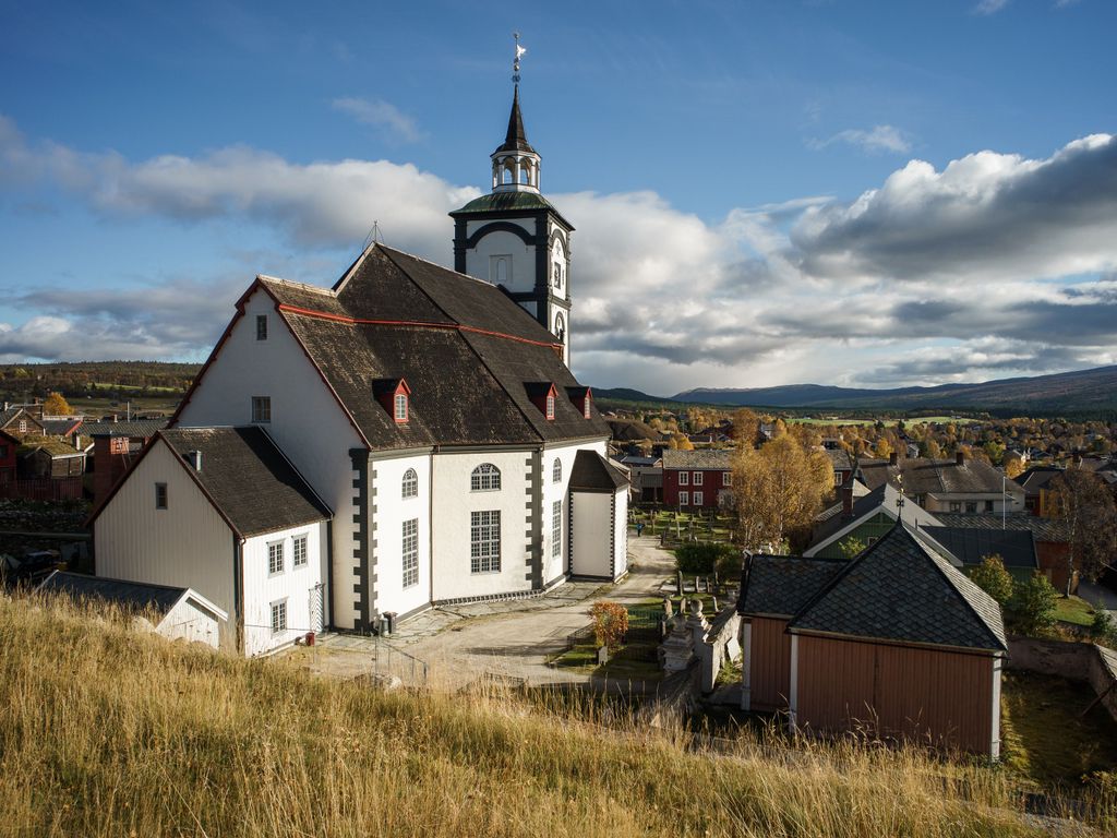
| Location | : | Roros, Røros kommune, Norway |
| Coordinate | : | 62.5775860, 11.3876750 |
| Description | : | The lower and older graveyard for predominantly prominent people, adjacent to the upper, separated by a steep slope. |
frequently asked questions (FAQ):
-
Where is Røros Lower Churchyard?
Røros Lower Churchyard is located at Roros, Røros kommune ,Sør-Trøndelag fylke ,Norway.
-
Røros Lower Churchyard cemetery's updated grave count on graveviews.com?
0 memorials
-
Where are the coordinates of the Røros Lower Churchyard?
Latitude: 62.5775860
Longitude: 11.3876750
Nearby Cemetories:
1. Røros Upper Churchyard
Roros, Røros kommune, Norway
Coordinate: 62.5791120, 11.3867950
2. Dalsbygda Cemetery
Os i Osterdalen, Os kommune, Norway
Coordinate: 62.5257410, 11.1081510
3. Narbuvollen
Os i Osterdalen, Os kommune, Norway
Coordinate: 62.3508810, 11.4674720
4. Brekken
Roros, Røros kommune, Norway
Coordinate: 62.6473560, 11.8726080
5. Tolga Church
Tolga, Tolga kommune, Norway
Coordinate: 62.4152342, 10.9939295
6. Aalen Cemetery
Ålen, Holtålen kommune, Norway
Coordinate: 62.8441360, 11.2845240
7. Tufsingdalen Cemetery
Os kommune, Norway
Coordinate: 62.3034140, 11.7199100
8. Tynset Cemetery
Tynset, Tynset kommune, Norway
Coordinate: 62.2851063, 10.7539129
9. Brydalen Kirke
Tynset, Tynset kommune, Norway
Coordinate: 62.1878415, 10.9882493
10. Singsaas Cemetery
Singsas, Midtre Gauldal kommune, Norway
Coordinate: 62.9418020, 10.6501640
11. Finstad Gravplass
Rendalen kommune, Norway
Coordinate: 62.1019500, 11.0336160
12. Kvikne Church Cemetery
Kvikneplassen, Tynset kommune, Norway
Coordinate: 62.5837220, 10.2852500
13. Tylldalen
Tyldal, Tynset kommune, Norway
Coordinate: 62.1375980, 10.7949710
14. Alvdal Kirke
Alvdal, Alvdal kommune, Norway
Coordinate: 62.1094173, 10.6299431
15. Alvdal Gamle Kirkegård
Alvdal, Alvdal kommune, Norway
Coordinate: 62.1035700, 10.6335600
16. Tännäs Church Cemetery
Tannas, Härjedalens kommun, Sweden
Coordinate: 62.4426030, 12.6796442
17. Innset
Innset, Rennebu kommune, Norway
Coordinate: 62.7203451, 10.0424773
18. Selbu Kirke Cemetery
Mebonden, Selbu kommune, Norway
Coordinate: 63.2167380, 11.0414680
19. Berkåk
Berkak, Rennebu kommune, Norway
Coordinate: 62.8304291, 10.0031652
20. Selbustrand
Selbu kommune, Norway
Coordinate: 63.2479063, 10.9502857
21. Øvre Rendal
Rendalen kommune, Norway
Coordinate: 61.8894690, 11.0783840
22. Drevsjø Kirkegaard
Drevsjo, Engerdal kommune, Norway
Coordinate: 61.8847220, 12.0297220
23. Horg
Horg, Melhus kommune, Norway
Coordinate: 63.1366860, 10.2550300
24. Folldal Church Cemetery
Folldal, Folldal kommune, Norway
Coordinate: 62.1272260, 10.0378220