
| Memorials | : | 528 |
| Location | : | Fulton County, USA |
| Coordinate | : | 41.6869957, -83.9121649 |
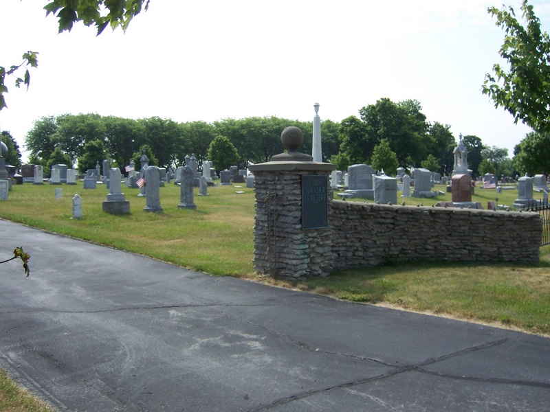
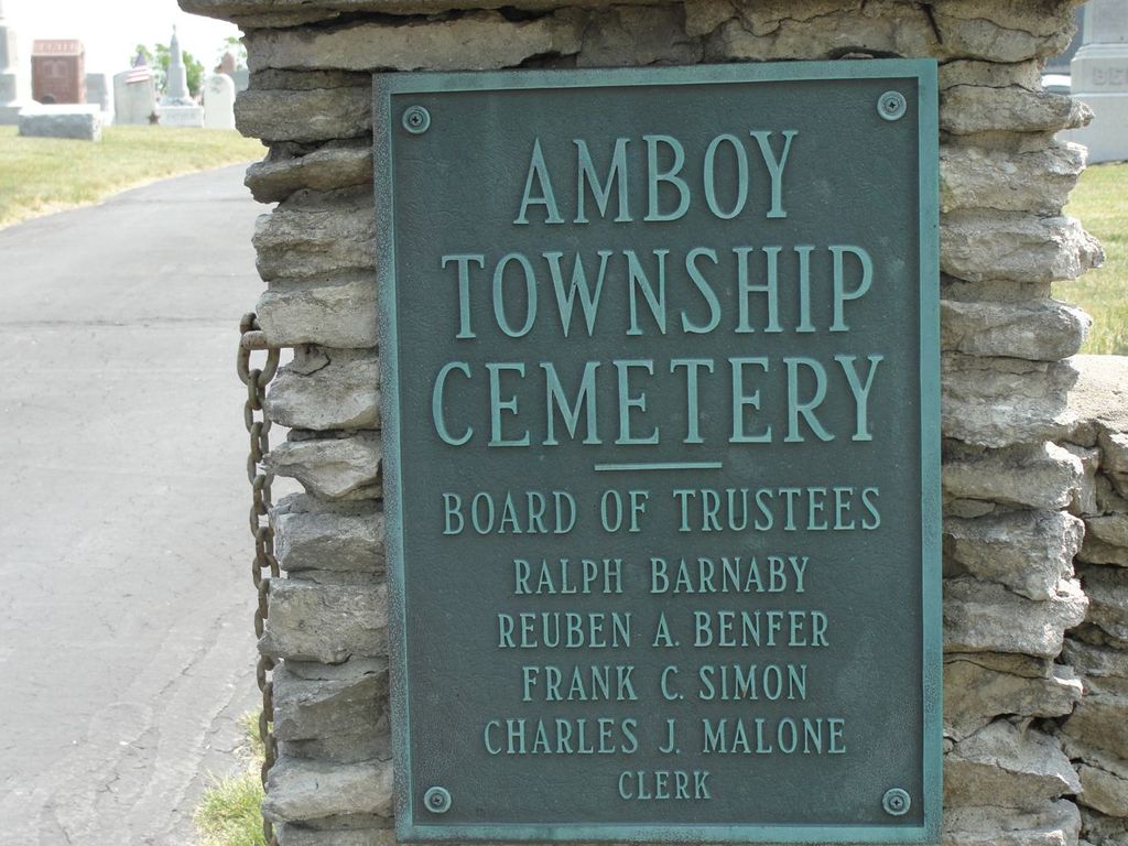
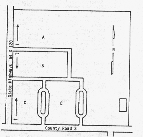
| Description | : | The Amboy Township Cemetery is located south of the village of Metamora at the northeast corner of the intersection of State Route 64 and County Road S. The cemetery occupies land purchased from the United States by James Hallet, Jr. in 1835. Burials commenced at an early date and one tombstone predates purchase and settlement of land in this area. In 1865 the Labounty Cemetery, as it was first known, was transferred to the Trustees, Amboy Township. Additional land was added in 1884 and 1909 with the grantors being J. Labounty, Jas. Robinson and Rodney Taylor. The cemetery contains about... Read More |
frequently asked questions (FAQ):
-
Where is Amboy Township Cemetery?
Amboy Township Cemetery is located at Ohio State Route 120 and County Road 2 Fulton County ,Ohio , 43540USA.
-
Amboy Township Cemetery cemetery's updated grave count on graveviews.com?
526 memorials
-
Where are the coordinates of the Amboy Township Cemetery?
Latitude: 41.6869957
Longitude: -83.9121649

Nearby Cemetories:
1. Saint Marys Catholic Cemetery
Assumption, Fulton County, USA
Coordinate: 41.6712400, -83.9120100
2. Dutch Ridge Cemetery
Fulton Township, Fulton County, USA
Coordinate: 41.6460991, -83.9558029
3. Peebles Cemetery
Lenawee Junction, Lenawee County, USA
Coordinate: 41.7296982, -83.9636002
4. Ai Cemetery
Ai, Fulton County, USA
Coordinate: 41.6283000, -83.9388100
5. Saint Elizabeth Cemetery
Berkey, Lucas County, USA
Coordinate: 41.6870000, -83.8243800
6. Ford Cemetery
Berkey, Lucas County, USA
Coordinate: 41.7150500, -83.8327200
7. Marygrove Cemetery
Raab Corners, Lucas County, USA
Coordinate: 41.6528300, -83.8174400
8. Luke Farm Cemetery
Ogden, Lenawee County, USA
Coordinate: 41.7571000, -83.9678200
9. Sharples Cemetery
Sharples, Lucas County, USA
Coordinate: 41.6286600, -83.8341100
10. Edgar Cemetery
Lyons, Fulton County, USA
Coordinate: 41.6739006, -84.0378036
11. Wolfinger Cemetery
Sylvania, Lucas County, USA
Coordinate: 41.6666985, -83.7853012
12. Saint Richards Cemetery
Swanton, Fulton County, USA
Coordinate: 41.5888000, -83.8972700
13. Fulton Union Cemetery
Delta, Fulton County, USA
Coordinate: 41.5936012, -83.9642029
14. Ridgeville Cemetery
Fairfield, Lenawee County, USA
Coordinate: 41.7566643, -84.0224991
15. East Swanton Cemetery
East Swanton, Lucas County, USA
Coordinate: 41.5850500, -83.8621600
16. Swanton Cemetery
Swanton, Fulton County, USA
Coordinate: 41.5777800, -83.8873400
17. Ogden Zion Cemetery
Blissfield, Lenawee County, USA
Coordinate: 41.8014710, -83.9267920
18. Our Lady of Fatima Cemetery
Lyons, Fulton County, USA
Coordinate: 41.6717300, -84.0678000
19. Lyons Cemetery
Lyons, Fulton County, USA
Coordinate: 41.6979180, -84.0768590
20. Aetna Cemetery
Winameg, Fulton County, USA
Coordinate: 41.6328011, -84.0631027
21. Lowe Cemetery
Jasper, Lenawee County, USA
Coordinate: 41.7779999, -84.0351105
22. Old Delta Cemetery
Delta, Fulton County, USA
Coordinate: 41.5811005, -84.0117035
23. Howard House Cemetery
Winameg, Fulton County, USA
Coordinate: 41.6214020, -84.0674230
24. Salsberry Cemetery
Delta, Fulton County, USA
Coordinate: 41.6013985, -84.0507965