
| Memorials | : | 0 |
| Location | : | Angelus, Chesterfield County, USA |
| Coordinate | : | 34.5971250, -80.3152350 |
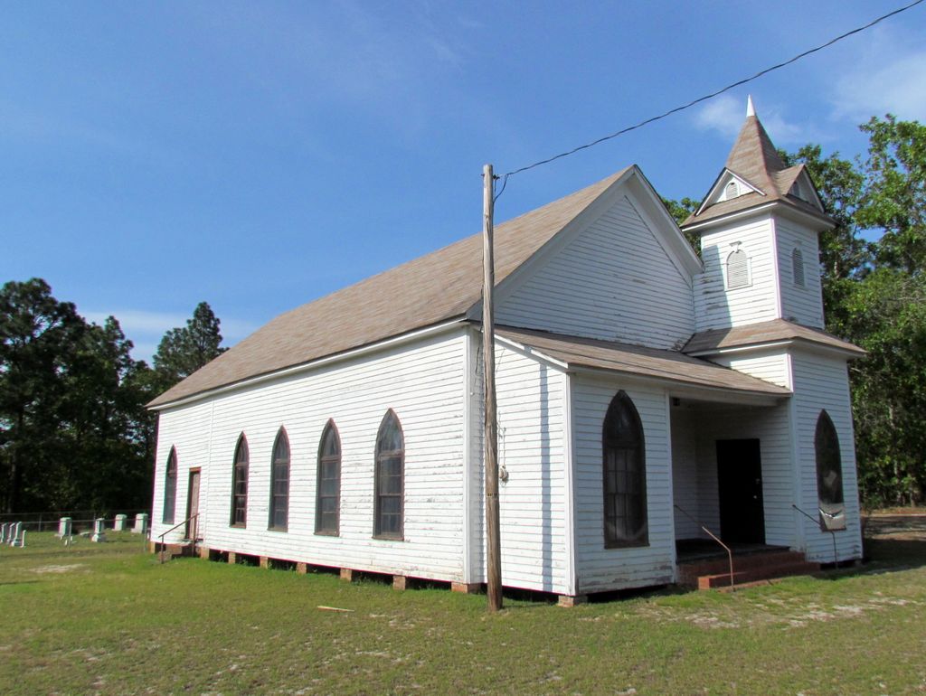
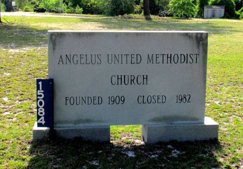
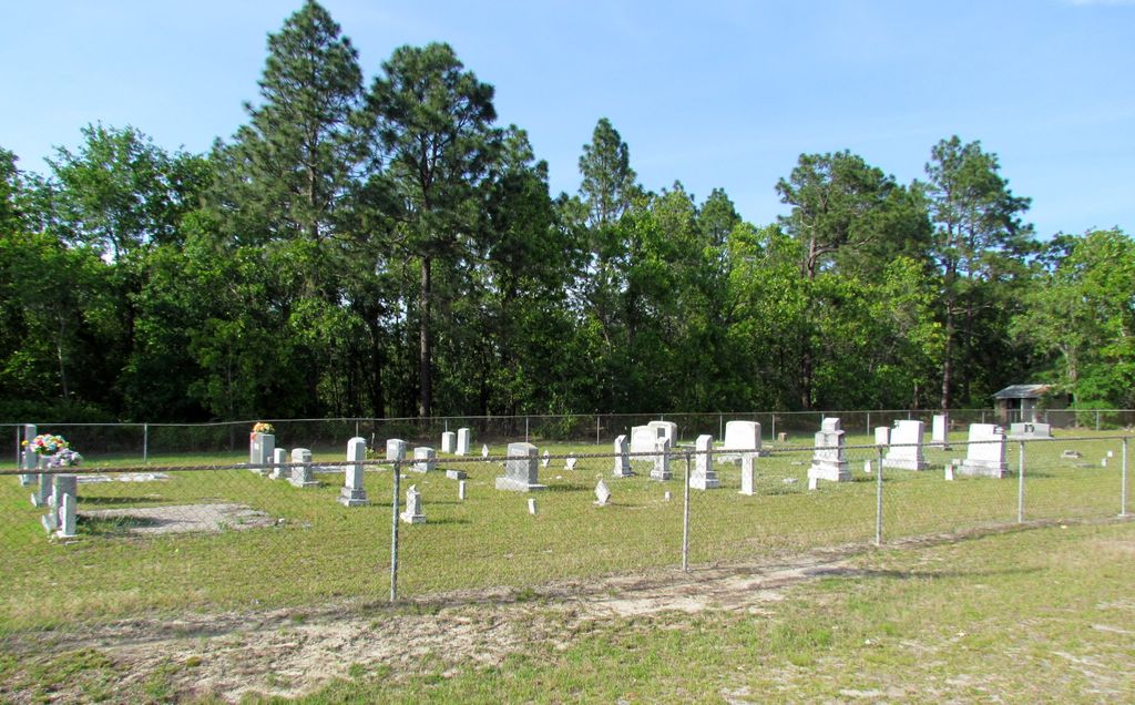
| Description | : | Directions: From Jefferson take Hwy 151 South to SC State Road 33. Take a left onto SC State Road 33. This church was founded in 1909 and closed in 1982. Features: This cemetery is well-maintained |
frequently asked questions (FAQ):
-
Where is Angelus United Methodist Church Cemetery?
Angelus United Methodist Church Cemetery is located at Angelus, Chesterfield County ,South Carolina ,USA.
-
Angelus United Methodist Church Cemetery cemetery's updated grave count on graveviews.com?
0 memorials
-
Where are the coordinates of the Angelus United Methodist Church Cemetery?
Latitude: 34.5971250
Longitude: -80.3152350
Nearby Cemetories:
1. Angelus Chapel AME Zion Cemetery
Angelus, Chesterfield County, USA
Coordinate: 34.5954290, -80.3229740
2. Antioch Baptist Church Cemetery
Jefferson, Chesterfield County, USA
Coordinate: 34.6199120, -80.3032130
3. Mount Elon United Methodist Church Cemetery
Jefferson, Chesterfield County, USA
Coordinate: 34.5766580, -80.3338600
4. Rocky Creek Presbyterian Church Cemetery
Chesterfield County, USA
Coordinate: 34.6195700, -80.3393860
5. Old Antioch Baptist Church Cemetery
Jefferson, Chesterfield County, USA
Coordinate: 34.6294290, -80.2991530
6. Macedonia Baptist Church Cemetery
Angelus, Chesterfield County, USA
Coordinate: 34.5893470, -80.3592710
7. McCaskill Family Cemetery
Jefferson, Chesterfield County, USA
Coordinate: 34.6374730, -80.3253680
8. Horton Family Cemetery
Angelus, Chesterfield County, USA
Coordinate: 34.5833370, -80.3662590
9. Sandy Run Missionary Baptist Church Cemetery
Angelus, Chesterfield County, USA
Coordinate: 34.5685920, -80.3596050
10. Rocky Creek Baptist Church Cemetery
Chesterfield County, USA
Coordinate: 34.6439610, -80.2950450
11. Oak Grove Baptist Church Cemetery
Jefferson, Chesterfield County, USA
Coordinate: 34.6332092, -80.3597870
12. Evans Family Cemetery
Jefferson, Chesterfield County, USA
Coordinate: 34.5605810, -80.3671110
13. Cross of Calvary Freewill Baptist Church
Mount Croghan, Chesterfield County, USA
Coordinate: 34.6518540, -80.2893920
14. Bethel Baptist Church Cemetery
Jefferson, Chesterfield County, USA
Coordinate: 34.6209560, -80.3812050
15. Twin Pines Freewill Baptist Church Cemetery
Jefferson, Chesterfield County, USA
Coordinate: 34.6564380, -80.3314310
16. Long Branch Baptist Church Cemetery
Jefferson, Chesterfield County, USA
Coordinate: 34.6539001, -80.3419037
17. Fork Creek United Methodist Church Cemetery
Jefferson, Chesterfield County, USA
Coordinate: 34.6338997, -80.3743973
18. Baker-Kirkley Family Cemetery
Jefferson, Chesterfield County, USA
Coordinate: 34.6394320, -80.3712550
19. Calvary Baptist Church Cemetery
Jefferson, Chesterfield County, USA
Coordinate: 34.6497290, -80.3613470
20. Hopewell Baptist Church
McBee, Chesterfield County, USA
Coordinate: 34.5273810, -80.3122470
21. Beauford Baptist Church Cemetery
McBee, Chesterfield County, USA
Coordinate: 34.5293150, -80.3395620
22. House Of Prayer Church Cemetery
Bethune, Kershaw County, USA
Coordinate: 34.5632990, -80.3929720
23. Mount Pisgah Baptist Church Cemetery
Mount Pisgah, Kershaw County, USA
Coordinate: 34.5783234, -80.4057922
24. Rhode Branch A.M.E. Zion Church Cemetery
Mount Croghan, Chesterfield County, USA
Coordinate: 34.6740540, -80.3184990