
| Memorials | : | 0 |
| Location | : | Flippin, Monroe County, USA |
| Coordinate | : | 36.7356200, -85.8785600 |
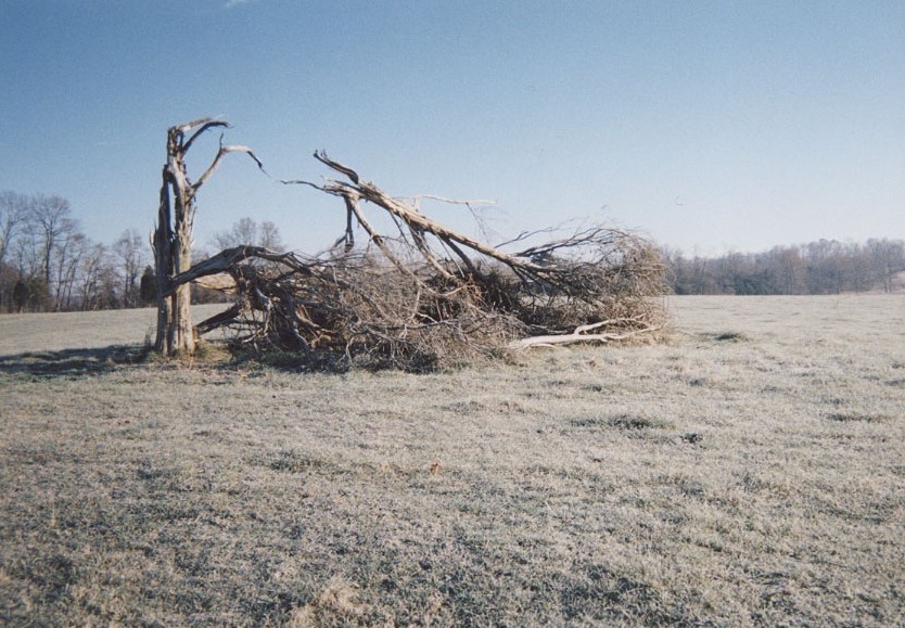
| Description | : | Located about 1 mile north of Flippin on Highway 249, about 1/2 mile due east of WARD-LEWIS Cemetery in the middle of the field. (Contact landowner for access.) There are several unidentified and unmarked grave sites known to be in this cemetery. Some were once marked with field stones. The cedar tree is gone, destroyed in a storm, but daffodils still come up each spring to mark the original cemetery site. Elzia Arterburn (#141415355) and Elizabeth Douglass Arterburn (#141415406) and other family members could be here or in WARD-LEWIS CEMETERY, if the latter served as an early burying ground... Read More |
frequently asked questions (FAQ):
-
Where is Arterburn Farm Cemetery?
Arterburn Farm Cemetery is located at Flippin, Monroe County ,Kentucky ,USA.
-
Arterburn Farm Cemetery cemetery's updated grave count on graveviews.com?
0 memorials
-
Where are the coordinates of the Arterburn Farm Cemetery?
Latitude: 36.7356200
Longitude: -85.8785600
Nearby Cemetories:
1. Isenberg Farm Cemetery
Flippin, Monroe County, USA
Coordinate: 36.7309600, -85.8734600
2. Ward-Lewis Cemetery
Flippin, Monroe County, USA
Coordinate: 36.7309140, -85.8848150
3. Johnson-Cross Cemetery
Flippin, Monroe County, USA
Coordinate: 36.7382760, -85.8873710
4. Old Pikesville Cemetery
Flippin, Monroe County, USA
Coordinate: 36.7334200, -85.8891800
5. Gillenwaters Cemetery
Flippin, Monroe County, USA
Coordinate: 36.7317783, -85.8676882
6. Old Pikesville Cemetery #2
Flippin, Monroe County, USA
Coordinate: 36.7398375, -85.8935605
7. Goodall Cemetery
Flippin, Monroe County, USA
Coordinate: 36.7221700, -85.8741700
8. Neal Farm Cemetery
Flippin, Monroe County, USA
Coordinate: 36.7238700, -85.8615000
9. Church of Christ Cemetery
Flippin, Monroe County, USA
Coordinate: 36.7165790, -85.8703340
10. Simmons Graveyard
Flippin, Monroe County, USA
Coordinate: 36.7324829, -85.8532576
11. Fraim Cemetery
Flippin, Monroe County, USA
Coordinate: 36.7125450, -85.8778040
12. McPherson Farm Cemetery
Flippin, Monroe County, USA
Coordinate: 36.7128122, -85.8649729
13. Johnson-Flowers Cemetery
Lamb, Monroe County, USA
Coordinate: 36.7591110, -85.8919440
14. Neal Cemetery
Flippin, Monroe County, USA
Coordinate: 36.7099991, -85.8681030
15. Flowers Slaves Cemetery
Lamb, Monroe County, USA
Coordinate: 36.7678588, -85.8833338
16. Milburn Cemetery
Barren County, USA
Coordinate: 36.7699890, -85.9011180
17. Fraim Slaves Cemetery
Flippin, Monroe County, USA
Coordinate: 36.7036111, -85.8461111
18. County House Cemetery
Tompkinsville, Monroe County, USA
Coordinate: 36.7451750, -85.8283010
19. Register Cemetery
Monroe County, USA
Coordinate: 36.7250270, -85.8218480
20. Lebanon Church Cemetery
Fountain Run, Monroe County, USA
Coordinate: 36.7226780, -85.9356720
21. New Salem-Turner Cemetery
Mud Lick, Monroe County, USA
Coordinate: 36.7459335, -85.8120651
22. White Oak Ridge Cemetery
Fountain Run, Monroe County, USA
Coordinate: 36.6870290, -85.9130140
23. Hoss Veach Farm Family Cemetery
Fountain Run, Monroe County, USA
Coordinate: 36.7169100, -85.9443800
24. Martin Family Cemetery
Mount Hermon, Monroe County, USA
Coordinate: 36.7887000, -85.8515500