
| Memorials | : | 0 |
| Location | : | Flippin, Monroe County, USA |
| Coordinate | : | 36.7317783, -85.8676882 |
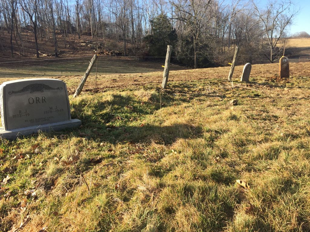
| Description | : | Located beside the barn at the end of “J Hale Rd” (sic: Jack Haile) off of Highway 678, east of Flippin, Kentucky. There are also two gravesites marked with field stones, without inscriptions. There could be other unmarked and unknown gravesites in this cemetery. (Contact landowner for access.) |
frequently asked questions (FAQ):
-
Where is Gillenwaters Cemetery?
Gillenwaters Cemetery is located at Flippin, Monroe County ,Kentucky ,USA.
-
Gillenwaters Cemetery cemetery's updated grave count on graveviews.com?
0 memorials
-
Where are the coordinates of the Gillenwaters Cemetery?
Latitude: 36.7317783
Longitude: -85.8676882
Nearby Cemetories:
1. Isenberg Farm Cemetery
Flippin, Monroe County, USA
Coordinate: 36.7309600, -85.8734600
2. Neal Farm Cemetery
Flippin, Monroe County, USA
Coordinate: 36.7238700, -85.8615000
3. Arterburn Farm Cemetery
Flippin, Monroe County, USA
Coordinate: 36.7356200, -85.8785600
4. Goodall Cemetery
Flippin, Monroe County, USA
Coordinate: 36.7221700, -85.8741700
5. Simmons Graveyard
Flippin, Monroe County, USA
Coordinate: 36.7324829, -85.8532576
6. Ward-Lewis Cemetery
Flippin, Monroe County, USA
Coordinate: 36.7309140, -85.8848150
7. Church of Christ Cemetery
Flippin, Monroe County, USA
Coordinate: 36.7165790, -85.8703340
8. Johnson-Cross Cemetery
Flippin, Monroe County, USA
Coordinate: 36.7382760, -85.8873710
9. Old Pikesville Cemetery
Flippin, Monroe County, USA
Coordinate: 36.7334200, -85.8891800
10. McPherson Farm Cemetery
Flippin, Monroe County, USA
Coordinate: 36.7128122, -85.8649729
11. Fraim Cemetery
Flippin, Monroe County, USA
Coordinate: 36.7125450, -85.8778040
12. Neal Cemetery
Flippin, Monroe County, USA
Coordinate: 36.7099991, -85.8681030
13. Old Pikesville Cemetery #2
Flippin, Monroe County, USA
Coordinate: 36.7398375, -85.8935605
14. Fraim Slaves Cemetery
Flippin, Monroe County, USA
Coordinate: 36.7036111, -85.8461111
15. Johnson-Flowers Cemetery
Lamb, Monroe County, USA
Coordinate: 36.7591110, -85.8919440
16. County House Cemetery
Tompkinsville, Monroe County, USA
Coordinate: 36.7451750, -85.8283010
17. Register Cemetery
Monroe County, USA
Coordinate: 36.7250270, -85.8218480
18. Flowers Slaves Cemetery
Lamb, Monroe County, USA
Coordinate: 36.7678588, -85.8833338
19. Milburn Cemetery
Barren County, USA
Coordinate: 36.7699890, -85.9011180
20. New Salem-Turner Cemetery
Mud Lick, Monroe County, USA
Coordinate: 36.7459335, -85.8120651
21. Mitchell Cemetery
Emberton, Monroe County, USA
Coordinate: 36.7182400, -85.8075850
22. Belcher Cemetery
Monroe County, USA
Coordinate: 36.7141991, -85.8080978
23. Lebanon Church Cemetery
Fountain Run, Monroe County, USA
Coordinate: 36.7226780, -85.9356720
24. Bethlehem Cemetery
Mud Lick, Monroe County, USA
Coordinate: 36.7627650, -85.8098640